Remmick: German Emigration to Borodino, Bessarabbia, Russia: 1812-1840s.
Last Updated: 17 Sept 2016
![]()
![]()
![]()
Bessarabian History continuted......
List of Borodino Families and Their Genealogy to the Present
Click on logo and it will take you to each individual mention in this section.
----
+

![]() PLACES
PLACES
![]()
Villages, towns & cities in which some
Borodino /Bessarabian German-Russian Colonists
lived before migrating to Russia
A / B / C / D / E / F / G / H / I / J / K / L /
M / N / O / P / Q / R / S / T / U / V / W / X / Y / Z
A / B / C / D / E / F / G / H / I / J / K / L /
M / N / O / P / Q / R / S / T / U / V / W / X / Y / Z
WEST, EAST and NEW EAST PRUSSIA
A / B / C / D / E / F / G / H / I / J / K / L /
M / N / O / P / Q / R / S / T / U / V / W / X / Y / Z
(3) PLACES IN MECKLENBURG & POMERANIA
A / B / C / D / E / F / G / H / I / J / K / L /
M / N / O / P / Q / R / S / T / U / V / W / X / Y / Z
(4) PLACES IN ALSACE (ELSASS), FRANCE & Other Places

Abrevations to Places Used In This Web Site
THEY are:
German States in Modern Times
![]() PLACES In GERMAN
STATES
PLACES In GERMAN
STATES![]()
(under construction)
Place names found during research on the German-Russian colonists of Borodinoians from the area we presently know as Germany.
There are errors at this time since I'm just getting the data gathered, so, when you find a error please contact me:
remmick@aol.com
I'll be happy to have a discussion and change whatever needs to be changed.
Different countries call Germany or the old German states by varying names. In German the country is called "Deutshland". In Scandinavia the area is known as "Tyskland". In French it is called "Allemagne" . In Poland it is known as "Niemcy". In Finnish it is "Saksa" and in Lituanian it is called "Vokietija".
MAPS: See Section on Historical Maps Pertaining to German Territories, Kingdoms, etc.
Page One: A/B/C/D/E/F/G/H/I/J/K/L/
Page two: M/N/O/P/Q/R/S/T/U/V/W/X/Y/Z
Aalen (City of)/ Ostalbkreis (Ostalb Dist.), Baden-Wuertttemberg. Location. History. Dating back to 8th and 5th BC lived the Meslithic settlements in this area. They left traces which include tools made of flint. Behind Kocherburg castle there was found traced of humans living there during the Bronze Age. The Celtics fortified the Schlossbaufeld settlement. Along came the Romans after they abandon the Lines Line around 150 AD and set up camp and then a town in 150 AD and it became part of the Roman Empire and the new line known as "Rhaetian Limes". The Roman cavalry unit "Ala II Flavia milliaria" were housed here and the remains of this is called "Kastell Aalen". Forced to retreat, the Romans gave up the for t and moved bank to the Rhine and Danube Rivers. Once the Romans left historians loose sight and knowledge of this area until the Middle Ages. In this area a village of Hammerstadt is mention in 839 but Aalen is not directly mentioned until in 1136 along with a man by the name of Conrad of Aalen. In 1214 to 1246 it's told the House of Hohenstaufen founded the town of Aalen. The area was gained by the Count of Oettingen who exchanged Aalen for money from the House of Wuerttenberg in 1358 or 1359. Village was destroyed in 1388 during the war between the Dukes of Bavaria and the Alliance of Swabian Cities. On 3 Dec 1360 Emperor Charles IV of the Holy Roman Empire. Charles IV declared Aalen as an Imperial free city which it kept until 1803. Reformation resulted in Aalen's major change from Catholic to Protestant which was followed by the Thirty Year's War during which resulted in Aalen swinging back to Catholic which resulted in the Protestant Union and afterwards both were able to worship and practice in Aalen together. 1634 proved just as difficult for the townspeople as. War and soldiers destroyed most of the city. The Swedes, Benard of Saxe-Weimar army and the Croatians looted what was left. During the Nine Years' War (1688) French troops enter Aalen and took their turn looting and destroying the town. The French marched through, again during the War of the Spanish Succession in 1702 and again during the War of Austrian Succession in 1741. The Imperial troops marched through in 1743,,, With the Catholic and Lutherans still in conflict it was ruled that both would have joint rule.... During the War of the Firs Coalition (1796) Aalen was looted. One has to wonder what there was to loot by this time. Anyway, in 1801 the Treat of Luneville lead to the Germans Mediatisation in 1803 giving Aalen to the Electorate of Wuerttemberg, which became part of the Duchy of Wuerttemberg and later the Kingdom of Wuerttemberg. Then came the War of the Third Coalition. On 6 Oct 1805 Napoleon arrived in Aalen with 40,000.... Two days later the Austrian and Bavarian troops moved into town as the French left... According to wikipedia the town clerk is credited in saying: "no feather could describe" what was happening to Aalen. In 1811 the municipality of Unterrombach was formed which merged parts of Aalen and territory of the Barons of Woellwarth. Napoleon was defeated. The town walls, gates and towers fell into disrepair. Then the stones were taken and used elsewhere... The fortification vanished....~
![]()
Aich n. Worms/ ___, Pfalz [See Eich / Alzey-Worms (am der Rhine) Dist., Rhineland-Palatinate] Often times "A" and "E" are interchangable, BUT, not always.. This time records should have "Eich" which is located north of Worms next to Biblis on the south, Riedstadt on the north and farther to the west is Alzey. Dates bach as far as 782 as a fishing village. ~ It can be placed in error, however, as is the following people who were. [Correction 17 Sept 2016.] Aich is about 170 miles away from Eich. It is in Esslingen and 18 km from. Stuttgart, Baden-Wuerttemberg, Germany. It is west of Nuertingen. South of Bonlanden and north of Neckartenzlingen.. Next to the river of Aich which is a tributary of the river Neckar. History: Was under the Holy Roman Emperor of Worms in 1075 and continued as "Groetzingen for cenuries. The village was destroyed in the mid 1600s and then the plaglue killed off just about everyone. Those who survived, 1/3 of them perished in the Thirty Years' War and many of those who survived emigrated to North America. Aichtal-Aich is the new village that rose up under the Water Castle and the Duke of Wuerttemberg. People from other villages were brought in and cottage crafts and crabs were to build up the new citizens into a better life. Wine was added later in 1832.... It was only after 1954 that the Catholis and a New Apostolic congregations were added to the Shwabian Protestant community. Attached to this community in the 21st century are the districts of Groetzingen, Aich, Neuenhaus, Rudolshoehe, and the so-called "abandoned villages" of Bergwirtshaus, Bombach and Muehlstetten, Forsthaus, Walbruderhaus, Gruenes, Haeusle, Brustelberg....
Thee is a Aich just north of Oberpframmen and south of Wolfersberg. Both are in the Ebersberg Dist., in Upper Bavaria (=Bayern) Hofenkirchen is the the west. East is Moosach and Grafing. South east and abt 24 km is Munich. South is Hohenkirchen-Siegertsbrunn and Egmating. Neubiberg is north northwest about 10 km.
![]()
Aichberg, Goeppingen-Wuerttemberg [Aichelberg / Goeppingen Dist., Baden-Wuerttemberg] which is located southwest of Goeppingen. To the west is Kirchheim unter Teck and to the east is Boll and Dumau. To the south is Weilheim an der Teck.
----
Aichberg / n. Hornberg, Rottweil Dist., Baden-Wuerttemberg (See Eichberg) It is near Hornberg and Hohrbach on the edge of the Black Forest.
![]()
Ainingen / __, Wuerttemberg [Ainingen (??)] NOTE: I assume someone miss typed, which, unfortunaely, I am often guilty, and the village name may be Ensingen. Tracking down other Stumpp/Stumpf family members I believe the village is Ensingen since Stumpps are listed as having migr. from Unterensingen (Unter.Einsingen = Under Ensingen)/ Nuerteingen, Baden-Wuerttemberg. Also, sometimes "A" can be "E" as it is for Aich / Eich village.
----
Ensingen [highly likely] / Ludwigsuburg, Baden-Wuerttemberg. Location. North of Vaihingen an der Enz. South east of Schuetzingen. South of Zaberfeld. North west is Horrheim and Hohenhaslach. Southeast is Sachsenheim.
![]()
|
Alb-Donau (Danube) Dist, Created in 1973
merged the districts of Ulm and Ehingen. Baden-Wuerttemberg
|
|
![]()
Aldingen / Ludwigsburg, Wuerttemberg [Aldingen / Borough of Remsseck, Ludwigsburg Dist., Baden-Wuerttemberg] (NOTE: It appears that people who recorded the Reinhardts that some have their place of origin as Aldingen & Altingen.)
Aldingen / Tuttlingen Dist, Baden-Wuerttemberg]; location is east of Trossingen, north of Spachingen and south east of Frottomgem and Rottweil. Stuttgart is more than 50 km north and farther north is Ludwigsburg.
![]()
Alfinger, Wuerttembrg [Alfinger (??)
![]()
Alfdorf / Rems-Mur-Kreis, Baden-Wuerttemberg [Aldorf / Reims-Mur Dist. , Baden-Wuerttemberg] This is another one of those confusing merges of villages. Aldorf came into being in 1972 and there was the merging of two villages: Pfalbronn and Vordersteinberg Therefore, can we assume Hans Steiner was born in either Pfahlbronn or Vordersteinenberg (vor.der.Steinen.berg)? If one uses logic, I would assume they lived in Vordersk since they carried the surname Steiner. The source did not give any additional information. Location: Southeast is Schwaebish Gmuend. Soutth is Lorch. West is Wetzheim. North is Gschend and Murhardt .
![]()
ALSACE (ELSASS) See the Alsace Listing. "A" to "Z"
![]()
Altbach / Esslingen, Wuerttemberg [Altbach / Esslingen Dist., Baden-Wuerttemberg] Location: It is on the southern slope of the Schur forest. Esslinngen is north northwest from Altbach. Plochingen is in the opposite direction abt 1 1/2 km south souhteast. Directly south is Deisisau and Wendingen am Neckar. West is Oberessingen. East is Lichterwald.
![]()
Altensteig Dist:,
Calw Dist., Baden-Wuerttemberg
|
![]()
Altingen / Ludwigsburg, Wuerttemberg Altingen (=Aldingen) / Bourough of Remseck/ Ludwigsburg Dist., Baden-Wuerttemberg
![]()
Altensteig / __, Wuerttemberg [Altensteig / Calw Dist., Baden-Wuerttemberg], Located in the eastern part of the Black Forest, abt 18 km from Calw, which is southwest, and 19 km from Freudenstadt which is northeast.
![]()
Althengstett / Calw, Wuerttemberg [Althengstett Calw Dist., Baden-Wuerttemberg] Location: Northeast of Calw abt 5 km. North is Simmozheim. East is Ostelsheim. South is Wuerm-Heckengaeu and farther south is Gechingen.
![]()
Alt Nuefa / Egenhausen , Wuerttemberg [Alt Nuifra =Altnuifra-Haiterbach / Calw Dist., n. Egenhausen, Baden-Wuerttemberg] See Egenhausen. Location: West is Neunuifra. Farther west is Freudenstadt abt 19 km. .Southwest about 4 km is Pfalzgrafenweiler and Edelweiler is slightly closer. East and slightly north is Waldorf. East is Rohrdorf which is about 4 km on a flat map.... North is Altensteig. History is not known at this time.
Note: There is a Braun & Sakman families mentioned in Altnuifra and in the nearby village of Haiterbach. An Anges Braun m. Michael Guekunst b, abt 1545, See web site on Gutekunst Genealogy at http://www.gutekunst-archiv.de/Gutekunst_Haiterbach.htm.
![]()
Alzey, A Collective Municipality (collection of
vllages) in Alzely-Worms Dist. in
Rhineland-Palatinate:
|
![]()
Aselfingen / ___, Wuerttemberg [Asselfingen / Alb-Donau Dist., Baden-Wuerttemberg] Location North is Stetten, northeast is Niederstotzingen. Southwest is Rammingen and beyond is Langenau, abt. 5 km, which is 14 km from Ulm. West is Ollingen. . History. See history of Ulm.
![]()
Auch / Worms, [n. Darmdsatdt], Pfalz See Eich / Alzey-Worms, Rhineland-Palatinate
![]()
Auggen / Wuerttemberg [Auggen / Breisgau-Hochschwarzwald Dist. Baden-Wuerttemberg] Auggen is "attacehed" to Hach which is northeast. Auggen is south of Muellheim, north of Schliengen and Basel, which is farther south, east of Ottmarsheim and west of Marlsburg-Marzell and Schoenau im Schwarzald. It in the Markgraeflerland Region, which refers to Margraves of Baden who ruled from 12th century. In 1526 the Margrave became Lutheran (Protestant). Viticulture became important in 1780 when the Swiss introducted a variety of grapes. The hills around Auggen are covered with grapevines and apple trees.
![]()
A/B/C/D/E/F/G/H/I/J/K/L/M/N/O/P/Q/R/S/T/U/V/W/X/Y/Z
Babenhausen / Bielefeld/ Nordhein-Westfalen [Babenahsuen / Bielefeld Dist., North Rhine-Westphalia and in the municipality of Dorngerg. Location West is Niederdornberg. West and slightly north is Deppendorf. Northwest is Schroettinghausen. West is Muehlenmasch. South is Wellensiek.. History. It was incorporated 1 Jan 1973 of Bielefeld which has 10 diestricts. Orgininally Babenhausen was called Pavenhosen in 974. For a time it was in the Ravensberg County but it's parish was Dornberg. The farming community, as some called it, belonged to the family of Bailiwick of Werther. In 1739 the taxes were assigned to Dornberger. In 1807 under Napoelon the District of Bielefeld was part of the Kingdom of Westphalia and ruled by Napoleon's brother Jerome. In 1811 the French placed Babenhausen under the Canton of Schildesche. After Napoleon's defeat it return to the Bielefeld County (1816). Presently (2012) Babenhausen is part of the independent city of Bielefeld in the District of Dornberg.
Babenhausen / Darmstadt-Dieburg Dist., Hesse
![]()
Backnang / Rems-Murr Dist., Baden-Wuerttemberg. Location. In the Mrr River valley. Murrhardt is abt 8 km northeast. East and slightly south is Auenwald and Weissach im Tal. South is Maubach and Winnenden abt 6 km. West is Kirchberg an der Murr adn farther west is Marbach am Neckar abt 10 km. . Norh is Oppenweiler and farther north is Spiegleberg and Prevorst. History. In 1325 the House of Zaehringer (Cadet Branch of House of Baden) gave control of Backnang to House of Wuerttemberg.
![]()
Bad Duerkheim District in Rhineland-Palatinate
![]()
Badfeld / Calw, Wuerttemberg [Badfeld (??) ____]
Did not find a Badfeld in Baden or Wuerttemberg. Could Badfeld be Bodfleld / Heilbronn Dist., Baden-Wuerttemberg, which is northwest of Heilbronn and near Bad Rappenau, which is north and Treschklingen which is west and Bad Wimpfen which is east?
![]()
Bad Kreuznach Dist. in Rhineland-Palatinate.
![]()
Bad Rappenau, City of / Heilbronn Dist., Baden-Wuettemberg Location. North is Siegelsbach and farther north abt 11 km is Mosbach / Neckark-Odenwald Dist., Baden-Wuerttemberg.. Northeast is Heinsheim. East is Offenau. Southeast is Bad Wimpfen and father is Heilbronn abt 10 km.. South is Bonfeld. West is Babstadt. History. First documented in 1343. According to the village legend, Rapenau was named over it's founder Rappo and was called Rappenheim. Somewhere between Rappo and 1339 the town was under the rule of the Lords of Vaihingen and Wuerttemberg. By 1344 the area belonged just to the Lords of Wuerttemberg. Villages known as the upper and lower Rappenau merged. In 1601 Eberhard von Gemmingen built a "water castle". During the Thirsty Years' War, Rappenau was burned down not just once but several times. Under Napoleon Baden took control in 1806. After 1930 the town took up the name Bad Rappeau, indicating it had brine bath water for treatments. The baths took up a large number of visitors.... The area remained part of Baden until 1936 when he was placed in the Sinsheim Dist. Between 1971 to 1973 it was a collection of municipalities... 1 Jan 1973 Bad rappenau was placed into the district of Heilbronn and so it became part of Wuerttemberg. .
Bad Rappenau's sub dist. are
: Plus the hamlets of
Villages that no longer exist are
Castle
![]()
Bad Urach / Reutlingen Dist., Baden-Wuerttemberg. Town has five dist. but they are not named. North is Uelben and Detingen an der Erms. North northwest is Metzingen. East is Roemerstein. West is Muennsingen See Urach.
![]()
Baden - History before it became part of one German state called Baden-Wuerttemberg:
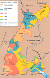 1801-1819 Map: See
larger map
Baden
1801-1819 Map: See
larger map
Baden
Baden came into existence in the 12th century. 1771 it was enlarge and became known as the Grand Duchy of Baden. [See Baden-Durlach] Remained a sovereign county from 1803-1806 . Joined the German Empire in 1871.... In 1951 there was the vote to merge with Wuerttemberg. Baden-Wuerttemberg officially became a state April 25, 1952. Map of Bden-Wuerttemberg in 2001
NOTE: Mike Pantel has an excellent site on history of Germany's southwest area. which includes Baden, with maps. It is found at:
http://www.pantel-web.de/bw_mirror/history/bwhist_e.htm
|
Baden-Wuerttemberg
Regions:
Urban disricts:
Rual Districts:
Independent cities are:
|
Necker Valley in Baden-Wuettemberg, showing Old Romantic Road - cities, towns, vilages and castles
General Map showing important cities
Baden-Wuerttemberg map showing Groetzingen
Baden
![]()
Baden-Baden / (urbn district), Baden-Wuerttemberg History: The history jumps right back to the Romans when they discovered the springs . Since then it's been known for its "baths" which many claim ease a person ills. From the 1300s to the 1600s it was the residence of the Margraves of Baden. The French troops marched into Baden-Baden in 1643, left and returned in 1689 and left nothing but ashes. It was't until outsiders discovered the baths (spas) that the city's popularity rose and became a meeting place for royality, high society, celebrities.... The rich and royality needed to be entertained so it was provided. Horse racing, gardens and casinos were only a part of what was happening in Baden-Baden. To drop a few names who visited Baden-Baden were Queen Victoria, Wilhelm I, Napoleon III, Brahms, Dostoyevsky.... Even Tolstoy's fictional characters Anna Karenina and her lover visited Baden-Baden. Garry and I spent an afternoon in a Baden-baden casino that resembles a place in which one could be sure that the famous spy 007 frequented in the movie theater .~
Baden-Baden, City of
XXXX
![]()
Baden-Durlach was part of the "outside" protection of the Habsburg of Austria. Margrave Charles II in 1565 ruled this area called Baden-Durlach. Most of the towns were were destroyed by the French in 1689. In 1715 Durlach was part of the grand-duchy of Baden. In 1771 Aujgustus Gerog of Baden-Baden died without sons and his lands passed to Charles Frederick of Baden-Durlach and he became rule of Baden-Baden and Baden-Durlach and it became one state known as Baden. Baden held territories that were scattered areas. During the Reign of Napoleon, Badenese fought on the side of Austria and the French devastated aeas, demanded payments, ceeded territories on the left bank of the Rhine to France. When the Russian Emperor Alexander I gave Baden the bishopric of Constance, part of the Rhenish Palatinate and other smaller districts with the title of Prince elector in 1806. Baden joined the Confederation of the Rhine and was raised to Grand Duke of Baden. In 1938 Durlach was incorporated with Karlsruhe Dist./ Baden. The German states Baden & Wuertttemberg became one state on 25 April 1952. See Baden.
![]()
Badfeld / Calw Dist., Wuerttemberg [Badfeld (??) / Calw Dist. Did not find a Badfeld in Calw Dist. nor any place within a 100 km. That does not mean there wasn't such a place. I will keep searching.
Badfeld n. Ehingen / Alb-Donau Dist, Baden-Wuerttemberg.
![]()
Bad Liebenzell District's Sub
Districts
|
Bad Liebenzell / Calw, Baden-Wuerttemberg A spa town in the Nagold River valley and is in the northern part of the Black Forest.
![]()
Baiertal / n. Weiisloch and Heidelerg, Bavaria [Baierital / Rhein-Neckar Dist. Baden-Wuerttemberg. Location: Abt 3 km wouthwest is Wiesloch. Next to it is a Goldclub Hohenhardter. Northeast is Schatthausen, Northwest is Sussloch. North is Leimen and father north is Heidlberg, which is abt 11 km. South is Dietheim. History. There were three important battles nearby: (1) Battle of Mingolsheim on 27 April 1622, (2) Battle of Wiesloch on 16 Aug 1632; and (3) Battle of Wiesloch 3 Dec 1799. The first two were during the Thity Years' War. The third was during the War of the Second Coalition.
![]()
Bammental / Heidelberg, Bavaria [Bammental Rhein-Neckar Dist. , Baden-Wuerttemberg] Location: North is Meckargenmend. East is Spechbach., South is Meckesheim. West is Leimen where the Roemmich once lived. Heidelberg is north northwest and abt 10 km. History of Bammental tells us that there are traces of the Romans and before them, about 500,000 to 600,000 years ago, were early humans known as Homo Heidelbergensis. In the 700s a Frankish settlement known as Risolfesheim was founded and Bammental is an extension of Reilsheim. The area from 1330 to 1830 belonged to the Palatinate which for a time was part of Bavaria. After 1803 the area went to Baden. Baden has merged with Wuerttemberg.
![]()
Bavaria (Bayern). A German Free (Republic) State. Location is in the south east corner of Germany. Some of the imporant cities are Munich, Nuremberg, Ausburg, Regnesburg, Wuerzburg, Bayreuth and Bamberg. See 1923 map of Bavaria & Palatinate areas. It is the largest state which is in the southeast part of Germany. History. And, it is one of the oldest German states in Europe which was estalished in the period called "the first millenium" on the Julian calendar. The Romans held it as two provinces, Raetia and Noricum. They found the Bavarians spoke what is called the "Old High German". As the Romans withdrew there was left an interesting mixture of different groups of people.. There were the Romans who had setteled in the area, Marcomanni, Allemanni, Quadi, Thuringians, Goths, Scirians, Rugians, and Heruli. The Celts called it "Baluvarii" this area. The source was written in 520. Saint Boniface is given the credit for having finished the conversion of the people to Christianity by the 8th century.
554 to 788 House of Agilofling
788 Charlemagne trooped into Bavaria and took up the role as ruler
After the death of Charlemagne numberous families held the key roles in the duchy.
976 the Babengerger king lost the area known as "Ostarrichi" and this begins the creation of the area known as Austria.
Henry "the Lion" (House of Welf) founded Munich and held his position of power until 1180 but was set aside by the Duke of Saxony and Bavaria who was his cousin Frederick I, the Holy Roman Emperor, known as "Barbarossa". The area of Bavaaria was awared as a "fief" to the Wittelsbach House, who were counts of Palatinate of Schyren (Scheyern). House of Wittelsbach ruled from 1180 to 1918. In 1214 the Wittelsbach acquired "Kurpfalz" (The Electorate of the Palatinate). Through the years the boundaries changed due to inheritance by various branches of the family, purchases, releases and in 1506 there was the Landshut War of Succession. Munich became the sole capital of the Wittelbach's.... The Bavarian Duke rose in power, replaces his relative, the Electorate of the Palatinate and in the early days of the Thiarty Years' War gained the title of "prince-electoral" in the Holy Roman Empries. A few more wars, some with Austria, and the deaths of the old Babarian branch of the family, allowed the Palatinian lines to governed once again.
The Kingdom of Bavaria emerged under Napoleon, who had abolished the Holy Roman Empires, in 1806. The area of Bavaria doubled in size, even though it ceded Salzburg bach to Austria, in returned for the Rhenish Palatinate and Franconia.
Even after the rise of the Prussian, Bavaria kept it's independence through the wars between Prussia and Austria and held it's own as a memer of the German Federation founded in 1870.
On 12 Nov. 1918 King Ludwig III signed the Anif Declarion relesing everyone from their oaths to him. With that said, the Wittlebachs never declared renunciation of the Bavarian throne.
District of Bavaria
are:
|
continued:
There are 71 administrative districts (landkreise) and 25 independent cities (kreisfreie Staedte): |
__???___/ __??__, Bavaria
![]()
Beinberg / Calw, Wuerttemberg [Beinberg-Bad Liebenzell / Calw Dist.,, Baden-Wuerttemberg] Location: just south of Bad Liebenzell, west is Bad Wildbad, north northwest is Schoemberg, north is Unterreichenbach, northeast is Neuhausen, east is Munkingen and south and slight west is Oberreichenbach. South is Hirsu and Calw. History: See Calw.
![]()
Beitingen / __??__, Germany
Beitingen _____ / Germany [Bietingen / n. Gottmadingen, which is in the Konstanz Dist., Dist., Tuebingen Adm., Baden-Wuerttemberg Location: Gottmadingen / Konstanz Dist., is east abt 2 km. Abt 5 km from Singen Northwest is Thayngen. North is the Swiss border. South southwest is Schaffhausen abt 15 km. . South is Doerfingen and Gailingen.
Beitingen / Eifeldreis Bitburg-Pruem Dist. Location: North and slightly west abt 12 km of Trier. Nearby is Nusbaum, Peffingen and Wissmarnsdorf and Bitburg. Abt. 8 km west is the border of Germany & Luxembourg.
![]()
Benningen / (Municipality of) Ludwigsburg-Wuerttemberg [Benningen am Neckar / Ludwigsburg, Baden-Wuerttemberg] Location: To the east is Marbach am Neckar. Freiberg is west of Benningen. North and slightly east is Murr. Ludwigsburg is south southwest abt 4.5 km.
Benningen / Unterllgau, Bavaria
![]()
Bergfelden / Horb am Neckar, Wuerttemberg [Bergfelden , Sulz am Neckar Sub Div., Rottweil Dist., Baden-Wuerttemberg]. Located: West is Sulz. South and slightly west is Voehringen. East is Gruol which is southwest of Haigerloch. North is Empfingen, and farther north of Empfingen is Horb am Neckar.See Sulz am Neckar and Horb am Neckar history. Districts changed in the 1970s, and, it might well have been n the Horb am Neckar Dist. earlier.
NOTE: There is listed in the Stumpp Migr. Bk a Jakob Ziegler from Sigmarswagen/ Horb, Wu. 1817 migr. to Glueckstal / Od.. There is an Oberschwandorf north of Horb am Neckar and near Haiterbach and Nagold. But I cannot find Sigmarswagen. They are all (10 km or less) near Bergfelden n. Voehringen. Horb was a district that has merged with Rottweill Dist. and I don't have a list of what the Horb dist. were in earleir times..
![]()
Bergheim / Stuttgart, Wuerttemberg [Bergheim/ Stuttgart-Weilimdorf Dist., Baden-Wuerttemberg] Location: It is in the municipality of Weilmdorf which is in the city of Stuttgart. Gerlingen is southwest of Bergheim. North is Giebel and farther north and slightly west is Ditzingen. East is Wolfbusch and Hohe Warte.
![]()
Bergstrasse District, Darmstadt Adm. Region, Hesse
Location. In the southern part of the state
of Hesse. Bergstrasse means "Mountain Road" which indicates it's located
in mountains, which are called Odenwald. . History. Created in
1938 by mergering the districts of Bensheim and Heppenheim.
|
![]()
Bergzabern - Pf [Bad Bergzabern / Suedliche Weinstrasse Dist., Rhineland-Palatinate] Location: n. the French border and abt 15 km southwest of Landau.
![]()
Berlin / State of Berlin, Germany: It is one of the 16 states of Germany and right in the middle of the State of Brandenburg. Location: NW Germany on the River Spree. Officially the area of Berlin and the surrounding area is called Berlin-Brandenburg Metropolitan Region. History: In the early days, Berlin was on the Slavic side (east side) and Coelin was on the German side (west side) of he Spree River. The town of Berlin was founded by Albert "the Bear, House of Brandenburg, who joined Coelin and Berlin and thereafter ruled the area as Margrave from 1157 to his death in Nov of 1170. . The House of Brandenburg came into the hands of Frederick IV , House of Hohenzollern [minor house of Brandenburg), the Burgrave of Nuremberg when he became Elector of Brandenburg as Frederick I in 1417. . In 1871 Berlin became the capital of the newly unified German Empire under the Hohenzollerns until Wilhelm II abdicated. In 1919 after WW I Berlin became the capital of the newly form Weimar Republic..... By the 1930s The Nazi's made Berlin the seat of the Greater Berlin and Mark Brandenburg Gaue (Administrative Division). With the defeat of the Germans in WW II, Berlin was divided into East Berlin, which was a part of the area known as East Germany, and West Berlin, which was a part of the area known as West Germany from 1940 to 3 Oct 1990 when Berlin became the capital of the new Federal Republic of Germany,. East Germany and West Germany became one country.
![]()
Bernbach / Calw, Wuerttemberg [Bernbach / n. Bad HerrenalbCalw Dist., Baden-Wuerttemberg]; Located in the northern part of the Black Forest. Bernbach is north of Bad Herrenalb. Abt 8 km southwest is Gernsbach and abt is 9 km west is Gaggenau . Baden-Baden is 22 km southwest and Rastatt is northwest, Maisch and Karlsbad ("Charles Spa") are north .
![]()
Bettingen / n. Lebach, Saarland, Germany
MAP - Bettingen / n. Lebach, Saarland, Germany
![]()
Betzingen, __, Wuerttemberg [Betzingen / Reutlingen Dist., Tueblingen Admin., Baden-Wuerttemberg ]. Location. Suburb of Reutlingen City with it's center north of Betzingen. South is Ringelbach. West is Wankheim. East is Burgholz. North and slightly east is Metzingen. North is Plezhausen. History. See history of Reutlingen. area.
![]()
Bietigheim / __, Wuerttemberg [Bietigheim-Bissingen / Ludwigsurg Dist., Baden-Wuerttemberg. Located on the Enz River and is abt 19 km north of Stuttgart and 20 km south of Heilbronn. History. Sites and still can be found are the "Old Gate" which dates to the 1300. Protestant church was built in 1401. Town hall is dated 1506. Casstle of Bietigheim was built in 1546 and renovated in the 21st century.
![]()
Billigheim / n. Landau, Baden [Billigheim-Ingenheim / n. Landau an der Pfalz, Rhineland-Palatinate] Located: Part of a municipality in the "Suedliche Weinstrasse" (wine road) district.
![]()
Birbach / __, Wuerttemberg [Birbach (??) / Baden-Wuerttemberg See Bernbach..
![]()
Birkmannsweiler / Wuerttemberg [Birkmannsweiler/ n. Winenden, Rems-Murr Dirst., Baden - Wuerttemberg. Location: West is Winnenden. Ludwigsburg is farther west. South is Bruningsweiler, east is Berglen. North east is Ochelbronn. North is Backnang. History: There is no information on Birkmannsweiler, which may be only a marker, now. See Winnenden for history of the area.
![]()
Bittenfeld, Waiblingen-Wuerttemberg [Bittenfeld / (in the town of) Waiblinen/ Rems-Murr Dist., Baden-Wuerttemberg] Location: Bittenfeld , Hegnach, Hohenacker and Neudstadt were incorporated into Waiblingen in 1975. Beinstein was earlier in 1971. See Waiblinen.
![]()
Blankenloch (= Stutensee) / Karlsruhe Dist., Baden-Wuerttemberg Location. It is northeast of Karlsruhe. History. In 1975 Stutensee with the connection of the following villages: Blankenloch, Buechig, Friedrichstal, Spoeck and Staffort. Founded in 1337.
![]()
Blaubrunn [= Blaubenuren) / Alb-Donau (Danube) Dist, Baden-Wuerttemberg Location. Near Ulm which is about 8 km east. North is Sonderbuch. South is Beiningen and Schelkingen. Southeast is Berbach. West is Seissen.
![]()
Bodelshausen / Tuebingen, Baden-Wuerttemberg [Bodelhausen / Tuebingen Dist., Baden-Wuerttmberg] Location: The village is in the southern part of the Rammert forest North northeast of the village is Mossingen and beyond is Tuebingen, which is abt 10 km, south is Hechingen, east is Belsen and west is Bechtoldsweiler and farther west is Rangendingen. Dobel (near Bad Waedbau) is north northwest abt 35 km. .
![]()
|
Bodenseekreis ( = Boden Sea District) "Lake Constance
District", Baden-Wuerttemberg. It was created in 1973 and merged the districts
of Tettnang and most of Ueberlingen.
Cities are:
Towns are:
* Added to list |
![]()
Boeblingen Dist., Baden-Wuerttemberg
It ws created in 1938 from the Oberamt Boeblingen which
was part of the Duncy of Wuerttemberg. In 1973 the district of Leonberg
and some of the district of Calw were added to Boeblingen Dist. They
are presently the following:
|
Boeblingen, City of / Boeblingen Dist., Stuttgart Admin., Baden-Wuerttemberg, Germany. Location. North is Sindelfingen. West is Dagersheim. South west is Ehningen and farther on is Gaertreingen. South is Holzgeringen. East is Musberg, Northeast is Stuttgart, which is abt abt 18 km. History. In 1253 Count Wilhelm von Tuebingen-Boeblingen laid claim to this settlement. 1357 Boeblingen came under the rule of Wuerttemberg. The German Peasants' War, which was a economic and religious revolt (1524-1526), held it's "bloodiest" battles here 12 May 1525. 15,000 armed peasants were attacked b y Joerg Trucsess von Waldburg forces. 32,000 were killed. During the Thirty Years" war the population was depleted, again, and by the end of the war only 600 citizens of Boeblingen remained alive. Napoleon changed the course of many villages and towns, however, Boeblingen remained under the House of Wuerttemberg who rule the new Kingdom of Wuerttemberg. By 1803 the citizens number 2,125. In 1818 the town became of seat of the administrative until (Oberamt). Property was kicked into gear when the railroad network connected the town in 1879. In 1938 Boeblingen the administrative unit (Oberamt) became District of Boeblingen (Landkreis) Seventy percent of the town was destroyed in 1943 during WW II. By 1962 it Boeblingen became a major district town (Grosse Kreisstadt) and it's current boundaries were set in 1971 when it merged with the Dagersheim's municipalities..
![]()
Boeckingen, Heilbronn-Wuerttemberg [Boeckingen / Heilbronn Dist., Baden-Wuerttemberg] It is immediately south or a part of Heilbronn and north of Flein.
![]()
Boehringen / Radolfzell, Freiburg, Baden-Wuerttemberg Location: Northwest of Lake Conssance, by Radolfzell which is south. Singen is to the west. Steisslingen is north.
Boehringen / Roemerstein, Tuebingen Dist., Baden-Wuerttemberg Location: North is Lennningen. West is Bad Urach and farther west is Reutlingen.
Boehringen , Dietingen, Freiburg, Baden-Wuerttemberg Location: Oberndorf is north north west. Rosenfeld is north northeast. Sout is Dietingen. East of Dietlingen is Schoemberg.
Bohringen / __?__, Wu.
![]()
Bolanden / ____ (??)
![]()
Boll / Goeppinen, n. Oberndorf, Baden-Wuerttemberg [Boll / __??__, Baden-Wuerttemberg. There is a contradiction of which Boll is the correct Boll. The Boll near Goeppingen or the Boll near Oberndorf which are both mentioned.... They are about 100 km apart. Since the other villages mentioned in the Bippus family is Trossengen and Balingen and Vohringen I am leaning toward Boll / Oberndorf am Necker (sub dist)., Rottweill Dist., Baden-Wuerttemberg and not Boll (Bad Boll) near Goeppingen. I have placed them both in this section just in case my logic has lead me wrong.
Boll/ Oberndorf am Neckar Dist., Rottweil Dist., Baden-Wuerttemberg Location. Boll is abt 1.2 southwest from Oberndorf am Neckar. Schramberg is about 12 km southwest of Oberndorf. South abt 11 km is Rottweil. , Rothenzimmern (sub Dist. of Bietingen in Rottweil Dist.) North is Weiden, northwest is Dorhan and north northeast is Sulz. Balingen is east.
Boll (Bad Boll) / Goeppingen Dist., Baden-Wuerttemberg]; Location. It is in the Goeppingen Dist. North of Boll is Heiningen and farther north abt 5 km is Goeppingen. East is Durnau and southeast is Gammelshauen. Southwest is Aichelberg. Northwest is Hattenhofen. Kirchheim unter Teck is at 10 km directly west. History: "Bad" is referring to the thermal spa which was en;joyed by the Dukes of Wuerttemberg who had a hunting lodge in Boll.
![]()
Bolzhaussen / __, Wuerttemberg [Bolzhausen (??)
Bozhausen in Wuerttemberg (??)
Bolzhausen / n. Sonderhofen, Bavaria Location: South of Wuerzburg abt 15 km. Gaukonigshofen is north. Obenckeisheim is east. West is Butthard. South is Gelchsheim
![]()
Brackenheim / __, Wuettemberg [Brackenheim / Heilbroon Dist., Baden-Wuerttemberg] Location. It is 15 km (9.3 milies) southwest of Heilbronn. On the banks of the Zaber River History: Was the largest grape-growing municipality of Wuerttemberg. The village is found in records in 1246. King Rudolf I von Habsburg held the rights to the village in 1280. In 1691 112 houses were burned to the ground.
![]()
Brambach (Branbach) / Aalen, Wuerttemberg. See Niederbrombach / Birkenfeld Dist., Rhineland-Paltinate
![]()
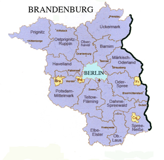
Brandenburg . State of Location. It is one of the eastern states of German. It's capital is Potsdam. History A complex history that needs more information than provided here. When I get some time, I will give it more depth. History. The Margraiates of Brandenburg was the major house of the family of Brandenburg. One of the minor branches is the von Hohenzollerns. The Margraviate of Brandenburg and the Duchy of Pussia were combined in 1618 and became Brandenburg-Prussia under the rule of the minor house of von Hohenzollern. In 1701 the Frederick (I) von Hohenzollern gave himself the title of King "in" Kingdom of Prussia.. See list of the von Hohenzollerns from Burchard I, Count von Zollern (d. 1061) to the last ruling member Emperor Wilhlem (William) II (1859 to 1941).
History in detail plus maps of historical interest and modern map of districts
![]()
|
Breisgau-Hochschwarzwald Dist. Baden-Wuerttemberg
Created in 1973 by mering the districts of Freiburg, Muellheim and
Hochschwarzwald. This area has three "distinct landscapes: (1) The Upper
Rhine River plain (Oberrheinebene) with the mountains of the Kaiserstuhl,
which is of volcanic origin, Tuniberg, Breisgau, and the Markgraeflerland;
(2) Black Forest mountains with the various valleys are reaching down to
the Rhine River...; (3) The Black Forest mountins rise up from these valleys.
The highest mountain is Felberg (1,493 m).
The district was created in 1973 and merged the districts of Freiburg, Muelheim and Hochschwarzald.
|
...continued:
|
![]()
Breitenholz / __, Wuerttemberg [Breitenholz/ __??Tuebingen__, Baden-Wuerttemberg] Location: North is Nufringen, which is the Boeblingen Dist. . Northwest is Herrenerg.. West is Gultstein and farther west is Nagold. South is Ammerbuch is right next door and in the Tuebingen Dist. Southwest is Oberndorf. Farther southeast is Tuebingen. Breitenholz is not mentioned in either dist. History: In 1544 the village is documented in the family of the von Wintzingerode.
![]()
Brenkenheim (??)/ _____, Wuerttemberg See Brackenheim.
![]()
Bretzenacker / Waiblingen-Wu [Bretzenacker/ Oberamt,Waiblingen, Rems-Murr Dist., Baden-Wuerttemberg] Location: Spechtshorf is next door. Lehnenberg is 1.2 km, Oberweiler is 1.9 km, Schuerhof is 3.7 km. Oschelbronn is 3.9 kn. Rohrbronn is 3.9 km.
![]()
Breutenbach / ___, Wuerttemberg [Breutenbach (??) not listed] Could it be Brettenbach / Emmendingen Dist., Baden-Wuerttemberg?
![]()
Brodeheim / __, Wuerttemberg [Brodeheim (??) not listed]
![]()
Bruehl / Schwetzingen-Baden [Bruehl / n. Schwetzingen, Rhein-Neckar Dist., Baden-Wuertttemberg], which is located n. Mannheim History.."Bruwele" was first recorded in 1157 as being part of the income for the bishop of Speyer. The Lords of Hanschuhsheim "govern" the area from 1405 to 1600. From 1600 to 1803 the area was part of Palatinate. After 1803 it was part of Baden. In 1878 Bruehl and Rohrhof were unified. In 1944 Rohrhof was to become part of Mannheim. In 1944 Rohrhof was given to Mammheim.
![]()
Bergstrasse Dist., Hesse
![]()
Buechig (= Stutensee) / Karlsruhe Dist., Baden-Wuerttemberg Location. It is northeast of Karlsruhe. History. In 1975 Stutensee with the connection of the following villages: Blankenloch, Buechig, Friedrichstal, Spoeck and Staffort Buechig was founded in 1373 with the original nam of Buchech.
![]()
Burgoesch / Sulz, Alsace See Alsace.
![]()
Burgstall / _?_, Wuerttemberg [Bergstall an der Murr / Rems-Murr, Baden-Wuerttemberg
Burgstadt / ___??__
?Buergstadt / Miltenberg Dist., Bavaria
![]()
A/B/C/D/E/F/G/H/I/J/K/L/M/N/O/P/Q/R/S/T/U/V/W/X/Y/Z
Calmbach / Calw Dist., Baden-Wuerttemberg See Kalmbach / Calw, Baden-Wuerttemberg
![]()
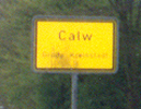
Calw Dist., Baden-Wuerttemberg
District was created in 1938 which merged Calw, Neuenbuerg
and Nagold. 15 villages were switched over to the neighboring dist.
of Enz, Rastatt and Boeblingen and was given 6 municipalites from Freudenstadt.
Horb dist. was dissolved. As of 1973 they are:
*Places in green are listed as places ancstor of German-Russians who lived in Borodino / Bessabaria, Southern Russia which is presently in the Ukraine. |
Calw (City of) / Calw Dist., Baden-Wuerttemberg Location: It is in south Germany and in the northern part of the Black Forest. History. First a small village then a town and, now, a city which has grown up around the castle of the Grafen of Calw which was first recorded in 1075. In the 16th century, the Duke of Wuerttemberg built his summer residence here.
 Remmick-Hubert Photo
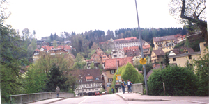 Remmick-Hubert Photo
![]()
Crailsheim (sub dist. of)/ Schwabish Hall Dist.,
Baden-Wuerttemberg
|
![]()
A/B/C/D/E/F/G/H/I/J/K/L/M/N/O/P/Q/R/S/T/U/V/W/X/Y/Z
Dagersheim / Boeblingen-Wuerttemberg [City of Boeblingen / Dagersheim Dist (within the city), Boeblingen Dist., Baden-Wuerttemberg] Location: Boeblingen has merged with Dagersheim and Sindelfingen. To the north is Graenau. To the south west is Aidinngen and to the south is Ghnigen and Gaertringen. Ludwigsburg is north east abut 20 km.
![]()
Daimbacher Hof / n. Moersfeld, Kirscheimbolanded Dist, Rhineland-Palatinate, Germany. Location. Slight east and north of Moersfeld abt 1 and 1/2 km. North is Stein-Backenheim. East and slightly north is Wendelsheim. East and slightly south abt 10 km is Alzey. South is Kirschheimbolanden abt 13 km. West and slightly north is Tiefenthal , west is Niederhausesn an der Appel. South and past Moersfeld is Keiegsfeld. History. Mercury mines known as "Altes Werk", "Neues Werk", "Carl Theodor" and Elisabethgrube" are known. It is believed the minimg activities can be dated as early as the 1100s.
![]()
Danube River Route from Ulm/ Wuerttemberg to Black Sea.
![]()
|
Darmstadt-Dieburg Dist., Hesse
Ceated in 1975 by merging the dist. of Darmstadt and
Dieburg. See Hesse / Hessen for districts, cities and
towns
|
Darnstadt, City of / Darnstadt's Urban Dist., Hesse] Within 20 km (clockwise) is Franfurt to the north, Aschaffenburg to the east, Bensheim to the south, which is just east of Worms. Mainz to the east and Wiesbaden at about 11 o'clock.
![]()
Delitz/ Saxony [Delitz (??) / ___ Dist., Saxony-Anhalt]
There is a Dehlitz, Saxony-Anhalt (Sachsen-Anhalt. Location: To the west is Burgwerben and Markwerben, which is, now, part of Weissenfels / Burgenland Dist., Saxony-Anhalt (2010).. South is Granschuetz and Zorbau. North is Schkortieben / Burgelandkreis (Burgeland Dist.), Saxony-Anhalt and Grosskorbetha, which is also, now, part of Weissenfels, which is on the Saale River.. West is Luetzen.
Delitz, Sachsen [Delitzsch / Nordsachsen Dist., Saxony] Location: less than 20 miles southeast of Halle. Between Halle and Delitzsch is Landesberg. North is Bitterfeld-Wolfen, east is Schoenwoekau. South is Rackwitz.
![]()
Derendingen / Tueblingen, Wuerttemberg [
![]()
Dettingen/ ___ Wuerttemberg
![]()
Dieburg / Darmstadt-Dieburg Dist., Hessen. Location. It is abt 10 km east of Darmstadt. History. The language spoken in the village was Middle High Berman. Words like "diot" means "people" and "Burg" means "castle". The village was named Dieburg in the tax boks of the archbishopric of Hessen-Nassu in 1492.
![]()
Diedersweiler / __, Wuerttemberg [Diedersweiler ??] Could be Dietersweiler / n. Freudenstadt, Baden-Wuerttemberg. Location: South of Hailwagen. Southeast of Freudentstadt. North of Ursental and Lossburg. In the Black Forest.
![]()
Dittlingen / __ Wuerttemberg [Dittlingen (?? ) / __Could this be Dettingen? Or Dietlingen / Enz Dist., Baden-Wuerttemberg? Dietlingen is northwest of Zufenhausen and Stuttgart. East is Ludwigsburg, West is Efflingen and south is Calw. Northwest is Karlsruhe.
![]()
Dobel, Calw-Wuerttemberg [Dobel / Calw Dist., Baden-Wuerttemberg]; located east of Bad Herrenalb, west of Hofen an der Enz and northeast of Bad Wildbad.] See Calw for History of area.
![]()
![]() Doehren / Minden, Westfalen, Prussia [Doehren / Petershagen,
Minden-Luebbecke Dist., North Rhine-Westphalia] Location:
Near Petershagen, which is southwest abt 5km. North northwest is Uchte.
East is Rehburg-Loccum. West is Haeverner Marsch then farther west
iis Raddestorf. South is Gehlberg
Doehren / Minden, Westfalen, Prussia [Doehren / Petershagen,
Minden-Luebbecke Dist., North Rhine-Westphalia] Location:
Near Petershagen, which is southwest abt 5km. North northwest is Uchte.
East is Rehburg-Loccum. West is Haeverner Marsch then farther west
iis Raddestorf. South is Gehlberg
![]()
Donnersberg Dist., Rhineland-Palatinate]
It is an area, not a town, which surrounded a mountain
Donnersberg [=Donners Mountain]. Merged in
1969 were the districts of Kircheimbolanded and Rockenhausen and they became
Donnersbergkreis (Donnersberg Dist.)
|
- |
Donnnersberg Dist. continued:
|
Donnersberg/ __, Pfalz [______??__ / Donnersberg Dist., Rhineland-Palatinate]
![]()
Dornstetten / ____, Wuerttemberg [Dornstetten / Freudenstadt Dist., Baden-Wuerttemberg]; located in the Black Forest. 7 km east of Freudenstadt. Since 1975 it is part of a reorganized communites of Dorsteen, farmstad Lattenberg, Aach, farmstead Benzinger Hoff. I will include the settlements which no longer exist. They are: Brenneweiler, Buehlerhof, and Diffentahl (=Niedertall)
![]()
Dachenbronn / Weissemburg, Alsace [=Drachenbrennen/ [Drachenbrennen/ Dept of Base-Rhin, Alsace, France] See Alsace.
![]()
Duerrmenz / Wuerttemberg [Durrmenz / n. Maulronn (1838), Enz District, Baden-Wuerttemberg], which is directly west of Vaihingen an der Enz] [Note: Waldensian colony in Duerrmenz (Kingdom of Wuerttemberg) was formed in 1699. The 500 or so reformed protestant refugees coming to this colony from the Piedmont region where all called Waldensers regardles of their original place of residence or religious history." See http://rtgenealogy.net/Durrmenz.htm Connected to this settlement were the villages of Maulbron, Schmle, Lienzingen, Otlsheim, Schoenenberg, Enzberg, Lomersheim and Muehlacker.
![]()
Duerrmettstetten / Sulz, Wuerttemberg [Duerrmetsstetten / n. Sulz am Neckar, Rottweil Dist., Baden-Wuerttemberg] Located 7.3 km north northwest of Sulz am Neckar. Kalten is north. Lossburg / Freudenstadt is west. Neckarhausen (7.3 km) and Empfingen is east
![]()
Durlach / Karlsruhe, Baden [Durlach Bourgh of the city of Karlsruhe / Karlsrluhe Dist., Baden-Wuerttemberg]Location: Northwest is Hagsfeld and northeast is Bretzingen. East is Pfinztal. South is Hohenwettersbach. Karlsruhe surrounds Durlach. It is abt. 8 miles from Karlsruhe's city center.. History. The earliest information I have is that Durlach was in the hands of the Holy Roman Emperor Frederick II (House of Hohenstaufen) Therefore, Durlach was part of the "outside" posessions of the Habsburg of Austria. Margrave Charles II in built his castle west of Durlach in 1565 and ruled this area called Baden-Durlach. It and a lot of the area was destroyed by the French in 1689. In 1715 Durlach was part of the grand-duchy of Baden.In 1938 Durlach was incorporated with Karlsruhe / Baden. Baden-Wuerttemberg became one 25 April 1952. The Pfaff family had a sewing machine factory, which is presently the Raum Fabrik building, in Durlach. Nearby is a village called Bretton where the Protestant reformer Philipp Schwartzerdts (1497-1560), was born. He collaborated with Martin Luther and along with Luther is considered on of the founders of the Lutheranism. He is also known as Philipp Melanchthon, because he had transformed his name to Greek, which he fondly learned from his teacher the rector Georg Simler of Wimpfen. There is a castle ruin on the Turmberg hill. See wikipedia for pictures. There is a "Turmbergbahn" (train) that will take you up for the view.
![]()
A/B/C/D/E/F/G/H/I/J/K/L/M/N/O/P/Q/R/S/T/U/V/W/X/Y/Z
Edenkoben / SuedlicheWeinstrasse Dist., Rheinland-Palatinate (Pfalz) / Location: Between Neustadt "an der Haardt" and Landau in der Pfalz . Speyer is abt 12 km east. Neustadt unter Rietburg is a few km south Just west is Ludwig I of Bavaria's summer villla known Ludwigshoehe. Above it is he ruins of the old castle Rietburg, which was built by Hermann von Riet, who-- I repeat the tale -- in 1255 took Welf Queen Elisabeth, the wife of German King Wilhelm, hostage. During the Thirty Years' War, the castle was destroyed and never rebuilt. There is a chairlift that will take you up to it or you can use the hiking trail. There is a restaurant Hoehengaststaette Reitburg which is quite popular. Map of Rheinland-Palatinae Wine Road. See flickr photos: http://www.flickr.com/potos/uempe/4971404975.
![]()
Egenhausen-Wuerttemberg [Egenhausen, Calw Dist., Baden-Wuerttemberg] Location: North is Altensteig. East is Waldorf. West is Wormererg. South is Beihingen. Nagold is east southeast abt 8 km. Calw is less than 10 miles northeast. See history for Calw. PamOramio has some nice photographs of Egenhausen by Pesch in 2004 at http://www.panoramio.com/photo/1409849
![]()
Eich, A Collective Municipality
in Alzely-Worms Dist. in
Rhineland-Palatinate:
|
Eich / Alzey-Worms (am der Rhine) Dist., Rhineland-Palatinate] Often times "A" and "E" are interchangable, BUT, not always.. Eich is located north of Worms next to Biblis on the south, Riedstadt on the north and farther to the west is Alzey. Dates bach as far as 782 as a fishing village. ~ It can be placed in error, however, as is the following people who were. [Correction 17 Sept 2016.]
![]()
Eichberg / Hornberg, Wuerttemberg [Eichberg = Aichberg / n. Hornberg Rottweil Dist., Baden-Wuerttemberg]. Near Hornberg / Calw Dist., Baden-Wuerttemberg, which is located in the eastern part of the Black Forest. It is right next and south of Alternsteig. Aichberg 2 km west from Rohrbach. And Schitach is not far away.
![]()
Eichloch / Darmstadt, Baden [Eichloch (??) /__??___, Baden-Wuerttemberg
Eichlach (??)/ Darmstadt-Dieburg Dist., Hesse]
Eichlach=Aichlach / Aichach-Friedberg Dist., Bavaria
Eichlach / n. Voehringen, Neu-Ulm Dist., Bavarian Swabia, Bavaria Location. Abt 3 km west is Voehringen. North is Illerberg. Northeas is Weissenhorn. East is Bubenhausen. South is Tiefenfach.
Eichlalch n. Hohentengen, Tueblingen Dist.Location. West is Hohenfengen. Norhwest about 12 km is Sigmaringen. North is Herbertingen. East is Bad-Saulgau. South is Wolfarsweiler.
![]()
Emmingen Dist., Freiburg Adm. Region,
Baden-Wuerttemberg
|
Emmingen / __, Wuerttemberg
Emmingen-Liptingen, Tuttlingen Dis., Baden-Wuerttemberg]; Emmingen and Liptingen were combined in 1975. They are located south of Wildberg, west of Haslach, which is southwest of Herrenberg and north of Nagold, abt 5 miles. History. First mentioned in records in 820. Merged with Liptingen in 1975.
Emmendingen /Emmendingen Dist., Freiburg Admin. Region, Baden-Wuerttemberg
![]()
Endersbach/Waiblingen, Wuerttemberg [Weinstadt-Endersbach / Rems-Murr Dist., Baden-Wuerttemberg]. Location is south of Korb, east of Waiblingen and west of Remishaiden and southwest of Esslinngen.
![]()
Endingen am Kaiserstuhl/ ___Baden and Wuerttemberg [Endingen / Emmendingen Dist., Baden-Wuerttemberg] Location: On the border with France. Held the status of "Imperial City" in the Roman Empire. In 1805 was assigned to Baden. History. Founded in 862. In the early years it belonged to the Lords of Endingen. After a few centures Endingen was in the hands of the Lords of Uesenerg. About 1285 it received city rights. When the Lords of Uesenberg became extinct, the town wa given to the Habsburgs who turned it into a "Vorderoesterreich" (territory outside). By the 15th century it held the status of an Imperial City of the Holy Roman Empire. In 1805 Endingen as assigned to Baden.
![]()
Ensingen / n. Vaihingen an der Enz, Ludwigsburg, Baden-Wuerttemberg. Location. North of Vaihingen an der enz. South east of Schuetzingen. South of Zaberfeld. North west is Horrheim and Hohenhaslach. Southeast is Sachsenheim History. See Vaihingen an der Enz.
![]()
Ensingen-Nuertingen, Wuerttemberg
Christian Hein b. 1750 Ensingen-Nuertingen, Wuerttemberg d. 1810 Ensingen-Nuertingen, Wu m.. 1782 Ensingen-Nurtingen, Wu to Erna Sophie Gerling b. 1751 d. 1812.. (Source: Familie Eckert web site: http://www.genealogy.net/privat/boehm.m/Fam_Eckert.htm) Issue:
![]()
Entringen / __, Wuerttemberg [Entringen / (Ammerbuch Municipalities), Tuebingen Dist., Baden-Wuerttemberg] Location: Tuebingen is south southeast abt 6 km (as the crow flies) North is Ammerbuch, south is Pfaffingen and Unterjesingen. East is a dense forest. West is Tailfingen abt 4 km. Herrenberg is abt 8 km north northwest. History. Excavation has proved there were Alamanni living here from abt the 5th century. Hohenentrigen Castle is above Entringen by Lord Adalbertus de Antringen. Notice the "A" has changed to "E". . The city is seen in records that date 1075. The castle is recorded in 1284. St. Michael's church construction started in 1425. Ou of 1,100 villagers, only 470 survived the plague and the Thirty Years' War. In 1806 the new road that came from Tuebingen to Herrenberg went through Entrignen and Entringen became part of Oberamt Herrenberg. In 1909 the towns were linked by the railroad. 1938 the town went back to Tueingen Dist.. It became part of the Ammerbuch municipality of Ammerbuch 1 Dec 1971 with five other villages.
![]()
Enz District (Enzkreis).
Baden-Wuerttemberg
|
continued....
Pforzheim: Although the dist. of Enz surrounds Pforzheim, it does not belong to Enz Dist or any other Admin. Dist. It stands alone.. It does have admin. offices in Enz Dist. |
![]()
Enztal / __, Wuerttemberg [Enztal / Calw Dist., , n. Enzkloesterle and Baden-Baden, Baden-Wuerttemberg Location. Baden is ab 10 km north northwest of Baden-Baden. North is Enzklowesterle and farther north is Bad Herrenaib-Dobel. South is Simmersfeld. West is Forbach. East is Neuweiler.
![]()
Enzweihingen / Vaihingen an der Enz Sub-Dist., Ludwigsburg Dist., Baden-Wuerttemberg. Location: Northwest abt 2 km is Vaihingen and der Enz. Northeast is Pulverdingen. Southeast is Markgroeningen abt. 5 km. South is Hochdorf an der Enz and Eberdingen and farther south is Hemingen.
![]()
Eppelheim / Baden [Eppelheim / Rhein-Neckar Dist., Baden-Wuerttemberg] Location; 1 mile northeast of Heidelberg. The urban dist. of Heidelberg almost surrounds Eppelheim in 2012. Mannheim is abt 20 km northest. West is Bruehl abt 6 km.. West and a little south is Plankstadt. North is Friedrichsteig. South southwest is Offersheim. Bruchhausen is south. History. There are archaelogoical finds from the neolithic (New Stone Age) era. In 770 the town was recorded when a grant was given. By the 1000s, the area belonged to the Electoral Palatinate. The French destroyed Eppelheim on 28 Jan. 1689.
MAP: Luetzelsachsen with Eppelhim, Landenburg , Mannheim, Schriesheim and Weinheim
![]()
Erbstetten / ___ Wuerttemberg [ Erbstetten / Laulterach, Alb-Donau Dist, Baden-Wuerttemberg Location: Anhausen and Hayingen is west in the Reutlingen Dis.. Mundingen is east and farther east is Ehingen in the Alb-Donau Dist.. North is Bichshausen then Apfelstetten before reaching Muensingen.
![]()
Erdmannhausen / Ludwigsburg, Wuerttemberg [Erdmannhausen / Ludwigsburg Dist., Baden-Wuerttemberg.] Location: West is Marbach am Neckar and will probably merge in the next few years, if it hasn't already. Ludwigsburg is south southwest abt 6 km. North is Steinheim an der Murr. West is Kirchberg an der Murr. South is Affalterbach
![]()
Erdmannsweiler [Erdmannsweiler / Schwarzald -Barr Dist., Baden-Wuerttemberg]; located n. Konigsfeld im Schwarzwald (Black Forest), south of Burgberg and west of Niedereschach and east of Sankt Georgen im Schwarzwald abt 11 km and north of Schabenhausen, which is north of Villigen-Schwenningen
![]()
Erpfingen / __, Wuerttemberg [Sonnebuehl-Erpfingen / Reutlingen, Baden-Wuerttemberg] Location: Erpfingen is south of Sonnebuehl abt 3 km. West is Hechingen abt 10 km, south is Hausen an der Lauchert. East is Enstingen. Tuebingen is north north west abt 10km. The other villages in the community of Sonneuehl enclude Genkingen, Undingen and Willmandingen. It is known for its " Baarenhehle " ("Bear Cave") , a limestone cave named for the cave bears who's skulls and bones were discovered. 20,000 years ago these small cave bears, cave lions and cave rhinos entered caves like this in the area of the Swaebishche Alb.. There are, also, spectacular stalactite and stalacmite formations.
![]()
Erzgrube/ Freudenstadt, Wuerttemberg [Erzgrube / ? Dist., (poss.Freudentadt Dist.), Baden-Wuerttemberg.] Location: Freudnstadt is abt 10 km south southwest of Erzgrube. Closer towns are Schernbach and Boettelfingen to the north and just slightly northwest is Nagoldtalslperre and Seewald / Freudenstadt Dist., Baden-Wuerttemberg.. Woenersberg and Nagold are east. Pfalzgrafenweiler is south southeast. Schwarwald (Black Forest) is west. The closest town west is Ruhestein. A dam over the Nagold River has created a lake named Nagoldsee next to Erzgrube.
![]()
Eschenburg / Lahn-Dill-Kreis Dist., Hesse, Germany Location. Like many German/ French villaes, this one dates back into the times of the Ketlics. Early on in its history there was mined in and around the village the metals of silver, nickel, copper and iron. Quarried near by was slate and diabase. In 1971 the villaes of Elbelshausen, Eiershausen and Wissenbach merged. In 1974 the villages of Hirzenhain, Simmersbach and Roth were merged. Today the area lies in a forrest area and it's pride is the 589 m. high mountain Eschenburg. History. The "radical pietist religion founder" Johann Daniel Mueller, was born in 1716 in nearby Wissenbach. He traveled east and d. in Russia, possibly Riga.
![]()
Esslingen Dist., Baden-Wuerttemberg
|
Esslingen, City of / Esslingen Dist., Baden-Wuerttemberg. Location. History. There is evidence where the city church was built, it was built on a site of preexsiting site that was a place created by people who gived there in the Neolithic Stone Age. The best guess is that the stie dates back to 1000 B.C. Laer, the Romanos built a warehouse in the area of Oberesslingen before the Romans built settelments and garrisons in Cannstatt and Koegen. By 777 the Catholic church had already set it's mark here and a chaplain of Charlemagne known as Pippin "bequeathed the church sixth cell upon the river Neckar to his monastery Saint-Denis. He also rought the bones of Saint Vitalis to Esslingen, which made it a target to pilgrimage and led to its growth." (Source: wikipedia). Therefore, it's growth gave it the attention of it's ruler to make it a market town which was certified in 866. From 946 to 953 the town was in the hands of the Liudolf, Due of Swabia. In 1229 it was given "city righs" under the House of Hohnstaufen,'s Emperior Frederick II, the Holy Roman Emperor, Built at this time was the Esslingen bridge across the Neckar River.... It was not long after that the Counts of Wuerttemberg began their conflict of inheritance and religion. This last throug to the 1500s. This was followed by the Thirty Years War which ended in 1648. War, famine, epidemic did not skup over Esslingen. More than half of it's population died during this time. The independent city lost it's rights under Napoleon who place it into the Duchy of Wuerttemberg. There was WWI then WWII. In 1973 Esslingen am Neckar merged with Nuertingen Dist.
![]()
Ettlingen / Karlsruhe Dist., Baden-Wuerttemberg Location: Abt. 8 km from Karlsruhe. It is on the northern edge of the Black Forest. Nearby are Waldronn,Rheinstetten.
![]()
A/B/C/D/E/F/G/H/I/J/K/L/M/N/O/P/Q/R/S/T/U/V/W/X/Y/Z
Feckelburg/ Pfalz [Feckelburg (??) See Foeckelberg.....
![]()
Flacht / Vaihingen, Wuerttemberg [Flacht / n. Weissach, and Vaihingen an der Enz Dist./ Baden-Wuerttemberg] Location: North is Wissach. East is Hirschlanden and Ditzingen which is slightly south of Hirschlanden, south is Perouse. West is Griozheim and Wimsheim. Vaihingen an der Enz is north northeast. History: See Vaihingen an der Enz.
Flacht / Rhein-Lahn Dist, Rhineland-Palaltinate
![]()
Flaeisheim / ___, Baden [Flaeisheim (??) Did not find a place called Flaeisheim in Baden. Will continue searching.
Flaesheim / Recklinghausen Dist. of Haltern an See (Ruhr area), North Rhine-Westphalia Location. 14 km (8.7 miles) from Recklinghausen / Westfalen. Recklinghausen is the most northern city in the Ruhr area. It was first mentioned in 1017 as "Ricoldinchuson... It was a part of the County of Vest owned by Recklinghausen. By 1576 it was in the hands of the Elector of Cologne. During the Colonge War this area was plundered, feuds over religion was constant.... Finding witches in Recklinghausen was out of hand from 1514 to 1710. There were more han 100 trails which claimed a person or people were witches. In 1600 Recklighausen area was divided. I do not have any history n Flaesheim.
![]()
Flehingen / Karlsruhe, Wuerttemberg [Oberderdingen-Flehingen / Karlsruhe, Baden-Germany] Location: 30 km east of Karlshuhe. Zaisenhausen is north and slightly east of it is Sulzfeld. East is Kurnbach, South is Maulbroon. West southwest is Gondelsheim. Kraichtal is north northwest. Flehingen is by the Bildingungszentrum Schloss See Karlsruhe History.
![]()
Feuerbach / ___, Wuerttemberg [Feurerbach\ Dist in City of Stuttgart (Stuttgart-Feuerbach), Baden-Wuerttemberg.] In 1933 Feuerbach was surrounded by city of Stuttgart and given the status of "Feuerbach district". in 2001 it was divided into the neighorhoods of An der Burg, Bahnhof Feurerbach, Feuerbach-Mitte, Feuerbach-Ost, Feuerbacher Tal, Hohe Warte, Lemberg-Foehrich and Siegelberg. See history of Stuttgart.
![]()
Fleorisheim/ n. Heidelberg, Baden [Floersheim-Dalsheim / Alzey-Worms Dist., Rhineland-Palinate. Location: Eppelsheim to the north. Worms-Pfeddersheim to the southeast and father east is Worms, which is abt 5 km away. Monsheim is south and west is Gauersheim and Stetten. Heidelberg is less than 20 km south southeast. You would pass Ludwigshafen and Mannheim on the way to Heidelberg..
![]()
Foeckelberg (Fockelberg / Kussel, Pfalz [Foeckelberg, Altenglan Sub-Dist. of Kussel Dist., Rhineland-Palatinate] Location: Northwest is Muehlbach and Rammelsbach. West is Haschbach am Remigusberg. South is Oberstaufenbach and Neunkirch am Potzberg. East is Niederstaufenbach. Although Fockelberg is listed as being in the Kussel Dist., it is presently in the Sub-Dist. (Verbansgemeinde) of Altenglan Dist. of Kusel Dist. in the state of Rhineland-Palatinate. See Rhineland-Palatinate Dist. section, map and history.
![]()
Frankenbach / Neckarkreis, Wuerttemberg [Fankenbach (??)/ ___ Rhine-Neckar Dist., Baden-Wuerttemberg], Location. History. Notes. I think an error has been made. Frankenbach is not in the Neckarkreis (Neckar District) it is in the Heilbronn Urban Dist. See below and Heilbronn / Heilbronn Urban Dist., Baden-Wuerttemberg.
Frankenbach n. Neckar (River) / Heilbronn Urban Dist, Baden-Wuerttemberg. Location. Just north of Heibronn (an der Neckar) . North and slighly west is Neckargartach n. Neckar River / Heilbronn Urban Dist./ Baden-Wuerttemberg.. North is Obereisesheim. West is Maessenbachhausen. Southwest is Leingarten and west of Leningarten is Schwaigern. History. See Heilbronn. See, also, history of Neckargartach.
![]()
Frankfurt am Main . City of ( Ural Dist.)., Hesse
which are:
Frankfurt am Main City Urban Dist.., Hesse:
|
Frankfurt [Frankfurt am Main (the city of) / (with 16 urban dist.), Hesse] Location: This city is not to be confused with Frankfurt an er Main.. This Frankfurt is on the Oder River where the earlly Franconian colonist settled on the western bank of the Oder Riber. There were settlements here earlier. They like those who followed dealt in trade because of their position on the Oder. In 1430 they became a part of the Hanseatic League. The Thirty Years' War placed Frankfurt on the Oder on the map because of a Battle between the Holy Roman Empire and the Swedish Empire, who, with the Scots, were the fictors. Napoleon placed Frankfurt on der Oder into the Province of Brandenburg in 1815. It little matter who was ruling, trade continued. The eastern bank was Frankfurt, once known as Dammvorstadt, which became part of the Polish town of Stubice in 1945. In 1990 it became part of the Staate of Brandenburg. Since it is the fifth largest city in Germany it has merged with many surrounding villages and towns through the years. There are 45 city districts which I have placed above.
![]()
Frankfurt an der Oder/ Brandenburg Location: On the border of Germany and Poland. It is little over half way to Pozan / Poland. Potsdam is to the west. Gorzow Wielkopoiski is northeast. North and about 100 km is Szczencin. Abt 50 km south is Ottbus. Before 1945 the city known, now, as Zliwitz (Swubice) was part of Frankfurt (Oder)... History. Founded in 1253 where a settelment probably already existed. In 1430 the town joined the Hanseatic Lealgue for a short time. Battle of Frankfurt an der Oder that was between the Swedes and the Holy Roman Empire occured in April 1631 durning the Thirty Years' War. The Swedes with the Scottish took the victory. In 1815 Frankfurt became part of the Province of Brandenburg. Since the city was beteen Berlin and Pozanan on the Oder River, it bore heavy traffic for trade as well as emigrants traveling east. See Brandenburg history and map.
![]()
Frauenzimmern,Württemburg [Frauenzimmrn / (subdivision of the town of) Gueglingen / Heilbronn Dist., Baden-Germany.] Location: Frauenzimmern and Elbensbach became a subdision of the town of Gueglingen, which is east and will probably merge at some point in time. Northeast is Brackenheim. Pfaffenhofen is west of Gueglingen. South is Cleebronn. North is Haberschlacht. Heilbronn is abt 10 km north northeast.
![]()
See larger map - Freudenstadt District |
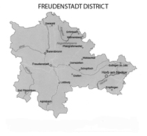
Freudenstadt, Dist.., Baden-Wuerttemberg
Cities
Administrative Districts
Towns and Municipalites are:
|
Freudenstadt / ___, Wuerttemberg [Freudenstadt, Freudenstadt, Dist.., Baden-Wuerttemberg] which is located on the north edge of the Black Forest. North is Baiersbronn. East is Domstetten. South is Lossburg. and west is Bad Beterstal-Griesbach about 12 km. It sits on the edge of the northern part of the Black Forest. History. I haven't found very much about this city and communities. We know that Heinrich Schickhardt, an architect, designed a building in Freudenstadt by the order of Duke Frederick of Wuerttemberg in 1599. The Bothic/Renaisance Evangelical Luther CHurch dates back to about 1601. Because it is a high plateua the air is fresh and appreciated.
![]()
Friedland / __, Mecklenburg [Friedland / Mecklennburgisch Seenplate, Mecklenburg-Western Pomerania] See Mecklenburg
![]()
Friedrichstal (=Stutensee ) / Karlsruhe Dist., Baden-Wuerttemberg Location. It is either near or has mierged with Stutensee which is northeast of Karlsruhe. History. In 1975 Stutensee with the connection of the following villages: Blankenloch, Buechig, Friedrichstal, Spoeck and Staffort. Friedricstal was founded in 1699 by Huguenots who migr. from Belgium, Switzerland and north of France (Source: wikipedia).
![]()
Friolzheim / Enz Kreis, Baden-Wuerttemberg [Friolzheim / Enz Dist., Baden-Wuerttemberg] Location: North is Wimsheim and a few km farther north is Wurmberg. East is Weissach. South is Betzenbuckel and Muelhausen. West is Neuenbuerg. Northeast is Pforzheim abt 10 km.
![]()
Friesenheim / __, Pfalz [Friesenheim / (sub dist)Nierstein-Oppenheim, of Mainz-Bingen Dist., Rhineland-Palatinate] Location: Friesenheim is in the collective municipality of Nierstein-Oppenheim in the Mainz-Bingen Dist. , Rhineland-Palatinate. North northeast is Oppenheim,. Darmstadt is abt 10 km east. and, south is Weinolsheim. West is Undernheim and farther west is Woerrstdt / Alzely-Worms Dist., Rhineland-Palatinate. North is Koengernheim and Hahnheim.
![]()
Fuerfeld / Bad Kreuznach, Rhineland-Palatinate Location. Map. History.
![]()
Fulda Dist/. Kassel Admin.. Hesse,
Germany
|
Fulda Fiulda Dist/. Kassel Admin.. Hesse, Germany. Location. Along the Fulda River in the state of Hesse. History. It exsisted in 744 and is doc when the Benedictine Monastery was built by Saint Sturm. The grandt was signed by Caroman, the son of Charles Martel. The Houses of Pippiid and Carolingian ruled the area from 747 to 779. It was a "sovereigh principlaity" and continued to be so under the Emperors of the Holy Roman Empire. . It was given to the prince of Orange-Nassau in 1803 then Napoleon ruled and annexed it to the Grand Duchy of Berg in 1806. In 1809 it was the princiipality of Franfurt. After the defeat of Napoleon, the Congress of Vienna gave the territory to the Elecorate of Hesse. In 1866 it was annexed to Prussia.
![]()
A/B/C/D/E/F/G/H/I/J/K/L/M/N/O/P/Q/R/S/T/U/V/W/X/Y/Z
Gaertringen), Boblingen, Wuerttemberg [Gaertringen / Boeblingen Dist., Baden-Wuerttemberg] Location: It is 25 km southwest of Stuttgart and has joined with the village of Rohrau, which is southeast. Southwest is Nufringen and beyond is Herrenberg, which is abt 5 km. West is Wildberg. North is Aidlingen. Northeast is Boeblingen, which is abt 5 km. East is Holzgerlingen and Altdorf. History: No data given... Will continue to search.
![]()
Gaiberg / near Heidelberg, (a municipality in Neckargekmuend sub dist. in ) Rhein-Neckar Dist., near Heidelberg, Baden-Wuerttemberg which is , Baden-Wuerttemberg Location: It is abt 10 km south and slightly east of Heidelberg. Leimen then Sandhausen are southwest. Neckargemuend is north. Wiesenbach and Bammental are east. Mauer is south southwest. History: Documents provide us with the information that the settlement exsisted before it was purchased by the Electoral Palatinate in 1419. Gaiberg was handed to Baden in 1803. Today it lies within the Neckartal-Odenwald National Park.
![]()
Gerbach / Crailsheim , Wuerttemberg [Gerebach (??), [poss. ]) See Crailsheim,
poss. Gersbach / n. Crailsheim, Schwabish Hall Hall Dist., Baden-Wuerttemberg Location. North is Schnelldorf, east is Feuchtwangen, southeast is Hohenkresberg, north is Fressberg, southwest is Goldbach and Crailsheim abt 5.9 km. West is Satteldorf. Northwest is Bronnholzheim and north northwest is Walhausen. Satellite view shows a few buildings off of Crailsheim Strasse off of road L1066.
Gerbach in Donnersberg Dist./ Rhineland-Palatinate.
![]()
Gebersheim / Leonberg, Wuerttmberg [Gerbersheim, n. Leonberg, Boeblingen Dist., Baden-Wuerttemberg]; Location is north of Leonberg, east of Rutesheim and west of Hofingen, which is northwest of Gerlingen. Became part of Leonberg in 1975 with Hoefingen and Warmbronn.
![]()
Gellmersbach / n., Weinsberg, Wu [Gellmersbach (merged with) Weinsberg / Heilbronn Dist., Baden-Wuerttemberg]
![]()
Gernsbach / ___ Baden [Gernsbach / Rastatt Dist., Baden-Wuerttemberg] is in the northern part of the Black Forest and nestled on both sides of he Murr River. The area was "nucleated" [villages suburbanized on the right of the Murr River are: Kelterberg Entensee, Kolonie and Nord.. On the left of the Murr River are: Klingele, Waldbach, Faltergrass, Heppeler, Walheimer, Hof, Stadtbuckel, Siedlung, Hanbachweg, Panoramaweg and Weinau. Baden-Baden is just west of Gernsbach. It is not surprising to discover that the main harvest are trees which co-insides with the plp and paper industry.
![]()
Gittlingen / __, Wuettemberg (? See Dettingen)
![]()
Glissen / Nienburg, Dist., , Niedersachsen [Glissen / n. Binnen (in the Sub-Div of Liebenau Municipality of ). Nienburg Dist., Lower Saxony] Location: North of Petershagen. Northwest of Windheim. West of Haevener. South of Radestorf. 10 km from Minden.
![]()
Godramstein / by Landau, Pfalz [Godramestein / Landau in der Pfalz, Rhineland-Palatinate] Located next to Landau to the east, next to Siebeldingen (2.5 km) and Birkweiler and Walsheim. South of Neudstadt an der Wessinstrasse. Just a short distance from Edenkoben.
![]()
|
Goeppingen Dist, Baden-Wuerttemberg
In 1938 Oberamter Geislingen and Goeppingen were merged. 1979 a few municipalites were added and they were Schaebish Gmuend and Ulm. The Staufen Hause had their roots in this area and is referred to as "Staufenkreiss" (Staufen District).
|
continued:
|
Goeppingen / ____, Wu.. [Goeppinen, Goeppinen Dist., Baden-Wuerttemberg]; Location: Part of the Stuttgart Region and at the base of the Hohenstaufen Mountains in the Fils River valley. . History. Founded by Geppo, a leader of the Alemannic (Suebian Germanic Tribes) around the 3rd or 4th century. . 25 Aug 1782 fire destroyed most of the town. By 1777 there was established nearby the Jewish village of Jebenhausen.
NOTE: Barons von Liebenstein issued what was called a protective letter that had granted Elias Gutmann and his fellow Jews to live in their new community from 1777 to 1938.. Town was destroyed in 1938 . A Jewish Museum opened in 1992 in (new) Jebenhausen
![]()
Goepfigheim / ___, Wuerttemberg [Hoepfigheim / n. Steinheim an der Muerr , Ludwigsburg Dist., Baden-Wuerttemberg] is located north of Marbach am Neckar which is north of Ludwigsburg. It is near a winery known as WG Hoepfigheim just off of K1611 road that comes from Kleingersheim and goes to Steinheim an der Murr..
![]()
Gotha, City of / Gotha Dist., Thuringia, Germany Locationl . North is Remstaedt. West is Truegleben. South is Kindleben. East is Tuetteben and farther east and slightly north is Erfurt. . History It appears that Gotaha existed by the time Charlemagne (b.742 d. 1814) was in power becasuse he mentions "Villa Gotha" ("Good Waters") in a document in a document in the 700s.. In 1640 Gotaha became th capital of the Duchy of Saxe-Gotha., a branch of te Wettin dynasty) Duke Ernest I "the Pious" built his residence (Schloss Friedenstein) in "Gotha". The city was part of the German Enlightenment during the Age of Enlightenment and Reason, whichwas a cultural movement in the 1700s. The rise of intellectural interchange, which often apposed abuses in the church, state and supersitions. It stands to reason that the carea played a large role in the German Workers' movement in the late 1800s.
There are 11 subdivisions in the Gotha District. See Thuringia, Sate of.
![]()
Greberg / by Heidelberg [Greberg (??)] An error. Should read Triberg..... Stumpp Bk. , page 471 tells us that Georg Wallewin migr. from Triberg/ Villingn-Ba to Borodino/ Bess., S. Russia. See Triberg.
![]()
Greunwettersbach / __, Baden [Greunwettersbach / n. Karlsruhe, Baden-Wuerttemberg. Location: Southwest and less than 5 km from Ettingen / Dist. of Karlsruhe. Karlsruhe is northwest abt 5 km. East is Remchingen, which is 18.4 km from Karlsruhe but in the Enz Dist. on the Pfinz River... South is Waldbronn and south of Waldbroon is Karlsbad.: Karlsruhe has 27 subdivisions and is part of an urban dist.. See history of Karlsruhe city.
![]()
Grimbach / ___, Wuerttemberg (Grimbach??) See same family listed for village of Groembach.
![]()
Groembach/ Freudenstadt, Wuerttemberg [Groebach / Freuenstadt Dist., Baden-Wuerttemberg] Location: Southeast is Woerrersberg, east northeast is Altensteig. North is Goettelfingen and farther north is Simmersfeld. . Freudenstadt is abt 11 km south southwest.
![]()
Groetzingen, Esslingen, Baden-Wuerttemberg [Groetzingen / n. Aichtal / Esslingen Dist., Baden-Wuerttemberg). Location: South of Aichtal . It is 18 km south of Stuttgart. North is Arthausen and farther north is Filderstadt. East is Nuertingen and farther east northeast is Esslingen South is Neckarailfingen and Altdorf. West is Waldenbuch and dense foret area. Nuertingen is about 4 km west.
----
Groetzingen / n. Karlsruhe, Baden-Wuerttemberg Location. West is Karlsruhe abt 8 km. Northwest is Hagsfeld. East is Pfinztal. Northwest is Durlach. History.
![]()
Gronau / Heilbronn, Wuerttemberg [Gronau / n. Obersteinfeld, Ludwigsburg, Baden-Wuerttemberg] Location: northeast of Obersteinfeld. Heilbronn and Weinsberg is north abt 7 km. Southeast of Beistein and south of Jettenbach. West of Nassach and Spiegelberg The villages of Gronau, Prevost and Obersteinfeld are incorporated with the district of Ludwigsburg, which is abt 15 km west southwest. Hstory. There is history of Oberstenfeld, Gronau and Preevost. It was owned by the Count of Lichtenerg who sold it to the Margraves of Baden. Gronau was bought by the Dukes of Wuerttemberg in 1350. Pevost along with Lichtenberg castle was taken over by the duke of Wuerttemberg in 1357. Somewhere in time after 1357 The imperial Nights held control. In 1803 it was retaken by Duchy of Wuerttemberg. Gronau and Prevost was part of Heilbronn Dist. after 1938 then was changed to the Ludwigsburg Dist. in 1972. Gets really confusing, doesn't it?
![]()
Grossapach / Backnang, Wuerttemberg [Grossapach / n. Backnang, Rems-Murr Dist. / Baden-Wuerttemberg] Location: Just north of Backnang, east of Rielingshausen . North of Grossapach is Allmersbach and Allmersbach am Weinberg. West is Steinheim an der Murr.
![]()
Grossingershausen / Wuerttemberg [Grossingershausen (??)....] Could the place be Grossingerheim because "heim" and "hausen" both mean "house".? . With more research, the Stumpp Bk. list him as migr. fr. Grossingersheim... See Grossingersheim
![]()
Grossingersheim / Ludwigsburg, Wuerttemberg [ Grossingersheim / n. Ingersheim / Ludwiigsburg Dist., Baden-Wueerttemberg] Located 1.7 km from Pleidelsheim, 3 km from Freiberg am Neckar and 6 km from Marbach am Neckar and 3.6 km from Bietigheim-Bissingen. Ludwigsburg is south abt 9 km. It is north of Ingersheim.
![]()
Groszinger / __, Wuerttemberg [??] See Groetzingen / Esslingen, Baden-Wuerttemberg
![]()
Gross Zimmern / Darmstadt-Dieburg, Hessen Location. 10 km east of Darmsstadt and next to Dieburg. History. See history of Dieburg / Darmstadt-Diwburg Dist. (Kreis), Hessen.
![]()
Grunbach / __, Wuerttemberg [Gruenbach / n. Remshalden, Rems-Murr Dist., Baden-Wuerttemberg], located 8 km wast of Waiblingen and 18 km east of Stuttgart.
NOTES: There is a Gruenbach in the Vogtlandkreis in Saxony. There is a Gruenbach in Erding Dist., Bavaria. And one in Upper Austria in the district of Freidstadt.
![]()
Gruenwettersbach / ___. Baden [Gruenwettersbach / n. Karlshrue (an urban dist.), Baden-Wuerttemberg]; Located by Holfartweier to the north, Hohenwettersbach to the north northeast, Palmsbach to the southeast and Waldbronn to the south and to the west is Ettlingen, Karlsrhue is north and a little to the west.
![]()
Gueglingen / __, Wuerttemberg [Gueglingen / Heilbronn Dist., Baden-Wuerttemberg] Location: 18 km southwest of Heibronn. It's subdivisions are Eibensbach and Frauenzimmer. To the west is Pfaffenhofen and Zaberfeld. North is Kleingartach. East is Brackenheim. South is Eibernsbach and southeast is Cleebronn.
![]()
Guenzburg District, Bavaria
Location. ZThe Danube River goes through the northern
part of the district and passes the cities of Guenzburg and Leipheim. The
eastern part of the disstrict is art of the Augsburg Western Forests Nature
Park. History: Guenzburg was known as the Burgau region. In 1213
the carea was bought by the Lords of Berg. The area became known as BergBurgau
until the ruler left no heirs in 1301. It became part of the area "outside"
Austria. When the Holy Roman Empire was abolished by Napoleon, the
area was taken by Bavaria. The Guenzburg Dist. was estabished in 1972
and the districts of Guenzburg and Krumbach were merged.
|
![]()
Gundelbach / __, Wuerttemberg [Gundelbach / Ludwigsburg Dist., Baden-Wuerttemberg.] Location: Maulbronn is west. Zaberfeld is north. Spielberg is east. Bundelbach is south and south of this is Vailingen an der Enz.
![]()
Gundelsheim, Heilbronn, Wuerttemberg [Gundelsheim / Heilbronn Dist., Baden-Wuerttemberg], located on the right bank of he Neckar River and is 17 km northwest of Heilbronn. Nearby are Neckarmuhbach to the west, Hassmersheim to the north and Hochstberg to the east.
![]()
Gundelshausen / ___, Wuerttemberg [Gundelshausen / Heilbronn Dist., Baden-Wuerttemberg.
Gundelshausen / n. Horb am Neckar, Wu.. Location. Horb am Necker is in the Freudenstadt Dist, Baden-Wuerttemberg
Gundelsheim/ Heilbronn, Baden-Wuerttemberg east of Neckamuelbach and a Gundelhausen in Ludwigsburg Dist...
Gunzenhausen / n. Ostrach / Sigmaringen, Baden-Wuerttemberg
Gundelshausen / Rottweil Dist, Baden-Wuerttemberg
![]()
Gundremmingen / __, Bavaria [Gundremmingen / Guenzburg Dist, (Swabia) Bavaria]; Located n. of Duerrlauingen, south off Laugen and west of Glott and southeast of Offingen which is east of Gunzburg. Although it was in Bavaria, it had been owned by the Habsburgs between 1301 to1806 when it became part of Bavaria.
![]()
Gruppenbach / __, Wuerttemberg [Gruppenbach (??)] It is a name of a river in Baden-Wuerttemberg. There is a castle known as Stettenfels (inhierited by Friedrich Spieser in 1957) that is in the Gruppenbach municipality which is in the Heilbronn Dist., Baden-Wuerttemberg.. There is a village called Uptergruppenbach, which I assume is across the river.
![]()
Gueglingen / Heilbronn, Baden-Wuerttemberg
![]()
Gueltlingen / Nagold , Wu [ Gueltlingen / n. Nagold, Calw Dist., Karlsruhe Admin., Baden-Wuerttemberg] Location. North is Stammheim. West is Neubulach. Southwest is Schonbronn. South is Wildberg. Farther south is Nagold. East is Deckenpfronn and farther east is Gaertringen. History. See Calw. history with maps.
![]()
Gutach / Wolfach, Baden [Gutach / (Schwarzwaldbahn im Schwarzwald) , n. Wolfach, Ortenau Dist., Baden-Wuerttemberg] Location. It appears to be a few building, one of which is the train station. To the north and slightly west is Hausach. If you turn around and head east from Hausach ther is Wolfach. It appear to be about 5 km as the crow flies, but it's in the Black Forest so it would be farther by road. Traveling farther west is Schiltach, which is where other Borodino ancester had lived for a time. . To the south is Hornberg. Kirnach is east. West, over many hills, is Muehlenbach.
Gutach / Gutach im Breisgau Sub Dist./ Emmingen Dist., Baden-Wuerttemberg. Location. Northeast is Niedenwiden and frther on is Winden im Eltzal. Southwest is Waldkirch. Southwest is Simmorswald. West is Emmendeingen abt 8 km as the crow flies. There are six villages in City of Gutach's Dist.
![]()
Gutenberg/ ___, Wuerttemberg [Gutenberg, n. Lenningen, Esslingen Dist., Baden-Wuerttemberg. ]; Located south southeast of Lenningen and north of Roemerstein which is east of Bad Urach. and in the Reutlingen Dist..
![]()
Gutlingge / ___ Wuerttemberg See: Gueglingen / Heilbronn, Baden-Wuerttemberg
![]()
A/B/C/D/E/F/G/H/I/J/K/L/M/N/O/P/Q/R/S/T/U/V/W/X/Y/Z
Haberschlacht / Brackenheim-Wuerttemberg [Haberschlacht / n. Brackenheim, Heilbronn, Baden-Wuerttenberg] Location: Just north and slightly west of Brackenheim which is abt 2 km away. Schwaigern is north , east is Nordheim, south is Gueglingen and Pfaffenhofen . West is Sulzfeld and Zaisenhausen. It is called a "stadtteile" of Brackenheim, which is on the Zaber River. History. First mention in records in 1246. If you are looking for local Envangelical-Lutheran Church records, Brackenheim is the seat of this Church District. The Brackenheim Castle was built in 1556 to 1559 which was destroyed by fire then rebuilt in 1677-1685. Near Stocksberg is another castle by the same name. Grapes became a major part of the agriculture since the 1300s.
![]()
Haevern / Minden, Westfallen [Winshwim / Petershagen Sub. Dist., Minden-Luebbecke Dist., North Rhine-Westphalia]
![]()
Hagelloch/ Wuerttemberg, Germany [Haggeloch / Tuebingen Dist., Baden-Wuerttemberg]. Location: Abt 4 km nortth northwest of Tuebingen. Northwest of Hagelloch is Entringen and Ammerbuch. South west is Pfaffingen. Northeast is Bebenhauen. History: It was known original as "Hagenloch" which was owned by the Palatinate counts of Tuebingen. It was sold to a religious order and Bebenhausen Abbey was built in 1296. This ownership was dissolved in 1807.
![]()
Haiterbach / Wu. = Haiterbach / Calw Dist., Baden-Wuerttemberg, Germany. Location: Eastern part of the Blak Forest. 19 km northeast of Freudenstadt and 30 km west of Tuebingen. North is Oberschwandorf. West is Boesingen. East is Nagold. History
![]()
Haldensleben / n. Magdeburg, Prussia [Haldensleben / Boerde Dist., Saxony-Anhalt] Location. On the Ohre River, a tributary to the Elbe River and abt 30 km northwest of Magdeburg. Northwest is Buelstringen. North is Klueden and Letzingen. East is Loitsche and southeast is Wolmirstedt and south is Ackendorf. It is the capital of the Boerde Dist. History. In 1938 Althaldlensleben (Old Hldensleben) merged with Neuhaldensleben (New Haldesleben) and was called Neuhaldesleben. Now, it's simply called Haldensleben. See Magdeburg and Saxony-Anhalt.
![]()
Halle District,
Saxony-Anhalt Location. History
|
Halle an der Saale, City of (Free Town and City = Kresifreie Stadt Halle") / Saxony-Anhalt Location. North is Borholzhausen. West is Versmold. Southwest is Harsewinkel. Southeast is Steinhagen. East southeast is Bielefeld. History. May have been called "Saale" first since it was the largest settlement on the Salle River. The reason for it's importance is it's salt, the Celtic's called the area "halen" which is Welsh/Greton word for Salt. It is probable that Halle existed as early as the Bronze Age (2300-600 BC). From 806 to 1680 Halle was a part of the Archbishopric of Mageburg. Meanwhile the Giebrichenstein Castle is mentioned in 961. 1680 Brandenburg-Russia annexed Halle and Magdeburg. Mortizbur Castle was built between 1484 to 1503. It as a "hot bed" of Martin Luther's Protestant leaders and followers.... 1806 the Battle of Halle was fought between Prussia and French lead by Napoleon who took control until his defeat. 1815 Halle went back to Prussia and was part of the Prussian Province of Saxony.
![]()
Hambach / _?_ , Wu., Germany (
Hambach / Winnenden, Stuttgart Dist./ Baden-Wuerttemberg
Hambach / Heilbronn Dist., Baden-Wuerttemberg
Hambach, an Urban Dist. (borough) in Neustadt an der Weinstrasse/ Neudstadt Dist., Rhineland-Palatinate There is the Hambach Castle found here.
Hambach / in Rhein-Lahn Dist., Rhineland-Palatinate.
![]()
Hamburg, Free and Hanseatic City of Hamburg (Freie und Hansestadt Hamburg). Locaion: Southern point of the Jutland Peninsula. The North Sea is west and the Baltic Sea is east. It is on the Elbe River. Romans were here as was Empeor Charlemagne in 808 AD. The Emp.'s caslte was called "Hammaburg".
![]()
Hannweiler / __, Wuerttemberg [=Hanweiler / Rems-Murr Dist, Baden-Wuerttemberg] Location: Winnenden is north of Hanweiler. Bergien is east. Korb is south a slightly west and abt half way to Waiblingen. West is Hegnach and Remseck.
![]()
Happenbach / -- Wuerttemberg [Happenbach / (in the) Abstatt (mumicipality in the), Heilbronn Dist., Baden-Wuerttemberg. Location: Happenbach is a "hamlet" of Abstatt which encludes Vohenlohe. Heibrpnn is abt 10 km northwest. Untergruppenbach, Lauffen am eckar and Beilstein surround Abstatt and Happenbach. History: Became part of Wuerttemberg in 1510 and Abstatt officals were the adminsrators of Happenbach.
![]()
Harreshausen / n. Babenhausen / Darmstadt-Dieburg Lankreis, Hesse, Germany
![]()
Hasslach / _____
Haslach / Bad Duerkheim Dist. , Rhineland-Palatinate Located west of Neustadt an der Weinstrasse
Hasslach im Kizital / Ortenakreis, Adim. of Freiburg (became incorerated in 1 Jan 1890), Baden-Wuerttemberg)
Haslach / merged with Herrenberg which is in the Boeblingen Dist., Baden Wuerttemberg which was the combination of Muehlhausen and Raisteingen in the 13th century. Today Herrenberg is the combination of 7 addtional villages, which are: Affstaette, Gueltstein, Haslach, Kayh, Kuppingen, Moenchberg and Oberjestingen.
![]()
Hasloch / Neustadt, Pf. See Haslach / Neustadt an der Winestrasse, Pf.
![]()
Hauburg / ___ , Wuerttemberg [Hauburg (??) Could Hauburg be Hamburg? Or Homburg? ...??
![]()
Haugstadt / __, Wuerttemberg [Haug Stadt (Place) on Haup Strassa / n. (in) Neubulach / Calw Dist., Baden-Wuerttemberg. Location. Near by is Oberhaugstetten. South is Wildberg and farher south is Nagold abt 10 km. Northeast is Calw, which is less than 5 km. West is Neuweiler. Northwest is Karlsruhe, which is more than 20 km from Calw.
Following Haupstrasse into Neubulach there is "Haptsitze" where Haupstrasse changes to Altbulacher Strasse.
Oberhaugstetten's photo shows an old barn out in the country side by Neubulbach.
![]()
Haustadt / n. Beckingen, Merzig-Wadern Dist, Saarland Baden-Wuerttemberg] Location: Haustadt is n. Beckingen which is south southwest abt 3 km. Dueppenweiler [place where pottery was made] is east. Wolferskopf is west. Merzig is abt 8 km northwest. History, The district became property of Prussia in 1816. It wasn't until 1946 that it was reunited with Saarland..
![]()
Hauweiler / Waiblingen, Wuerttemberg [ Heuweiler / n. Korb / Rems-Murr Dist., n. Waiblingen, Baden-Wuerttemberg] Location: Between Hanweiler and Waiblingen is Korb / Rems-Murr Dist., which is abt 3 km southwest of Korb. Northwest is Schwaikhim and Winneden. Bergien is east. Southeast is Buoch and Remshaiden. History. Both Waiblingen and Winneden were under the Swabian League by 1519. In 1616 there was an epidemic in Winneden which took half of the lives. During the Thirty Years' War (1618 to 1648) the cities and towns around Hauweiler were pillaged by French and Swedish troopss. In 1634 Waiblingen was completely destroyed and the citizens were killed or deported. It was rebuilt after the Thirty Years' War.
Hauweiler / Breisgau-Hochschwarzwald, Baden-Wuerttemberg
![]()
Havelberg/ Stendal, Sachsen-Anhalt, Prussia, [Havelberg / Stendal Dist., Saxony-Anhalt. Germay ]Location: Part of the town is built on an island in the center of the Havel River. Hansestadt Havelberg is north. Border of Sachsen-Anhalt and Brandenburg is north. On the Brandenburg side is Truppenuebungsplatz Gloewen. Southwest is Sandu and Sadauerhollz. South is Kamen. Northwest is Werben. Dense forest area is east and on the edge is Untere Havel.
![]()
Hechingen / n. Tuebingen, Baden-Wuerttemberg Nearby is Castle Fortress of von Hohenzollern. See Hohenzollern Castle
![]()
Heidelberg / (Urban dist. in Rhein-Neckar Metropolitian Region), Baden-Wuerttemberg, Germany [Old Capital of Palatinate] Location: Southwest Germany. Left bank of the Neckar River and at the base of the two mountains ranges of Koenigsstuhn and Gaisberg. History: There has been found an extinct species of the genus Homo found nearby Mauer. It is recorded that a Celtic fortress was there in the 5th century. The "Mountain of Saints" (Heilgenberg) was a place of worship for the Celtics. The 24th Roman cohort occupied the area in 40 AD and later by the 2nd Cyrenaican cohort. And here the Romans remained until 260 AD when the Germanic tribes invaded and conquered the area. It was the village of Bergheim (Mountain Home), which is, now, in the middle of Heidelberg mention in 769 AD documents. The first reference of the exist of a village known as Heidelberg occurred in 1155 when the Heidelberg castle and the area nearby were taken by Conrad of Hohenstaufen (House of). Conrad of Hohenstaufen became Count Palatine of the Rhine (Pfalzgraf bei Rhein). In 1225 Louis I, Duke of Bavaria gained the Palatinate. The "Winter King" Frederick V of Bohemian ruled but one winter because the Habsburgs trooped into Heidelberg in 1621 and the Thirty Years' War started. Catholic line of the Bavarian branch of the House of Wittelsbach gained the area of Heidelberg as weil as the title of Prince-Elector but at the end of the war in 1648 the Winter King's, Frederick V's son, Charles I Louis, Elector Palatine recovered his titles and lands. The Protestants and the Catholics were have their tug-of-wars politically and with troops. The Protestant Reformation divided families of rulers on down to the peasants who worked the field. The Nine Years' War --often called War of the Palatine Succession or War of the Grand Alliance or the War of the League of Augsurg-- occurred from 1688 to 1697. With the constant turmoil and severe winters, thousands of Protestant German Palatines emigrated to the lower Palatinate in the early 1700s. There were over 6,000 Palatines who headed to New York and ended up in Pennsylvania. Then came 1803 and Heidelberg was to become a part of the Grand Duchy of Baden under Charles Frederick, Grand Duke of Baden. In 1815 everything changed, again, but Heidelberg remained part of Baden. Prussian troops entered Heidelberg in 1848 during the Paltinate-Baden rebellion of what's known as the 1848 Revolution and stayed until 1850.
Districts in Heidelberg , City of
are:
|
![]()
|
Heilbronn District (County of) /
Baden-Wuerttemberg.
Municipalites and Administravie Districts are:
List of cities and town in it's suburian area:
The villages in Heilbronn which were villages that were taken into Heilbronn are:
|
 See larger map of the cities by the Neckar River from Mannheim
down to Villingen-Schwenningen.
See larger map of the cities by the Neckar River from Mannheim
down to Villingen-Schwenningen.
Heilbronn (City of) / Wuerttemberg [Heilbronn / Heilbronn Urban area = county, Baden-Wuerttemberg; Located on the Neckar River. Ludwig is south abt 20 km. Stuttgart is south and slightly west abt 40 km. History: The village then town and, now, a city lies on both sides of the Neckar River. Humans date back to the Old Stone Age (30,000 BC). There are present day areas where the site of the Bronze Age can be found. The Celts arrived and mined here for salt. The town lies on what is historically called the "Lime Line" which is as far as the Romans pushed west which was east of the Rhine and Heilbroon was on the border of the outer boundary of the Roman Empire. . 150 AD the line became blurred and by the 4th and 5th century came under the Frankish Empire. The first Frankish settlement was built in what is presently the center of Heilbroon. By 841 King Louis "the German" set up court here. The name came earlier and was referring to the healing well (Heilbrunna". A large group of Jews made their home here in 1050. The town gain it's right to hold "market days" and "mint coins". In 1225 Heilbroon was taken into the Hohenstaufen Empire and it's noted that it was a city that had "parapet" and "trenches" around the city as a protect measure. Along came the Teutonic Knights and they gained ownership of the area south of Heilbroon which remained under the order until 1805, which is a period of time known as the German Mediatsation in 1805. Heilbroon left the hands of the (Hohen)Staufen House and went into the hands of King Rudolf I (House of Habsburg) who returned Heilbronns status of "city". With the return of status came the various right of being able to construct dams, harbours, mills and erect a new market place which it did on the foundation of Michaelsbasilica. The Habsburg Emperors were pleased with the prosperity and raised the city to "Imperial Free City in 1371. The villages of Boeckingen, Flein, Frankenbach and Neckargartach became part of the territory of Heilbronn, which kept being ambitious. A treaty with the Electoral Palatinate (1417 to 1622) allowed Heilbronn excellent protection of Wuerttemberg.... But as often happens, the peasants were unhappy and rose in rebellion... April 1525 the city was forced to open it's gates and the peasant marched into town with trouble and revenge toward the nobles and the churches... Robbery followed.... When the dust settled around the Reformation as the Lutheran nobles sighed the Augusburg Confession in 1528, the Lutherans set up their church and make the claim they have held the second longest catechism in the Protestant Church. Unrest rose again ... Charles V (House of Habsburg) spent Christmas in 1546 in Heilbroon and attended the criminal proceedings of those who lost the fight. But the struggles were not to fade and vanish. There was the Thirty Years' War... By 1631 Heilbroon was occupied by Imperial troops but they last ground and the Swedes took the city. In 1644 to 1647 the area was won back by the Habsburg's troops. BUT the French returned and then came those troops from the Palatinate. It was returned through the Pace of Westphilia. But the mood remain tense and imperial troops remained and held their armed maneuvres as a warning to the French, who, of course, returned in 1688. When the French were "persuaded" to leave the area in 1693 back came the imperial troops who fortified the city. The 1700s brought new prosperity to the city. Buildings in the Rococo style were built. Schiller and Boethe visited the city. But war between the French and the Germans was not at an end. Frederick I of Wuerttemberg and his troops entered state left as the French Revolutions took the left back of the Rhine. The German Duke took the right bank of the Rhine that included Heilbronn. And so, Heilbroon in 1803 became part of Wuerttemberg. And it was here the major armies fighting Napoleon planed the defeat of Napoleon. Emperor Franz (House of Habsburg), Alexander I, Emperor. of Russia and 126 German princes and generals were there. 10,000 men in uniform stated a parade for their leaders. It is here where a woman known as Baroness Juliane von Keuedener met with Alexander I and with her influence, Alexander I founded the "Holy Alliance", a forerunner of the United Nations. Dust settled, again, and Heilbronn continued to prosper. In 1820 it was at the end of the rain line from Stuttgart and so began the industrialization of the area. But everything wasn't going to carry the city into good times without a few hitches. It suffered during the Baden Revolution.... In 1871 Heilbroon became part of the german Empire during the unification of Germany. The railroad was extended to Schwaebish Hall in the 1860s... The city always seem to have people who saw into the future. A power plant was built in Lauffen and Heilbronn connected it's power in 1892 and became the first city in the world to be connect to power outside of it's area which gave the city electricity.
![]()
Heidelberg / __, Bavaria [Heidelberg / (urban dist.), Baden-Wuerttemberg] Location: Eppelheim is west. Neckargenmuend is east. Mannheim is north nortwest abt 12 km. History: After 1803 was part of Baden, presently in Baden-Wuerttemberg
![]()
Heidenheim Dist., Baden-Wuerttemberg
It was created from the historical Oberamt
Heidenheim. Back in 1808 it was merged with Oberamt Giengen. In
1934 and 1938 it was enlarged by added municipalities from Obermant Neresheim
and Oberamt Ulm. There was some reform in 1973 and the district was
shifted but no changed in boundary. History. Humans have been in the
area about 8,000 years ago. The first settlement established in the
records was in 1300 BD. The Romans built Castle Aquileia here and had
more than 1,000 mounted soldiers attached here. As the years passed
the Roman settlement was the largest in the area we know now as
Baden-Wuerttemberg. In 260 the Alamanni tribes end the Roman hold....The
Roman fortress was replaced by the Hellenstein Castle in the 700s. From
1190 to 1420 the town was surrounded by a city wall and it was granted as
a "market town" and was under the rule of the von Helfenstin family... Town
became a city and part of the Duchy of Teck ruled by Wuerttemberg in 1448.
For a brief time it was ruled by the Eletor of Bavaria (1462 to 1504.).
It went back into the hands of Wuerttemberg. Napoloen gave
Wueerttemberg more land in 1803 which connected Heidenhim with the rest of
the Wuerttemberg duchy. This meant the area was predominately Protestant
after the Reformation....There were pockets of Catholics.... But they were
slowly overshadowed until the late 1800s .... The event called "Shepherd's
Run" started in 1723 under Eberhard Ludwig....
|
![]()
Heidenheim, Wuerttemberg [Heidenheim an der Brenz / Heidenheim Dist., Baden-Wuerttemberg] Location: Northeast corner of the Swabian Alb. North and slightly west is Aalen. East is Naltheim. West is Steineim am Albuch. South is Giengen and Herbrechtingen.
![]()
Heimsheim / __, Wuerttemberg [Heimsheim / Enz Dist., Baden-Wuerttemberg] Location: Abt 16 km southeast of Pforzheim. Muehlhausen is to the west. Perouse is to the east. Weil der Stadt is south abt 5 km. Norh is Friolzheim and father north is Moensheim. Weissach is abt 7 km north northeast .See history of Pforzheim.
![]()
Heiterbach, Wuertterburg [Haiterbach/ Calw Dist., Baden-Wuerttemberg]. Location is east from Pfalzgrafenweiler, west of Nagold, south of Egenhausen and north of Horb am Neckar.
![]()
Herford Dist. "Wittenkind's Land", North Rhine
Westphalia History. 1816 the first Herford Dist.
was established. 1832 it was merged with Bluende Dist.
|
![]()
Herrenberg / __, Wuerttemberg [Herrenberg / Boeblingen Dist., Baden-Wuerttemberg]. Located on the western edge of the Schoenbuch forest. Abt. the same distant from Merrenberg is Boeblingen to the northeast is Tuebingen to the southeast. Nearby is Nufringen to the north. Gultstein is south. Haslach is southwest. History. Two hamlets Muehlhausen and Raisteingen were merged and renamined Herrenberg. 1271 is the first document that speaks of Herrenberg. In 1278 it was documntated by Pfalzgraf Rudolf von Tuebingen. There were two "great fires" in 1466 and 1635. After old town which lost 280 houses, was rebuildt and has been preserved which in 2012 are great old historical buildings which have that medieval ambiamce with modern noises....and susrroundings. So, if you visit, take the "historical walk" and you'll hear the words that it is "half-timber heaven", which pretains to it buildings construction with special square timbers that are secure by large wooden pegs that creates a building capable of bearing more than two or three floors.... Added to this to finish a building is the clay or plaster that when applied is called "noging".
![]()
Herzogsweiler/ Freudenstadt, Wuerttemberg [Herzogswseiler/ n. Pfalzgrafenweiler, Freudenstadt Dist., Baden-Wuerttemberg] Location: Pfalzgrafenweiler is north east and will probably merge with Herzogsweiler, if it hasn't already. Hallwangen is southwest. Althufra is east. Baiersbronn iis west abt 10 km (as the crow flies). Just south of Baiersbronn is Freudenstadt. History: The Counts of Tuebingen had a large casted in Pfalgrafenweiler. From 1972 to 1975 the following became municipalites of Pfalzgrafnweiler. They are: Boesingen, Durrweiler, Edelweiler, Herzogsweiler, and a littel later was added Kaelberbronn.
![]()
|
Hesse, State
of
Districts (21)
Independent cities (5)
|
Hesse-Darmstadt (= Hessen-Darmstadt, a state in the Holy Roman Empire. The capital was Darmstadt.) Landgraviate of Hesse-Darmstadt came into being in 1567. When the Hesse-Marburg line was extinct there was a dispute between the Calvinist Hesse-Kassel line and the Luthera Hesse-Darmstadt line. This conflict continued into the Thirty Years' War. After Napoleon gained control in 1806, the Holy Roman Empires was dissolutioned, and the Elector of Hesse-Kassel took the title of Grand Duke of Hesse. Hesse became a Grand Duchy. The area was divided among the Ecclesiastical, secular, Count and Lords , cities and towns.
(City of) Darnstadt / Darnstadt's Urban Dist., Hesse] Within 20 km (clockwise) is Franfurt to the north, Aschaffenburg to the east, Bensheim to the south, which is just east of Worms. Mainz to the east and Wiesbaden at about 11 o'clock.
![]()
Hoerdt,/ Germersheim, Pf [Hoerdt / Germershim Dist. Rhineland-Palatinate] Location: North is Germersheim. Southwest is Ruelzheim and Kuhardt. Farther west is Rohrbach. East is Dettenheim. The history of Germersheim is mentioned and is probably Herdt's history. The area was part of the Palatinate from the 11 cenury. Palatinate was invaded and torn apart by the French under Napoleon who dissolved Palatinate in 1803. After the defeat of Napoleon, the Congress of Vienna have the territory to Bavaria. After WW II, it was taken into the new state of Rhineland-Palatinate.
![]()
Hoerschweiler / Waldachtal , Freudenstadt Dist., Baden-Wuerttemberg Location. Next to Waldachtal which is Freudenstadt Landkries. It is south of Pfalzgraafenweiler, Nagold is east northeast, south, south is Schopfloch and west is Dornstetten and beyond is Freudenstadt. Therefore, it is in the middle of the Black Forest mountains and by the Neckar River. .History. No history shown.
![]()
Hohenlohe Dist., Baden-Wuerttemberg
Created in 1973 when the districts of Oehringen
and Kuenzelsau were merged. It was named after the House of Hohenlohe
who ruled most of this area until 1806 when it became part of Wuerttemberg
under Napoleon.
|
![]()
Hoffenheim / ___, Baden [Hoffenheim/ Sinsheim, Rhein-Neckar Dist./ Baden-Wuerttemberg]; Location: It is a suburb of Sinsheim; located about 22 km southeast of Heidelberg and 28 km northwest of Heilbronn. Sinsheim presently wholes 11 suburbian villages.] History. The area around Hoffenheim and Sinsheim was settled since 700,000 BD. Fossiles of Homo Heidelbergensis were found in the village of Mauer. Ruling the area fromm 90 AD to 260 AD were the Romans. In 1192 city rights were granted by Henry IV, the Holy Roman Emperor. Having been a victim of the turmil of various wars, the town was heavily affected.
![]()
Hohnweiler / Wuerttemberg [Hohnweiler--Auenwald / Rems-Murr, Baden-Wuerttemberg. Location: It is abt 5 km east of Backnang. In between Weissach im Tal and Auerwald is Hohnweiler Strasse. where the town may have been.... North and slightly east is Murrhardt. South is Defern and Rudersberg. North is Sulzbach. The area is at the foot of the Swabian Forest.
:
![]()
Hohenzollern Castle, n. Hechingen and Tuebingen, Baden-Wuerttemberg, (Hohenzollernburg = Castle Fortress of von Hohenzollern)
![[Image]](index_pict1.jpeg) THE von
HOHENZOLLERNS
THE von
HOHENZOLLERNS
![]()
Holzhausen / __, Wuerttemberg There are at least 5 Holzhausen in Baden-Wuerttemberg. They are found in the districts of Goppingen (2) , Breisgau-Hochschwarwald (1), Ortenau, and Rottweil near Sulz am Neckar (1) , and the other is in. Rheinau. which is near the French border in old Baden(1) .
![]()
Holzgerlingen / Boeblingen, Baden-Wuerttemberg Location: It lies in a clearing in the large forest area known as Schoenbuch. North is Nufringen and Gaertringen /Boeblinge Dist., Baden-Wuerttemberg. Southwest is Herrenberg. South is Kayh. West is Hildnzhauen and Aldorf and next is Holzgeringen. It is abt 8 km southwest of Boeblingen. History. Scientists have dated an early settelemebt of the Neolithic (Stone) Age. It is thought that the Celts arrived around 550 BD. About 100 AD the Romanos occupied the area. They were in turn conquered and the area wasw settled by the Alemannic tribes abt 300 AD. A moated Kalteneck Castle dated back to 1002. The Bishop of Bamberg mentioned i in 1007 which was during the rule of Henry II, the Holy Romman Emeror. The Palatinate of Tuebingen took conctrol of the area abt 1100 and held it until 1348 when they sold it to Wuerttemberg. The new caslte was built over the old castle's foundation in the 1300s.... The area was affected by the German Peasnts' War in 1525, by the Protestant Reformation in 1534 when the city became Lutheran. The War of the Polish Succession brought troops into town before they marhed westward. 1743 Freherr Franz von der Trenck, who fought for the Habsburg Queen Maria Theresa, quartered his privately owned Pandur troops here. [A side note. It is reported that he was very ruthless. Unfortantly, he was to make Baron Frederick von der Trenck, his first cousin, his heir of his millions. The reason this was unforunate, was : the Baron was part of Frederick "the Greats" private army and having made the Baron his heir made it appear that the Baron was his friend rather than his enemy. At the time Prussia was fighting the Habsburg in the War of the Austrian Succession. . See the lives of both men in the Hohenzollen section.] Back to Holzgerlingen. In 1812 it is noted that fifteen men joined Napoleon's army for his march into Russia. Not one of the fifteen returned. (I'd love to know their names!)
![]()
Hopfau / __, Wuerttemberg [. Hopfau / n. Sulz am Neckar, Rottweil Dist., Baden-Wuerttemberg.]. Location. North is Duerrenmettstetten. South is Niederdobel. Southeast is Sulz am Neckar abt 1.6 km. West is Bettenhhausen. Southwest is Dornhan. Hisory.
![]()
Horb am Neckar, Town of / Freudenstadt Dist., Wuerttemberg Location. North and slightly east is Nagold. East and slightly north is Tuebingen and Rottenburg. South is Sulz. West is Freudenstadt.
Horb District was added to Rottweil Dist. in 1973 Also added was the districts of Wolfach, Hechingen and Villingen. See Rottweil Dist.
![]()
Hornberg, Wuerttemberg [Hornberg / __??__, Wuerttenberg]
Hornberg / Ortenau Sub.Dist. of Freiburg im Breisgau, Baden-Wuerttemberg Location: In the Black Forest and abt 25 km northwest of Villingen-Schenningen. To name a few villages which are closer, they are: Elzach to the west, Hausach and Wolfach to the north and to the eaast is Lauterbach and Schwamberg. Calw is about 60 km northeast of Hornberg.
Horberg / Neckarzimmern / Neckar-Odenwald Dist., Baden-Wuerttemberg Location. North is Mosbach. South is Hassmersheim. West is Kalbertshausen. East is heavy forest area.
Hornberg, Kirchberg an der Jagst Location. Schwabish Hall is west and slightly south abt 12 kmm. South is Crailsheim abt 5 km. North is Blaufelden. East is Wailhausen.
Friebad Hornberg , (Frombachstrasse), Hornberg . Northheast is Schramberg. South southwest is Freiburg. Oberndorf is east and slightly north abt 12 km.
Hornberg / Simmersfeld Dist./ Calw Dist., Baden-Wuerttemberg Location. West is Simmersfeld. Altensteig is south. West is Wildberg. Calw is east northeast abt 14 km.
Hornberg / n. Altensteig, Calw, Baden-Wuerttemberg. Baden-Wuerttemberg. Location. Just south abt 1 km from Altersteig / Calw Dist. , Baden-Wuerttemberg. . South is Egenhausen. Walddorf and Rohrdorf are between Hornberg and Nagold to the southeast abt 8 km.
![]()
Horrheim / Vaihingen , Wuerttemberg [Horrheim / n. Sersheim , Ludwigsburg Dist., (north east of Vaihingen an der Enz, Ludwigsburg Dist.) , Baden-Wuerttemberg] Location. Southwest Vaihingen an der Enz IRiver] abt 5 km. West is Lienzingen. North east is Hohenhaslach. North and slightly east is Speilberg. Abt. 5 km south southeast is Sachsenheim. South is Sersheim. History. The old spelling of the village was "Horheim". See history of Vaihingen an der Enz.
 Bergner
von Horheim's Song written in the early 1300s.
Bergner
von Horheim's Song written in the early 1300s.
![]()
Hunsbach / Alsace . See Hunspach / Alsace
![]()
Hunspach / n. Weissenbourg, France See Alsace section.
![]()
A/B/C/D/E/F/G/H/I/J/K/L/M/N/O/P/Q/R/S/T/U/V/W/X/Y/Z
Ilvesheim/ ____, Baden [Ilvesheim / Rhein-Neckar Dist, Baden-Wuerttemberg] Location: Mannheim is southwest, Ladenburg is east, north is Wallstadt and south is Seckenheim and farther south is Edingen-Neckarhausen. It has Barockschloss (castle? ? Barock Schloss= Large Manor house built in the mid to late 1600s in the syle known as Baroque architecture )
![]()
Ilse / Minden, Westfalen, Prussia [ Ilse / (in the dist. of) Petershagen, (of the) Minden-Luebbecke Dist., North Rhine-Westphalia] See Petershagen.
![]()
Imsbach / Donnersbergkreis, Rhineland-Palatinate] Location. Map. North is Falkenstein, about 3 km. Father north and a little west is Rockenhausen. Northeast is Kirchheimbolnden. East is the Golf Club am Donnersberg and farther east is Steinbach am Donnersberg with Worms about 23 km. away South is Muenchweiler. West and slightly south is Hochstein and Winnweiler. West is schwisweiler. History. See history of Donnersberg. Imsbach's "Mining World of Imsbach" has guided tours that take vistors down into the "White Mine": (Weiss Grube) and the mine called "Maria". You will experience a travel back into time. There is a secial exhibition of "Copper" and other collections of various minerals. agates, also, found in these hills. Winnweiler, also, has guided tours into their mines. One of the families who were part of the mines were the Pfaffs. It is believed the the Kelts were some of the earliest miners. Many modern scientists are not interested in the minerals but it's location as being one of the places to measure seismetic actions (earth rembors). The rock called "rhyolie" in "Thumder Mountain" is very compressed and the smallest seismic waves can be measured here. To these scientists the White Mine is called the "White Hole" which hold one of eight seismic stations in Rheinland-Palatinate..
Imsbach / n. Kaiserslauthern, Rhineland-Palatinate (same as above)
![]()
A/B/C/D/E/F/G/H/I/J/K/L/M/N/O/P/Q/R/S/T/U/V/W/X/Y/Z
Jebach / Heilbronn, Wuerttemberg [Jebach?] See Heilbronn / Urban Dist., Baden-Wuerttemberg. [Note: It could be someone confused Heilbronn / Ku (Caucasus) where Friedrich Buerger migr. in 1817 with Heilbronn Germany. It is believed the Buerger family. migr. from Sufflenheim / Bischweiler, Alsace (Germany). Yabak (also spelled Jabak or Jeka-Tersoslaw, which part of the South Caucasus migr.) was a colonly founded in Chelyabinsk (Tscheljabinsk) and was an Evangelical comminity. Their parish was part of Orenburg's. .
![]()
Joessen / Minden,, Westfalen, Prussia [Joessen / (in the sb-dist. of) Petershagen, (of the) Minden-Luebbecke Dist., North Rhine-Westphalia] Location: It lies between Petershagen and Windheim, which is north abt 1.4 km. Hopen is southeast. and Windheimer Marsch is north. See Minden history.
![]()
A/B/C/D/E/F/G/H/I/J/K/L/M/N/O/P/Q/R/S/T/U/V/W/X/Y/Z
Kaelbersbronn/ Freudenstadt, Wuerttemberg [Kaelberbronn / Freudenstadt Dist., Baden-Wuerttemberg] In Schwarzwald (Black Forest) To the east is Pfalzgafenweiler (Pfalzgafenweiler-Kaelberbronn). North is Erzgnue, West is Igelsberg and north of Igelsberg is Hallwangen. Nagold is more than 10 km and diectly east.. There wasn't any information on Kaelbershbronn but if you google the place name you will see some nice photographs. Since it is so close to Pfalzgrafeneiler I will give you history on it because it is probably close to Kaelbersbronn's history. The Count of Tuebingen had a large castle built in Pfalzgrafenweiler in the 1200s. From 1972 to 1975 Kaelberbronn was placed into Pfalzfrafenweiler's municipality with Boesingen, Durrweiler, Edelweiler and Herzogsweiler.
![]()
Kaltenwesten / __, Wuerttemberg [Neckarwestheim / Heilbronn, Baden-Wuerttemberg]. This is one of those places you cannot find but can only stumble over and discover information that Kaltenwesten was renamed Neckarestheim. Location. It is near by the Neckar River and surrounded by the villages and town which few of us have heard about. To the east is Ilsfeld. South is Liebensstein Castle and a golf course and beyond is the village of Ottmarseim. South west is Walheim. West is Gemmingheim. Northwest is Kircheim am Neckar. Abt. 10 km passed farmland is Talheim. History. Next door is Liebenstein Castle which was built in the 1100s by Count Liebenstein, a Catholic surrounded by Protestants under the rule of the House of Wuerttemberg. Additions to the castle were made in the 1200s. In 1123 it was called Westheim. After a few hundred years the Wuerttembergs took up the property and made it their country estate. The Lietenstein family regained the property only to turn around later and sell it to the Wuerttembergs who used it, again, as their country estate. In 1884 it was renamed Neckarwestheim by a royal decree. In 1673 it was renamed Kaltenwiesten. In 1938 it was to became part of the Heilbroon Dist. In 1985 the Wuerttembergs sold to it's present owner who turned it into a hotel and resturant . [A personal side note. I had one of my favorite meals in all of Europe in the restaurant.]
 Liebenstein
Castle
Liebenstein
Castle
![]()
Kalmbach / Calw, Wuertttemberg [Calmbach / n. Calw/ Calw Dist., Baden-Wuerttemberg] South southeast is Calw. Between Calmbach and Calw is Oberreichenbach. Calmbach is closer to Bad Wildbad, which is slightly west and slightly south. Hofen an der Enz is north. A little farther west is Dobel. See Calw for history.
![]()
Karlshuld / Bavaria [Karlshuld / Neuburg-Schrobenhausen / Bavaria]. Location: Neuburg an der Donau is northwest. Weichering is north. Ingolstadt is northeast abt 15 km, maybe less. East is Karlskronn and Baar-Ebenhausen. South is Berg and south southeast is Pfaffenhofen an der IIm.. History. Evidently the area was a faromer bog on the south side of th Danube River known as the Old Bavarian Donaumoos. The drainage was created in 1790. by the order of Charles Theodore, Elector of Bavaria. Due to the affect of the natural enviromnment, some water is being reversed today. What we call "wetlands" is a home for all kinds of wild life. Anyway, back to what the elector did with the drained lands. He had had a long standing policy of not allowing people of any other faith accept Catholics in Bavaria. In 1802 he gave permission for 120 Memmonite families to settle in the drained bog area. Not finding life suitable, the Mennonites left the coly and migrated to the USA. There were some Lutherans (Envangelical and Reform), who were also settled here and you'll find their history in the parishes of Karlshuld, Ludwigsmoos and Untermaxfeld. It is noted that some of the settlers were "convicts".
![]()
|
Karlsruhe Dist, Baden-Wuerttemberg
The historic district was known as Oberamt
Karlsruhe. In 1809 it was divivded and it chaned in 1865 and 1938.
In 1973 the area was enlarged and adding Bruchsal Dist. and part of
the districts of Sinsheim, Vaihingen, Pforzheim and Rastatt.
Cities
Adminsrative Districts
|
. |
Towns
Urban Districts
See Karlsruhe Region section below |
Karlsruhe Region, Baden-Wuerttemberg,
which is divided into four adminstrative regions (Regierungsbezirk)
and they are Middle Upper Rhine (Oberrhein), Rhein-Neckar and Northern Black
Forest (Nordschwarzwald)
|
Karlsuhe, the City of, Karlsruhe Dist, Baden-Wuerttemberg Location. It is near the German-French border. History. Before Karlsrue was founded in 1715 and it's founding father Charles II (Carl II or Karl II), Margrave of Baden-Durlach used Washington D.C. in USA as his inspiration for a city's design.. The Carlsruhe or Karlsruhe Palace was placed into their city plan as if it was our US capital.... 32 streets are the spokes on the wheel with the Palace tower as the center.... There was a settlement called Durlach nearby (abt 8 miles east) which was the previous capital until Margrave Charles III of Baden-Durlach decided to make this new place called Karlsruhe his capital. See the history of Baden-Durlach.
![]()
Karlstal / ___, Wuerttemberg , .
Karlstal/ Koblenz Dist.., Rhineland-Palatinate Location: See Koblenz history.
Karlstal / Zollernalbkries Dist., Baden-Wuerttemberg, which is north of Haigerloch and south of Horb am Neckar / District Freudenstadt, Baden-Wuerttemberg
![]()
Kastel / ___
![]()
Kiespach/ ___, Baden (Kiespach ??) NOTE: There is a Kuernbach Dist. in the city of Karlsruhe. The reason I mention this is because there is a Heinrich Loeffer who migr. fr. Karlsruhe to Russia mentioned in Stumpp's Mirg. Bk., but I do not know if there is a connection to Maria Barbara Loeffler. There is a Griesbach (Bad Petstal-Griebach) / Ortenau Dist., Baden-Wuerttemberg. It is abt 10 km west of Freudenstadt. South is Oberwolfach and Wolfach. West is Offenburg..
![]()
Kilchberg / (part of the city of )Tuebingen, Tuebingen Dist., Baden-Wuerttemberg Location. 2.6 miles (4.2 km) from the city of the city of Tuebingen to th wouthwest. Along the south bank of the Neckar River. History. In corporated into the Tuebingen 's univsersity city in 1 july 1971. The intresting fact about Kilchberg the local people spoke the Alemannic German as did the Kilcherg in northern Switzerland , This was once called the old High German and presently called a dialect of the Upper German banch of the Germanic language. Basel and Zuerich. It is thought that the word Kilch refers to a freshwater whitefish which somehow becomes translated as meaning "salmon mountrain" or Salmon hill". However, I go with the possible origin dating bach to the Keltics meaning "chalice hill", which refiers to an ancient Ketlic murial mound which resembled the same of an upsidedown chailiace. It was a small farming area until the Mideele Ages when the moted stone caste ASchloss Kilcberg was built. The owner was from the ancient "lesser" nobility called "Uradel Niederadelich" who was probably a Baron probably from the family belong to the "Reichsritter" (Knights of the Realm or Imperial Knights). Their loyality as tto the German Kings/ Emperos and the Counts of uebingen.... In 1236 Count Wilhelm von Tuegingen's daughter signed as witness to the marriage of Adelheid, who was the daughter of the Count.
Kirchardt / Sinsheim, Baden [Kirchsart / Heilbronn Dist., Baden-Wuettemberg] Location: Sinsheim is abt 9 km north northwest. Ehrstaedt is north. East is Treschker.. Bad Rappenau is abt 6 km north northeast, north is Neckarbischofsheim and south is Gemmingen and slightly east from Gemmingen is Eppingen and sligtly east from Gemmingen is Schwaigern Abt 10 km farther south southeast is Heibronn. Known by different spellings such as: "Kirchart" and "Kirhart".
![]()
Kirchberg / Germany There are more than one village called Kirchberg
Kirchberg / Murr, Wuerttemberg [Kirchberg an der Murr / Rems-Murr Dist., Baden-Wuerttemberg] Location: North is Rielingshausen. West is Erdmannhausen and farther west is Marbach am Neckar. South southeast is Burgstetten and east is Backnang.
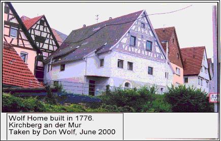
Kirchberg in Saxony
Kirchberg an der Jagst / Baden-Wuerttemberg
Kirchberg / Hunsrueck, Rhineland-Palainate
Kirchberg / Sulz am Neckar, Rottweil Dist., Baden-Wuerttemberg
Kirschberg/ Marbach, Wuerttemberg [Kirschberg / n. Marbach am Neckar, in the Ludwigsburg, Dist., Baden-Wuerttemberg. located north of Erdmannhausen, southeast of Marbach am Necker, west of Backnang and southeast of Steinheim an der Murr. Ludwigsburg is about 9 km southwest. .
Kirchberg / _??_, Wuerttemberg The following people migr. fr. a place called Kirchberg but I'm not sure which Kirchberg is correct so I'm listing them here.
![]()
Kirchendorf/ ___, Wuerttemberg [Kirchendorf (??)/ ____, Baden-Wuerttemberg]
There is a Kirchen-Dorf near the Austrian border.
There is a Kirchdorf an der Iller / Biberach Dist., Baden-Wuerttemberg. Located North is Dettingen an der Iller. East is Fellheim and Boos. South is Buxheim and abt 8 km is Memmingen. West is Edenbachen and Erlenmoos. The area is between the Danube and the Iller rivers.
![]()
Kirnbach, Heilbronn, Württemberg [Kirnbach (??) See Heilbronn.
Kirnbach / n. Maulbronn, Wuerttemberg [Kirbach (??) NOTE: Maulbronn / Dist. of Enz, Baden-Wuerttemberg.didn't exist until 1838
Kirnbach / __ Baden-Wuerttemberg Location: Grossstadelhofen, Hermannsberg is 1.9 km, Pfullendorf is 5.6 km, Kleinschoenach is 1.2 km.
Kirnbach / n. Wolfach in the Black Forest. Location: North is Wolfach / Ortenau Dist., Baden-Wuerttemberg. North and slighly west is Hausach, South is Hornberg. East is Aichhalden and east southeast is Schramberg.
![]()
Kirchhardt / Sinsheim, Baden See Kirchardt
![]()
Kircheim / Pfalz [= Kircheimbolanden / Donnersbergkreis, Rhineland-Palatinate] Location. About 25 km west of Worms. 30 km northeast of Kaiserlautern. History. Kirsch is first mention in 774. In 1368 it became a town. The family of Sponheim was involved with the town's towers and wall, I assume some sort of guardianship. William , Duke of Nassu, the ancestor of the royal families of Belguim, Sweden, Denmark and Nortway was born in Kirschheimbolanden. An ancestor the grand-ducal family of Luxembourg was also born here.... See history of Donnersbergkreis (Donnersberg Dist.), Rheinland-Palatinate. See map: http://www.remmick.org/EdenkobenPfalz/Page39.html
![]()
Kleebronn / __ Wuerttemberg [Cleebronn/ Heilbronn Dist., Baden-Wuerttemberg. It is south of Brackenheim and west of Kirchhein am Neckar.
![]()
Klein-Bettingen (Kleinbettingen) / Nuertingen, Esslingen Dist., Wuerttemberg [NOTE: There is a Dettingen and a Jessingen near Kirchheim unter Teck. Could Bettingen be Dettingen?? or Jessingen??] Location. (??) History and location of Nuertingen. On the Neckar River in southern Germany. Zizishausen is to the North. Reuderm is east. Kircheim unter Teck / Esslingen Dist./ Baden-Wuerttemberg, which is northeast abt 10 km. . South is Frickenhausen. West and slightly south is Neckarhausen.(??) History. (??) Nuertingen was first doc. in 1046. In 1421 the area became part of Wuerttemberg widows' territory. 1634 over half of the citizens died in the Thirty Years' War and plague which followed. 1750 Great Fire.
![]()
Kleinhappech (Klein-Happech) / Waiblingen, Wuerttemberg [= Kleinheppach / n. Waiblingen, Rems-Murr Dist., Baden-Wuerttemberg]
![]()
Kleinsachsenheim / Neckarkreis, Wuerttemberg [Kleinsachsenheim / Sachsenheim, Ludwigsburg Dist., Baden-Wuerttemberg]. Location. It is about 10 km northnorthwest of Ludwigsburg. Hohenhaslach is north about 2 km. Horrheim is west about 2 km. Bietigheim-Bissingen is abt 5 km southeast. Steinheim an der Murr is east and on the other side of the River. In the "Saxony district" of Ludwigsburg and lies on the Kirbach Creek which is the left tributary Metter River. Kleinsachsenhim is, now, a community in Sachsenheim. History. Sachsenheim was anmed for the Lords of Saxony where they held their headquarts since 1090. The old castle ruins is in Altsachsenheim (Old Sachsen Home). Abt 1400 a new residence was built in what is called Sachsen. The Gothic moasted castle was destroyed by fire in 1542. It was rebult and desrigned by Reihnard von Sachsen in the Renaissance style. In 1561 it became a city of Wuerttemberg. After the Thrity Years War there were only half of the previous inhabitants. There was in influx of Swiss... There was crop failure then a famine from 1816 to 1817 and the inhabitiants declined.... The Saxony's status "disolved" and went to Oberamt Vaihingen...Then the Earl of Vaihingen House became extinct in 1356 the House of Wuerttemberg inherited the area. In 1853 the railroad connection was built and created an ecomonic boom in this area. Kleinsachsenheim is just north and means "Small Sachsen Home / Place. It was mention as early as 1140 and held a close connection to the Grosssachsenheim (Larger Sachsenheim) / Sachsenheim.
There was, also, a caslte built in Kleinsachsen which in 1561 was turned over to Wuerttemberg. The fields around the smaller castle held grape vines which were surrounded by stone walls which held two towers and a "curtain wall". In 1971 Kleinsachsenheim was incorporated into Grosssachsenheim. Several years later Hohenhaslach, Ochsenbach, Spielbrg and Haefnerhaslach were also taken into Sachsenheim.
![]()
Kobolenz, Rheinland-Palatinate, Germany Location. It is 92 km (57 miles) north of Cologne by way of the train. On a map just follow the Rhine River. History. Known as Kobolenz (German), Coblenz (English), Coblence (French)....The well known fortifacation on the hill that overlooks two main rivers, the Rhine and the Moselle, is known as Festung Ehrenbreitstein. It is a very interesting place to visit with it's large bride built by the Romans in 49 AD... One can fully understand the importance of conquiering and holding this city. that gained it's importance under Julius Caesar to the Franks under the Charlemagne's empire and later.... Unfortunately, as each invasion occured and a new ruler took control the city was destroyed and had to rebuild. The Normans arrived in 882. By 925 it became part of the eastern German Kingdom then the Holy Roman Empire. In 1018 Henry II, Archbihop nad Princ elector of Trier gained the charter and so it remained in his care and then his successors .... It became part of the Leaglue of the Rheinish cities.... The Tuetonic Knights entered the picture abt 1231.... As it happen all across Europe, the Thirty Years War crimbled the grat prosperity it had known. Philip Christoper, Elector of Trier fell to the French who gained the all imporant garrison o Ehrenbreitstein in 1632. Along came the Swedes but they left the city to the french in 1636 when they stormed the city, again, and with this new invasion came destruction..... The Old City lay in ruins.... The city was rebuilt and one can see a great deal of these building today. The French Revolution the city's archbishop-elector's chief minister Freiherr Ferdinand von Duminquie sent out an open invitation to the French emigres. Royals and peasants joined the Prussiand and Austrian solder and they invdaded France in 1792 but without sucess and the French retook Koblenze under Marceau.... In march the Russian Emperor Alexander I in 1814.... After the victory over Napoleon and his French, the Conress of Vienna gave the city to Prussia. 1822 the city wa made the seat of the government for the Prussian rhine Provice. Two world wars occured. After WWII (1947 - 1950) it sserved as the sseat of government of Rhineland-Palatinate. It is presently in the German State of Rhineland-Palatinate.
![]()
Kochendorf/ Heilbronn, Wuerttemberg [Kochendorf / (Sub division of) Bad Friedrichshall, Heilbronn Dist., Baden-Wuerttemberg]. Location: Bad Friedrichshall (center of the town is north) has subdivided part of Kochendorf, which as been merged with the hamlets of Waldau and Hasenmuehle. Jagstfeld, Hagenbach (it has lost some of it's area to Kochendorf), Duttenberg, Untergriesheim and Plattenwoard. South is Unteereisesheim. East is Oedheim. Heilbronn is south abt 10 km. West is Bad Wimpfen. A little history: It was first documented as it's existence in 817. Through the years 4 castels were built. The knights even had a "hotel" here.. In 1806 it was given to Wuerttemberg as a "free municipality".
![]()
Korb, Waiblingen, Wuerttemberg [Korb / Rems-Murr Dist., Baden-Wuerttemberg] Location: It is abt 3 km east of Waiblingen and 15 km northeast of Stuttgart. South is Kleinheppach. East is Harrweiler. North is Schwaikheim. West is Oeffingen. See Waiblingen for history.
![]()
Kornwestheim, / Ludwigsburg, ___ [Kornweistheim / Ludwigburg Dist., Baden-Wuerttembeerg]; located 10 km north of Stuttgart and 5 km south of Ludwigsburg.
![]()
Kraehenberg / Zweibruecken , Pflaz [Kraehenberg / Suedwestpfalz Dist., Rhineland-Palatinate], Location: It is directly east of Homburg
![]()
Kreckow, Mecklenberg-Strelitz See Mecklenberg List.
![]()
Kremenez / Frankfurt an der Oder/ Brandenburg Location: On the border of Germany and Poland. It is little over half way to Pozan / Poland. Potsdam is to the west. Gorzow Wielkopoiski is northeast. North and about 100 km is Szczencin. Abt 50 km south is Ottbus. See history of Frankfurt an der Oder.
![]()
Kronau, Wuerttemberg [Kronau / Karlsuhe Dist., Baden-Wuerttemberg] Location: Just west of Bad Schoeborn, south of the St Leon Rot Briebsgesellschaft Golf Club which is south of St. Leon-Rot. West is Waghaeussel, which is on the other side of a dense wooded area.. South of Kronau is Steffeld which is next to Ubstadt-Weiher. Bruchsal is farther south. See histsory of Karlsuhe.
![]()
Kuppingen / __ Wuerttemberg [Kuppingen, Herrenberg (merged 1971) / Boeblingen Dist., Baden-Wuerttemberg]; located north of Herrenberg, west of Nufringen, west of Weldberg. Boeblingen is north northwest. See history of Herrenberg.
![]()
Kurnach / Sinsheim-Baden [Kuernach (??) / n. Sinsheim Sub Dist., Rhein-Neckar Dist., Baden-Wuerttemberg] There is a Kurbach abt 13 km south of Sinsheim. See Sinsheim histsory..
Kuernach / Wuerzburg Dist, Bavaria
![]()
Kreuzmach / __, Pfalz [=Kreusnach = Bad Kreusnach / District Bad Krukeuznach, Rhineland-Palatinate] Location: Sponheim is the the west. Bretzenheim is north. Pfaffen-Schwabenheim is east. Hackenheim is south. Mainz is about 20 km east northeast. History. There was a Celtic settlement in this area and abt 58 BD was part of the Roman Empire. About 250 AD a huge palace was built here as part of the foritication of the Limes Line against the Alemanni ... The Franish Empire took up the village and made it their own royal settelment. The Counts os Sponheim became extinct in 1414 and the area was divided etween Counts of Veldenz, Margrave of Baden and the County Palatine Simmern. During the Thirty Years War the city was occupied by Swedish imperial armies. From 1708 it returned to Palatinate. From 1792 to 1814 the Frech invaded and it was annexed by France. Became part of Mont-Tonnerre Dept. When the Germans regained Kreusnach, it became a "border own" with the Grand Duchy of Hess to the east and the Bavarian Rhenish Palatinate to the south. It wasn't until 1817 that the baths were, once again, in the center of attention as a place for treatment which helped the rivial of the town.....At this time it is in the Rhineland-Palatinate.
![]()
Kurnach / Sinsheim, Baden [Kurnach / n. Steinsberg Castle, Sinsheim (City of). Sinsheim Dist., -Baden-Wuerttemberg] See Sinsheim
Kurnach / n. Wuerzburg / (urban dist.), Lower Franconia Admin., Bavaria. Location. Wuerzburg is south west. Rimpar is west. Unterpleichfeld is north and north east is Oberplecihfeld. East is Prosselsheim. South is Rottendorf.
|
Kuernach may be Kuernbach or Kirnbach
?????????
Kirnbach / Maulbronn, Baden
Kirnbach / Heilbronn, Wuerttemberg
Kirnbach / n. Wolfach, Ortenaukreis, Black Forest, Baden-Wuerttemberg Kirnbach / n. Ellwangen am der Jagst, Ostalbkreis, Stuttgart Admin., Baden-Wuerttemberg. Location. North is Shonau. South is Ellwangen. Kirnbach / Heiligenberg, Bodenseekreis Dist., Tuebelingen Admin.., Baden-Wuerttemberg Location. South of Pfullendorf. Near Lake Constance and the Alps. |
![]()
Kurnbach / Karlsruhe, Baden [Kuernbach / Karlsruhe Dist., Baden-Wuerttemberg. Location. North is Zaisenhausen and Suzfeld. East is Muehlbach. South is Sterenfels and south west is Oberderdingen. It is quite a distance from Karlsruhe. Kuernbach is half way between Karlsruhe and Heilbronnn which is north northeast. History.
![]()
A/B/C/D/E/F/G/H/I/J/K/L/M/N/O/P/Q/R/S/T/U/V/W/X/Y/Z
. Lachen / ______, Speyer, Pf
![]()
Lahde / Minden, Nordrhein-Westfalen [Lahde / next to Nienburgstrasse 37 by Petershagen / Minden-Luebbecke Dist., North Rhine-Westphalia] See Petershagen.
![]()
Lahn-Dill-Kries (Dist.) / Hesse, Germany Location. It is in the west area of Hesse, Germany. History. In 1977 the Giessen Dist. merged with the Wetzlar and Dillkreis Districts. The merge was unpopular and in 1979 Geissen parted and stands on its own. The main rivers are the Lahn and the Dill. The mountains are the areas of Westerwald west and Taunus in the south. Map.
![]()
Lampoldhausen / ___, Wuerttemberg [Lampoldhausen / n. Heilbronn Dist., Stuttgart Admin., Baden-Wuerttemberg] Location: North is Widdern and Moeckmuehl, which is by the Jagst River and about 22 km from Heilbronn. West is Neudenau. South s Hardthausen and Langenbrettach. South southeast is Oehringen, abt 8 km. Beyond is Schwabish Hall, which is about 21 km south southeast. West is Neudenau, Hochsberg and Gundelsheim. Heilbronn is farther southwest abt 12 km from Lampoldsausen. .
![]()
Landau / ___Pf. [Landau/ ____Rhineland-Palatinate [Landau in der Pfalz / Rheinland-Palatinate] Location: It is part of te Southern Wine Route (Suedliche Weinstrasse) North is Edesheim and Edenkoben. South is Impflingen and Rohrbach. Birkweiler is west. East is Offenbach an der Queic and farther east is Germersheim abt 14 km. History: The area was ocupied by the French Revolutionary Army and a little later by Napoleon (1680 to 1815). It had been part of the Alsace. In 1816 it was granted to the King of Bavaria in 1816. Map: http://www.remmick.org/EdenkobenPfalz/Page39.html
Landau / Alsace (Elsass) Along the border of France there is a Petit-Landau / Haut-Rhin, Alsace which may be the one mentioned here.
![]()
Landenburg /
MAP - Luetzelsachsen with Eppelhim, Landenburg , Mannheim, Schriesheim and Weinheim
![]()
|
Lehengerich Sub.Dist ./
Rottweil Dist., Baden-Wuerttemberg
Lehengerich Dist. consists of settelments and hamletsand they are: Herdweg, Aug dem Hof, Schelzle, Vor dem unteren Erinsbach, Vor Reichenbaechle, Welschdorf, Hoeellgraben, Im Eulerach, Im hinteren Erdinsbach, Kienbronn, Rohrbach, Rubstock, Deisenbauernhof plus several farms that are isolated in the area. Schiltach is north and slightly west of Rohrbach. South and slightly west is Hintertehengencht. Sout hsoutheast is Aichalden. East is Fluom Winzein. North is Schenkenzell abt 3 km. Roetenberg is north northeast about 3 km (as the crow flies over a dense forest area (eastern part of the Black Forest and near the Kinzig River) History: Dukes of Teck founded the town but there was settlemens earlier since the raod through and pass Schiltach was built by the Romans connecting the Empire to Strasbourg. Fro time it was under the rule of Dukes of Urslingen. In 1381 it was sold to the Dukes of Wuerttemberg and in 1810 became a part of the Duncy of Wuerttemberg. In 174 the comminity of Lehengerich was reincoprtoed into the town of Schiltach. There are the ruins of three castles in the area. They are Schiltach ruin on the Schlossberg, Willenburg ruin above the Staaighofen on the Schloessleberg (Little castle mountain) and Klingenburg, ruin in Hinterlehengericht on the Burbachfelsen (Burbachrock) |
![]()
Leidringen / Balingen, Wuerttemberg [ Leidringen,. Balingen, Dist. of Zollernal, Baden-Wuerttemberg] Located: North is Rosesnfeld. West is Obendorf. East is Balingen. South is Rotenzimmen and Dautmergen.
![]()
Leimen / n. Heidelberg, Bavaria [Leimen / Rhein-Neckar Dist., Baden-Wuerttemberg Location. It is abt 7 km (4.3 miles) south of Heidelberg. It is on the "Bergstrasse" (Mountarin Road) and well known for being on the route which Bertha Benz drove the first Benz automobile to Heidelberg. History. It has been merged with two other villages. They are Gauangelloch and St. (Sankt) Ligen in 1970s. Since then the "boroughs" of Lingetal and Ochsenbach were added. To go back into time, the first known record of Leimen is from 791 through documents dealing with the Lorsch Abbey and the Diocese of Worms who held land in this area. In 1262 it is noted that the Lords of Bruchsal owned Leimen when Leimen was given to the Palatinate of Rhine as a "fiefdom" and would remain. so until 1803 when the Grand Duchy of Baden was enlarged under Charles Frederick, Grand Duke of Baden.
![]()
Leinfelden / Wuerttemberg [Leinfelden-Echterdingen / Esslingen Dist., Baden-Wuerttemberg] Location. History.
![]()
Leitringen See: Leidringen,. Balingen, Dist. of Zollernal, Baden-Wuerttemberg
![]()
Lenninen / Esslingen Dist., Baden-Wuerttemberg.
![]()
Leonberg / Borough in Boblingen Dist, Baden-Wuerttemberg Location. History. Merged with Eltingen in 1938. About 10 milies west of Stuttgart. It is known for it witch hunt of Katharina Kepler in 1615. History. Old town dates back to Middle Ages and is known for it6 restored half-timbered houses. It has a terraced garden that dates back to the Renaissace Period and was next to the palace which was a retreat for the widows of the Wuerttemberg Duchy. Leonberg when translated means "bitter orange"... The area was mostly Protestants and Catholicism did not arrived until the first parish was established about 1946.
Leonberg / Tirschenreuth Dist., Bavaria
![]()
Leonbronn / Heilbronn, Wuerttemberg [Leonbronn / (merged with) Zaberfeld/ Heilbronn Dist., Baden-Wuerttemberg) Location is 1.2 km south of Ochsenburg and west of Heilbroon / Heilbroon Dist., Baden-Wuerttemberg.
Leonbronn and Ochsenberg merged and became known as the community of Burgbronn which merged with Zaberfeld / Heilbronn, Baden-Wueerttemberg in 1975.
![]()
Lettlingen / ___, Wuerttemberg Location. History. See Kleinbettingen / Nuertingen, Wuerttemerg.
![]()
Liebenstein Castle See, also, Kaltenwesten / __, Wuerttemberg [Neckarwestheim / Heilbronn, Baden-Wuerttemberg].
![]()
Liebingheim / __, Wuerttemberg (??)
![]()
Liebenzell / __, Wuerttemberg [Bad Liebenzell / Calw Dist., Baden-Wuerttemberg. ] It has been merged into subdistricts: with Moettlingen, Unterhaugstett, Monakam, Beinberg, Unterlengenhardt and Maisenbach-Zainen in 1992. Location: Pforzheim is abt 9 km north. Bad Wildbad and Schoemberg are west. Hirsau is south a little farther south is Calw. E, which is less than 5 km away from Bad Liebenzell. East is Mainsheim and Renningen.
![]()
Lindach / Gmuend, Wuerttmberg [Schwabish-Gmuend / Ostalbkreis (Ostalb Dist.), Baden-Wuerttemberg.] Location: Abt 50 km east of Stuttgart. At the foot of the Swabian Jura Mountains. It is on the Rems River. Lindach is north of Mutlangen and Sprattbach. Southwest is Lorch and Pludenhaussen. South is Walstetten, Wgoldingen and Schwaebisch Gmuend abt 3 km.. East is Iggingen and fartheer east and slightly south Boblingen an der Rems. See Schwaebisch Gmuend Dist. history.
![]()
Lingenhausen / Alsace See Alsace List
![]()
Linkenheim, Baden [Linkeneneim-Hochstetten, Karlsruhe Dist., Baden-Wuerttemberg] Location: Graben-Neudorf . Farther north is Germersheim. East is Bruchsal. South is Karlsruhe, abt 15 km. West is Rhorbach. It lies on the right bank of he Rhine River near the FGrench border . See history of Karlsruhe. History. Linkenheim and Hochstetten merged in 1975. Linkenheim was in exsistence in 777 AD. All I know about the town is that it's is known for it's "great fishing". in the near by lake.
![]()
Lochen / n. Speier, Rhein [Lachen-Speyerdorf / Neustadt n. Speyer, Rhineland-Palatinate] Locaion: Neustadt is to the northwest, Hasloch is to the northeast. South is Edenkoben and north is Ruppertsberg. Speyer is east southeast. See history of Neustadt and her Weinstrasse and an der Haardt (River).
![]()
|
Ludwigsburg Dist. -
Baden-Wuerttemberg -
MAP
Towns are:
Municipal federations are:
Municipalities are:
*Places in green are listed as places ancstor of German-Russians who lived in Borodino / Bessabaria, Southern Russia which is presently in the Ukraine. |
(City of) Ludwigsburg / Ludwigsburg Dist. - Baden-Wuerttemberg Location: Abt 12 miles north of Stuttgart. History. Historians have taken Ludwigsburg area back to the stone and bronze ages. The culture is known as the Hallstatt which is linked to the Proto-Celtic and Celtic. The Romans were here and afterwards the Alamanni settled in the area. A small country house was started in 1704.... But, plans do change. Instead, a large baroque castle was drawn and construction occured from 1718 to 1723 for Duke Eberhadt Ludwig of the House of von Wuerttemberg. The Hunting lodge which was built is called Schloss Favorit. And Monrepos Castle was built in 1764 next to Lake. In 1800 Napoleon occupied the German states who were forced into an alliance. In 1806, Prince-Elector Friedrich was crown king of Wuerttemberg. There were 15,800 Wuerttemberg men ordered to served Napoleon in his army. Out of all those men it is believed that only a few hundred returned to their homes.
Ludwig/ Ludwigsburg, Wuerttemberg [Ludwig (??) / Ludwigsburg Dist./ Baden-Wuerttemberg
![]()
Luetzelsachsen / Baden [Luetzelsachen / n. Weinheim, Rhein-Neckar Kreis (Dist), .Baden-Wuerttemberg] Location . Town is south of Waldsee which is southwest of Weinheim which is about 3..5 km South of Luetzelsachsen is Hohensachsen. East is Sommergasse. It was part of Palatinate until 1305 and them became part of Baden under the dist. of Mannheim, which is south southwest abt 10 km.. In 1973 it became part of Rhine-Neckar Dist..... MAP .
![]()
Lumbach / __, Wuerttemberg [Lumbach (??) / Baden-Wuerttemberg]]
Limbach / Neckar-Odenwald Dist., Baden-Wuerttemberg Location. is east of Waldrunn and Eberbach, north of Ritersbach and south of Mudau. Elztal is south.
Lumbach / Heinberg. Nordrhein Westfalen (North Rhine-Westphalia, Location: It is north northwest of Heinsberg
Lumbach / Oberbayrn
![]()
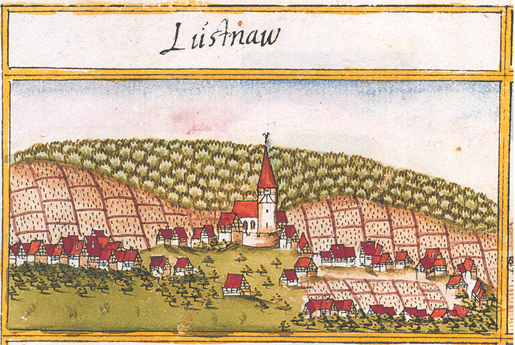
Engraving from Wikipeida Commons: File: Lustnau, Tuebingen, Andreas Kieser.png - 1683
Lustnau / Tuebingen , Wuerttemberg Location: Lustnau is a subdivision of Tuebingen since 1934. Tuebingen / Tuebingen Dist., . Baden-Wuerttenberg It is near Limbach / Neckar-Odenwald Dist., Baden-Wuerttemberg wich is east of Waldrunn and Eberbach, north of Ritersbach and south of Mudau. Elztal is south. The Neckar River runs through Lustnau. Hstory. The village of Lustnau dates back to an Alemannic (Germanic) tribe which daties back to the first millennium) settlement . The Roman's had a settlement near the old weaving mill, which was known as Egeria. About the year 1100 the village of Lustnow was founded. There was a man (first name not recorded) by the name of von Lustnau (Lustnow), who owned the village of Lustnau and lived in the castle that once stood on Castle Road . There is a document showing a von Lustnau's family member testifing in 1466 on a local matter. Wine and agriculture was the main source of income for the people living in and near Lustnau. The three main vineyards were Herrlesberg, Oesterberg and Neuhalde. By 1715 the village was the property of the village of Pfrondor. Sice 1974 Lustnau is a subdivision of Tuebingen. There are about 10,000 people living in this subdivision. (Source: records found by ancesstry.com and repeated in de-wikipedia.org into English.) See Tuebingen history..
![]()
Lutzelsachsen / Baden [see Luetzelsachen / Weinheim, Rhein-Neckar Dist.Baden-Wuerttemberg]
![]() continued
next
page---------------->M
continued
next
page---------------->M
(2) PLACES IN POLAND & PRUSSIA
(3) PLACES IN MECKLENBURG & POMERANIA
PHOTOGRAPH INDEX
INDEX
Indicates There Are Photographs
Attached To Other Remmick-Hubert Web sites


Borodino.Bess.Genealogy
|
Hein Genealogy |
|
Borodino/Bess.Site |
Hubert |
Schweikert Genealogy |
 See larger map of invasions from 1622 to 1648