Remmick: German Emigration to Borodino, Bessarabbia, Russia: 1812-1840s.
Last Updated: 6 June 2014
![]()
![]()
![]()
Bessarabian History continuted......
List of Borodino Families and Their Genealogy to the Present
----
(2) PLACES IN POLAND & PRUSSIA
(3) PLACES IN MECKLENBURG & POMERANIA

![]() PLACES In
GERMANY
PLACES In
GERMANY![]()
Page 2
Magdeburg, Prussia [Magdeburg City and Bundesland (with 40 urban villages), Saxony-Anhalt (1990)]; Located by the Elb River in the northern middle of the eastern part of Germany. Back in the 800s Charlemagne built a fortress here because of it's location on the Ellbe River. Braunschweig is abt. 08 km to the west. Gottingen is south south west abt 80 km. Leipzig is abt 90 km to the south and slighty east. Halle is about 20 west of Leipgiz. Potsdam, the residence of Frederick The Geat, was about 60 km to the east and slight north of Magdeburg. North is Neu Neustadt and farther north is Wolmmirstedt. On the eastern shore were the Slavs. 1524 Martin Luther, a leader of the protestors of Catholitism, caused farther unrest and defection was on the road to the rise of what we know today as the bitrh of Lutheraism in the Protestants rebellion known later as the Protestant Reformation. . In 16311 during the Thirty Years" War the French entered the city, massacred the townspeople (history claims 20,000 perished). When the war ended iit is said that only 400 residence remained. The Peace of Westphailia (1648) gave Magdeburg to Brandburg-Prussia. The French in 1806 entered and would control Madeburg untill Napoleon's defeat and in 1815 Magdeburg went to the new Prussian Province of Saxony..
![]()
Mannheim / ___, Baden [Mannheim / (urban dist.) , Karlsruhe Admin., Baden-Wuerttemberg] Location: Northwest is Ludwigshafen, northeast is Ivesheim and Ladenburg. South is Bruehl and farther south is Ketsch. Heidelberg is south southeast abt 10 km. History: Mannheim was leveled during the Thirty Years War abt 1622 by Johan Tilly's troops and again in 1689 in the Nine Years' War by the French Army. In 1698 the rebuilding started, again. 1720 the Electoral Palatinate moved from Heidelberg to Mannheim. In 1802 Mannheim was removed from the Palatinate and given to the Grand Duchy of Baden. Mannheim claimed the "world's first bicycle" was built here by Freiherr Karl von Drais in 1817. They, also, claim, the "first motorcar" was bilt here by Karl Benz in 1885. Interesting note: They have acquired American buffalos for their city park zoo (Wild Park).
![]()
MAPS of Historical Interest - Germany
![]()
Marbach / ___??__
Marbach / Zweibruecken, Wuerttemberg [Marbach / __??__ (Do not know the district it is in presently).
Marbach am Necker, Ludwigsurg Dist., Baden-Wuerttemberg
Marbach an der Lauter merged with Gomadingen / Reutlingen Dist., Baden-Wuerttemberg.
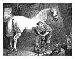
Marbach Stud Farm (Weil-Marbach), Baden-Wuerttemberg Location. Reutlingen District/ Baden-Wuerttenberg. History. Believed to be the oldest German horse stud farm. It dates back 500 years [maybe more].... By 1477 it belonged to Graf Eberhard V. Christoph, the Duke of Wuerttemberg, who expanded the stud farm in 1573 and named his horses line as Wuerttembergers that had been improved by local breeds. By the 1700s and 1800s, the Marbach Stud Farm, as it was known by then, was using Mecklenburger, Holstein and an English and Norman-bred studs for the heavier breeds such known to us as the Cleveland Bay, orkshire Coach Horse and m favorite the Clydesdale for the heavier work horese. The "sport horeses" were thoroghbred and known as Trakehner. The best known was the stallion was Julmond (1938-1965) used to formed the Wuerttemberger from the work horse into a sport horse. It was known in it's earlier times as a stud farm for "warmblood" horses. It still breeds what is known as he Wuerttmberger. However, today, it's known best for its Weil-Marbach Arabians. A statue of Hadban Enzahi (Arabian from Egypt) stands at the Marbach Stud Farm. They have a few "cold blood" thouroughbreds. [NOTE: My great grandfather in Borodino Bessarabia, S. Russia, bred horses. He had Arabians from Persia, several Clydesdale-like studs and mares and studs and mares bred for the heavier horse breed used by officers in the Tsar's Cavalry.] The one Hein family was said to have between 300 to 400 horses near Kischinev. See Alfred Hein's section.
Marbach merged with Petersburg / Fulda Histrict, Hesse
Marbach / Marburg-Biedenkopf, Hesse
![]()
Marschalkenzimmern / ____, Wuerttemberg [Marschalkenzimmern / n. Dornhan, Rottweil Dis., Baden-Wuerttemberg] Location: north and slightly west is Dornhan. Oberdorf is south. East is Voehringen and Sulz Southeast is Freudenstadt abt 14 km. It is found in the eastern part of the Black Forest (Schwarzwald). See Rottweil history.
![]()
Markgroeningen / ____., Wuerttemberg [Markgroeningen, / am der Timber-Frame Road, Ludwigsburg Dist., Baden-Wuerttemberg] Located is next to the Glems River and abt. 9 km west of Ludwigsburg. North is Sachsenheim. East is Pulverdingen. South is Schweibeerdingen and farther south is Ditzingen abt 8 km.. Abt 15 km northwest of Stuttgart. See Ludwigsburg history.
![]()
Markroeningen / ___ (see Markgroeningen)
![]()
Marschalkenimmern / ____, Wuerttemberg [Marschalkenzimmern / Rottweil Dist., Baden-Wuerttemberg], which is located west of Sulz and Vohringen and south of Glatten and north of Oberndorf.
![]()
Maulbronn) / n. Vaihingen, Wuerttemberg [Maulbronn / Enz Dist., Baden-Wuerttemberg] Town of Maulbronn did not official exist until 1838, however, there was a settlement near the Maulbronn Abbey founded in 1147.
![]()
Meckesheim / Rhein-Neckar Dist., Baden-Wuerttemberg. Location. Between Heidelberg and Sinsheim in the Rhein-Neckar dist. It is a little south of Bammental, as well as abt 5 km from Leimen, where the Roemmich once lived..... History. Home of Mechinos Heim (Home) In 1330 became part of the Electorte of the Palatinate. During Napoleon's time the village became a part of Baden.
![]() Memmingen / Bayern [Memmingen / (urban Dist.) Bavaria]
(Bayer=Bavaria) Location: To the north is Heimertingen
and Niederrieden. To the west is Tannheim. South is Woringen
and Lautrach. To the east is Sontheim Called
"Gateway to the Allgaeu" To the west of the town is the Iller
River that marks the border of Baden-Wuerttemberg.
Memmingen / Bayern [Memmingen / (urban Dist.) Bavaria]
(Bayer=Bavaria) Location: To the north is Heimertingen
and Niederrieden. To the west is Tannheim. South is Woringen
and Lautrach. To the east is Sontheim Called
"Gateway to the Allgaeu" To the west of the town is the Iller
River that marks the border of Baden-Wuerttemberg.
![]()
Merklingem / Ulm, Wuerttemberg [Merklingen / Alb-Donau Dist., Baden-Wuerttemberg] Location is northwest of Ulm, south of Goeppingen and north of Ehingen and Erbach.
![]()
Merscheid / n. Morbach, Rheinland-Palatinate (Pfalz)
![]()
Merzig-Wadern Dist, Saarland
Baden-Wuerttemberg
|
Maps of Merzig Area
![]()
Mettlach / Merzig-Wadern Dist., Saaarland- Location Merzig is 7 km southwest and 30 km from Trier which is north.. East is Losheim am See. West is Peri. Abt. 15 km northwest. is Remich in Luxembourg and lies on the left bank of the Moselle River.
![]()
Mettenheim / ___, Pfalz [Mettenheim / Alzey-Worms Dist., Rhineland-Palatinate]. Location: Alszey is north of Mettenheim.. West is Bechtheim. South is Osthofen and farther south is Worms. Aich is nearby.
Is there a Metterheim or Metternheim in Hesse? Is Charlotte and Elisabetha Charlotte the same person?
Hesse is nearby, so, it may well have been part of Hesse at sometime. I do not have enough information to say it was or it wasn't at this time.
It does appear that Charlotte and Elisabetha Nickel is the same person.
![]()
Minden /Minden-Luebbecke Dist., North Rhie-Westphalia Location. Lies on the Weser River which flows through north-western German and Lower Saxony before reaching the North Sea port city of Bremen and continues passed the city to empty into the North Sea 50 m north at Bremerhaven. . It lies on the North German Plain bounded by the Wester Hills and the Wiehen Hills. The main villages involved are Minden, Hille, Petershagen, part of Porta Westfalica, Luebbecke, Espelkamp, Pressisch Oldendorf, Rahden and Semwede. Not all of these cities and town are in the Minden-Luebbecke Dist.. History. There was a settlement before 3 A.D. where Minden stands . Charlemagne held his imperial assembly here in 798. The rights to hold a market, mints coins and collect custom duties were granted in 977. The old cathedral which is in the Weser Renaissance style is over 1,000 years old. The Wichgraf, which was the bishop who was appointed administrator of the town, rule until the citizens gained independence in 1230. Minden joined the Hanseatic League. The disgruntled Bishop Gottfried von Waldeck moved his official residence from Minden to Petershagen in 1306/7. As happen in most towns and cities in Germany, the Reformation did the same in Minden. Nicholas Krage announced his new Evangelical Lutheran church order on 13 Feb 1530... The town was not without it's witch hunts. Between 1603 and 1684 there were 128 witches condemned. During the Thirty Years''s War (1618 to 1648), Imperial troops held Minden from 1625 to 1634 when the Protestant Swedish troops captured Minden. The Swedish Queen Christina, who reigned from 1632 to 1654, gave Minden full sovereignty on all affairs. Bradenburg-Prussia took possession of Minden under the Peace of Westphalia and it remained so until 1948. Minden lost it's independence because the King had dissolved the Swedish government and replace the administrators with 16 tradesmen, 16 businessmen and 8 town representatives of their communities. The Battles continued. Battle of Minden occurred at the town gates on 1 Aug 1759 during the Seven Years' War. From 1719 to 1807 Minden was the capital of the Territory of Mindenn-Ravensberg. The French troops held Minden on 13 Nov 1806 and became part of the Kingdom of Westphalia, and, part of France to 1810. After the Battle of Leipzig, the French left Minden and Prussia marched into town. Minden fortress was rebuilt. The first new fortress commander was Ernst Michael von Schweichow and he'd be followed by many until 1873 when fortress were being torn down. . After the defeat of Napoleon, Minden was the capital of the District of Minden from 1816 to 1947. ~
![]()
Mifi"/ Mittelfischach :
![]()
Miltenberg/ Altensteig, Wuerttemberg [Mitenberg (??) / Altensteig/ Calw Dist., Baden-Wuerttemberg.] Location: Did not find Miltenberg near Calw. Did find Altensteig which is abt 18 km southwest of Calw. Abt 19 km northeat of Freudentadt. Eastern part of the Black Forest.
Miltenberg / Miltenberg Dist., Lower Franconia, Bavaria Location: Abt 50 km north northwest is Frankfurt. Abt 5 km is Erlenbach am Main. South is Amorbach.. East is Eichenbuehl. West abt 4 km is the Hessen and Baverian border. Michael stadt and Erbach are in Hessen and abt 10 km from Miltenberg.
![]()
Mindbach / __, Bavaria [Mindbach (??). Location. History. See Bavaria
![]()
Minden / Minden-Luebbecke Dist., North Rhine-Westphalia. Location: The right and left sides of the Wester River holds the town of Minden. It is known for the Mittelland Canal. To the northwest is Petershagen. Abt 20 km east is Hanover. To the west is Luebbecke. To the south is Porta Westfalca and Wlotho. To the east is Dankersen, Seggebruch and Hellpsen. History. There is evidence that settlements existed here since 3 AD. For more information is the data on the Rhine-Weser-Germanic history. There are imperial burial fields at Minden-Roemmerring and Porta Westfalica-Costedt. Charlemagne is known to have an imperial assembly here in 798 and several years later founded the bishopric of Minden. The village had the right to hold a market, mint coins and collect custom duties by 977. It was the bishop of Minden who controled the appointments of the leader and administrator of the town. The village broke free of the church yoke in 1230 and received a town charter. Minden became a member of the Hansetic League and increased it's prosperity... The church moved it's residence from Minden to Petershagen in 1306. The Protestant Reformation caused conflict between the citizens of the town. A new Evangelical Lutheran Church was built after 1530. Between 1603 and 1684 witch hunts darken the towns history. 128 (most were women) were declared guilty of witchcraft and they were prosecuted and sentences. The Thirty Years' War occurred and imperial troops occupied Minden. The Protestant Swedish Queen Christina granted Minden it's full rights as sovereignty of it's own affairs. In 1648 the Peace of Westphalia gave possession of Minden to Brandenburg-Prussia in 1648. Frederick I of Prussia disolved Minden's independence and the town councile was replaced of 16 businessmen, 16 tradesmen, 8 representatives of the community.... The Seven Year's War placed troops at the gates of Minden and the Battle of Minden occurred 1 Aug 1759. Duke Ferdinand of Brunswick defeat the France and allies. Minden remained Prussian. Minden became the capital of the Territory of Minden-Ravensberg from 1719 to 1807. 1806 French troops occupied Minden. so for a time was part of the Kingdom of Westphalia and part of Fance until 1810. After Napoleon's defeat, Minden was the capital of the Minden District from 1816 to 1947. There remains old buildings and gates that date from the 1000s. Even a statue with Charlemagne shaking hands with Duke Widukind, the last Saxon leader, declaring the settlement to be called Minden. Angles play a harpsichord in plaster above the alter of Minden cathedral built in 1425.
![]()
Moeglingen / Ludwigsburg, Wuerttemberg [ Moeglingen / Ludwigsburg Dist., Baden-Wuerttemberg] Location: To the east is Ludwigsburg and to the northwest is Markgroeingen. To the south is Kornwestheim.. It is a municipality .
![]()
Moehringen / Stuttgart Dist., Baden-Wuerttemberg Location: North is Sonnenberg and Degerlaoch. Farther north and slightly east is Stuttgart. East is Riederberg. West is Vaihingen Mitte. South east is Sternhaule. South is Mohringen Ost (East] and Mohringen Sued (South).
 Henke
Family
Henke
Family
--
Moehringen / Biberach Dist. , Baden-Wuerttemberg . Location: Have not found the village. Biberach an der Riss is in the Biberach Dist., Baden-Wuerttemberg. The other two large cites Ochsenhausen and Laupheim. It is between the rivers of the Danube and he Iller. The Riss River is "an affluent of the Danbue" and runs from south to north. Federsee (Feder Lake) has become famous becaue of the Neolithic discoveres and rare birds.
--
Moehringen / Rhin-Neckarkreis, Wuerttemberg . Location: Have not found the village. Neckarkreiss (Rhin-Neckar Dist.) is in Baden-Wuerttemberg.
--
Moerhringen an der Donau / Tuttlingen, Baden-Wuerttemberg: Location: It is west and south of Tuttlingen. Farther west is Geisingen. South is Engen. North north west is Trossingen. East is Neuhausen. South and slightly east is Emmingen-Liptingen. History. Kelts lived here .. The clan leader may have been "Mero" and afer the 5th centry was known as Christ Moerhringen.... Moerhringen is doc. in 882 because it belonged to the abby of Reichenau. In the 1300s the Lords of Klingenberg governed the area and was known as a "Castle City". . The area was stold in 1520 to Fuerstenberg. 1806 during the Reign of Napoloen it was added to the Grand Duchy of Baden.
?? There is a Maehring / Tirschenreuth , Bayern (Bavaria) , which is close to the present day Czech-Bavarian border. History.
![]()
Moenchweiler / __, Wuerttemberg [Moenchweiler / Schwarzwald-Baar Dist., Baden-Wuerttemberg ] Location: West is St. (Sankt) Georgen im Schwarzwald (Black Forest) and farther west is Triberg. North is Koenigsfeld im Schwarzwald. West is Niederschach. South southeast is Villingen-Schwenningen.
![]()
Moersbach / Zweibrueken, __ [Moersbach / Obergerischer Dist., North Rhine-Westphalia] , 50 km east of Colonge, on the border of North Rhine-Westphailia and Rhineland-Palatinate ; Zweibrueken is near by and presently in the Rhineland-Palatinate, where it has been since 1814. History. A stone hatchet and pieces of a flint blade tell us that the first known settlement goes all the way back to the Neolithic Age (4000-1800 B.D. .Abt 800 in the area was under the rule of Charlemagne and the Moersbach Parish was owned by the Auelgau (Sieggau) and was administered from the region counts of Sayn. About 895 Moersbach was mentioned in a documentary in church records. By 1174 there is mention of a mountain castle... 1311 Counts of Sayn-Homburg recognized fishing rights and the 10th of a copper mine Boecklingen as possession of the counts. About 1400 Moarsbach a place of property of the Dukes of Berg, who had been raised to his station under Emperor Wenzel. 1563 Moersbach is divided into two religious sects, Catholic and Lutheran. The Dukes of Berg and Count Hermann von Hatzfeldt exchange ownerships between 1614 and 1742 when the ruler of the area, Elector Karl Theodor becomes duke of Berg as well as Elector of Bavaria and takes up residence in Munich. The French Revolutionary army entered in 1795 and Napoleon forms an alliance with Elector Maximilian Joseph von Pfalz-Zweibruecken in 1805. 1806 the area become a Grand Duchy under the brother-9n-law of Napoleon, Joachim Murat, who is the regent of the this area. The citizens of this area were in the new canton Waldbroel in the Dept. of Seig. in 1808... The defeat of Napoleon placed Moersbach into the Cologne Dist. in the province Kleve-Juelich-Berg in 1816. By 1932 Moersbach was a municipality that was combined with Gummersbach and Obergergischer Dist. 1946 Moersbach in the Obergergischer Dist. was placed in the new North Rhine-Westphalia State.
?? Moersbach / n. Zweibruecken , Zweibruecken Dist., Rheineland-Palatinate Located on the border of Rheinland-Pfalz and Saarland. It is northeast of Saarbruecke. Betweem Saarbruecken and Moersbach is St. Ingberg / Saarpfalz-Kreis, Saarland History. Ceded to France in 1801 then reunited to Bavaria in 1814. See Zweibruecken history.
![]()
Moresfeld / Rockenhausen, Palatinate [Moersfeld ).n. Rockenhausen, Municipality of Kirchheimbolanden, Donnersberg Dist (Donnersbergkreis), Rhineland-Palatinate ] Location: This village was northeast of Rockenhausen, maybe 10 km on an old map Nearby were the villlages of Weinheim and Alzely to the east. Winterborn was to the west and Bad Kruznach / Rheinhessen was north and slightly west, maybe 15 km. South was Kriegsfeld and farther south was Kirchheimbolanden (Kirchsheim-Bolanden), which is the capital of Donnersberg dist., Rhineland-Palatinate. Today, Kirscheimbolanded is abt 25 km west of Worms and 30 km north east of Kaiserslautern. Settlements date back to 774. See hisstory of Pfalz (Palatinate) and Rheinhessen..
![]()
Moresfelden-Walldorf / n. Frankfurt and Weisbaden in the Gross-Geraiu Dist., Hesse Location: About five km from Frankfurt am Main Sud and Weisbaden is about 20 km to the west, and Mainz is directly west.
![]()
Monrepos
Palace [Schloss n. Ludwigsburg
Castle, Ba.-Wu
![]()
Monharder [Monhardter] Hof, which is / was a farm in the Monhardt Municipality, n. Altenssteig / Calw Dist., in the Black Forest, Baden-Wuerttemberg. It is directly north of Walddorf and east of Altensteig.
![]()
Monsheim,
A Collective Municipality (collection of
vllages) in Alzely-Worms Dist. in Rhineland-Palatinate
See Rhineland-Palatinate (Pfalz) for more
details.
|
![]()
Mossingen / Tuebeingen, Wuerttemberg [Mossingen / Tueblingen Dist., Baden-Wuerttemberg) Location: Abt 9 km south of Tuebingen with Gomaringen between them. Reutingen is north northeast. Sonnebuehl is east. Burladingen is south. And west is Bodelshausen and farther west and slightly north is Horb am Neckar.
![]()
Mossbach / ___, Pfalz .... [Mossbach = Mosbach Pfalz = Mosbach / Baden - Wuerttemberg]. One in the same village known as. Mosbach, which was in the Palatinate-Mosbach-Neumarkt and in 1806 became part of the Grand Duchy of Baden. Presently it is: Mosbach / Neckar-Odenwald Dist., Baden-Wuerttemberg
Mosbach / ___, Baden = Mosbach / Pfalz One in the same. Mosbach was in the Palatinate-Mosbach-Neumarkt and in 1806 became part of the Grand Duchy of Baden. Presently it is: Mosbach / Neckar-Odenwald Dist., Baden-Wuerttemberg
![]()
Muehlacker / Duerrmenz, Wuerttemberg, [Muehlacker, Enz Dist., Baden-Wuerttemberg] Location. North is Lienzingen. East is Illingen and southeast is Vaihingen an der Enz. South is Pinache. West is Oelbronn-Duerm and farther west is Goebrichen. Wouthwest is Pforzheim abt 10 km. [Note: Waldensian colony in Cuerrmenz (Kingdom of Wuerttemberg) was formed in 1699. The 500 or so reformed protestant refugees, who migr. to this colony from the Piedmont region, were all called Waldensers regardless of their original place of residence or religious history." See http://rtgenealogy.net/Durrmenz.htm Muehlacker was one of these settlements establsihed by Duke Eberhard-Ludwig of Wuerttemberg.]
![]()
Muelhausen/ ____. Wuerttemberg [Muehlhausen / ___(??__)
Muehlhausen Unter der Enz / n. Heimsheim / Enz Dist., Baden-Wuerttemberg Location: North is Tieffenbronn, then Friozheim and farther north is Niefern-Oschelbronn abt. 12 km. East is Heimsheim abt 4 km. and farther east is Perouse.. Northwest is Schelbronn. Neuhausen is southwest and abt 6 km is Bad Liebenzell.
Muehlhausen (Kraichgau), a municipality in Rhein-Neckar Dist., ., Baden-Wuerttemberg Location: North and slightly west is Raunberg, North is Dielheim and abt 6 km farther north is Wiesloch and beyound is Heidelberg.. Northeast is Tairbach and southeast is Angelbachtal. South is Ostringen. West is St (Sankt) Leon-Rot.
Muehlhausen by Schwenningen, a comunity in Villingen-Schwenningen , (two towns which have merged with other villages) , Schwarzwald-Baar Dist., Baden-Wuerttemberg
Muehlhausen im Taele / Goeppingen Dist., Baden-Wuerttemberg
Muehlhausen am Neckar merged with Stuttgart municipalities, Baden-Wuerttemberg.
![]()
Muehlheim / Sulz, Wuerttemberg [Muehlheim / (is in municipality of the town of) Empfingen / Freudenstadt Dist., Baden-Wuerttemberg Empfingen has two local districts of Wiesensstetten and Dommelsberg. Location: Muehlheim is southwest of Empfingen. It is abt. 4 km northeast of Sulz. Haigerloch is southeast. Horb am Neckar is north. West is Duerrenmettstetten. South is a dense forest area. Voehringen is south southwest of this same forest area and abt 5 km. See history of Freudenstadt
![]()
Muensterappel /______ [Muensterappel / n. Niedershausen an der Appel, Dommersbergkreis, Rhineland-Palatinate] Location: Map. It is south south west of Niederhausen an der Appel. South of Winterborn. West is Kalkoben. Moersfeld is east and slightly north abt 4 km as the crow flies. To the History. No data given.
Johannes Kolb "Muellermeister", Lutheran, b. 1675 Tiiefenthal / ___; d 22 June 1743 Tiefenthall / ___ m. 12 July 1703 Anna Maria Senff b. 31 Oct 1679 Muensterappel / ___ d. 4 Feb 1747 Tiefenthal / ___
![]()
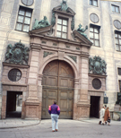
Munich / Germany
 (Click
on the logo and go to Page 1)
(Click
on the logo and go to Page 1)
![]()
Murrhardt / ___, Wuerttemberg [Murrhardt / Rems-Murr Dist., Baden-Wuerttemberg] Located 12 km east of Backnang. and 18 km southwest of Schwaebish Hall. Closer villages are Sternberg which is north. Fichtenberg is east. West is Oppenweiler. And south is Sechselberg and Kaisersbach. The source of the Murr River, a tributary of the Neckar River. is four miles south of Murrhardt. The river heads runs through Sulzbach an der Murr and heads toward Backnang where it widens in the marrow valley and then heads into the Ludwigsburg Dist. and runs south of the Loewenseiner Berge hills..... See history of Backnang.
![]()
Musberg / Wu. [ Musberg, (merged with) Leinfelden-Echterdingen, / Esslingen Dist., Baden-Wuerttemberg] Location: Leinfelden is east. Moehringen-Sued is north. Setten is southeas. Steinenbronn is south. Schonach is southwest. . History: Musberg merged with Leinfelden-Echterdingen in 1975]
![]()
A/B/C/D/E/F/G/H/I/J/K/L/M/N/O/P/Q/R/S/T/U/V/W/X/Y/Z
Nagold / Wuerttemberg [Nagold / Calw Dist., Baden-Wuerttemberg] Location: Calw is north of Nagold and Stuttgart is northeast; Tuebingen is east. History. The city center has the half-timbered houses that stand not far from settlemtns of the earl Stone Age known as the Hallstatt culture (700 BD to 450 BC). The Celts were living in the Ngold basin by the 5th century. In fact, there is a burial mound called Krautbuehl believed to have been part of the royal family found at Schlossberg. This weather and the rech soil attracted the Romanos. The Alamanni follwed the Romans who were follwed around 700 AD by the Franks. By the end of the 13th cnetury there was a stone wall with a moat and fate towers and under the control of Grafen von Hohenberg. The old Marien Church 's construction started in 1350 but it was destroyed in 1876 but the original tower still stands on Turmstrasse St.. After the "farms' uprisings" in the 16th century, the Habsburgs reclaimed his lands. The Thirty Years' War took it's toll and the Hohennagold Castle was destroyed. Still standing is the "Late Post" (1699) tht serrved as an old mail stop for the line that ran between Stuttgart and Freudenstadt. When you view the following photographs, the bridge that leads into town is built over the Nagold River.
Nagold
![]()
Nauenburg / __, Wuerttemberg [See Neuenburg am Rhein, Breisgau-Hochschwarzwals, Baden--Wuerttemberg]
![]()
Neckarkreis = Neckar Kries = Neckar District. See Rhin-Neckar Dist.
![]()
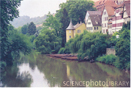
Neckar River
Map of the Necker / Neckar Valley, Baden-Wuerttemberg plus links to photographs
Map #2: Cities along the Necker River
![]()
Neckarau / Mannheim, Baden [Neckarau (merged with] city of Mannheim / (urban distr.), Admin. is Karlsrluhe, Baden-Wuerttemberg] See Mannheim history.
![]()
Neckargartach / Heilbronn Urban Dist., Baden-Wuerttemberg. Location. North is Frankenbach.... History. Neckargartach lies at the "mouth of Neckar Leinbachs," (Neckar and Leintals (early known as the Gartach) Rivers). Next to the Boellingen's (Bellinger / Bollingers) homestead (yards) which is doc. in the 9th century. (See history of the Boellinger Mill in Wikipedia.) Earlier there was an Alemannic settelment built abt 767. In 1161 it was called Neccargardacha and mentioned in a charter of Emperor Barbarossa. In the middle ages the Castle Church was fortified and served as a shtler. By the 11th century it was under the feudal rule of the Upper Diocese of Worms. The Lords of the vineyard and village was Engelhardt in 1323 and they sold it in 1341 for 1,2000 Hellers. It then came under the fief of the Heilbronn partricaisn Feurer Bewin and Erer. In 1399 Wuerttemberg soldiers burned down the village. It rose up out of the ashes. In 1440 the town and the vineyar came under the rule of Palatinte. It was a dipute that lasted a century because Wuerttemberg believed it belonged to them along with the imperial city of Heilbronn. They did hold the monasteries in Billingen, Laulfen, Odenheim, St. Peter in Wimpfen Carle Monastery in Heilbronn as well as the hosptial and farms in Neckargartach. In 1622 te Spanish picted their tentns in Neckarartach for the battle of Wimpfen. The tales about the Spanish while in Neckargartach are filled with "horrible atrocities". In 1664 a fired destroyed Neckargartach, again, but this time it was the French during the French-Dutch War. In 1738 to 1756 against the authorities in Heilbronn who ruled their surfdom with an iron hand. Johann Philipp Hagner , the leader of the resistence, was arrested in 1747 and died in prision. Under Napoleon, Wuerttemberg gained it's freedom and Neckargartch became a separate commmunity. It became a ural place and ws mainily agricultre and vitculture through the 19th and 20th centuries. On 1 Oct 1938 Neckargartch ws incorported to Heilbronn. The Boellinger Mill, in part, exsits today. as a "cultural monument".
![]()
Neckarhausen / n. Mannheim, Baden [Edingen-Neckarhausen / Rhein-Neckar Dist., Baden-Wuerttemberg.] Located south of Ladenburg, southeast of Mannheim along the Neckar River abt 12 km (map). South of Nckarhausen is Eppelheim and farther south is Heidelberg abt. 17 km. West of Dossenheim. Was part of Palatinate until 1803 when it became part of Baden. In 1975 Edingen and Neckarhausen united. Then Neu Edingen was conbimed with Mannheim-Friedrichsfeld. History: Neckarhausen was built on a Celtic settlement who also enjoyed the mild climate and fertile soil. Edingen was first recorded in 765 when it was granted to Ladenburg, known then as Lopodonum. Edingen Manor belonged to the Imperial Abby of Lorsh and the Bishopric of Worms. Count Palatine gained the part lordship of the town in the 12th century to 1705 when Palatinate gained all until 1802. Both Neckarhausen and Edingen becme part of Baden in 1803....
![]()
Neckar-Odenwald-Kreis (Dist.), Badem-Wuerttemberg
Location: In the northern part of
Baden-Wuerttenburg. History. 1973 the districts of Mosbach and
Buchen were merged and named Odenwaldreis but confusion occured and it was
renamed in 1974 to Neckar-Odesnwald-Kreis.
|
Neckar River Map Showing a Few Town
Map of the Necker / Neckar Valley, Baden-Wuerttemberg plus links to photographs
Map #2: Cities along the Necker River
![]()
Neckartailfingen / __, Wuerttemberg [Neckartalfingen / Esslingen Dist., Baden-Wuerttemberg], Located n. Schlaitdorf, west of Nuertingen and south of Grotzingen. It is 10 km north of Reutlingen and 25 km / 12 miles south of Stuttgart. It is on the Neckar River. MAP
![]()
Neckarsteinach / Baden [Neckarsteinach / Bergstrasse Dist., Admin. Region. Darmstadt, Hesse Location: The village is bordered on the north and on the east by the Steinach River, on the south by the Neckar River on on the west by the Burgberg. Heidelberg is west about 20 km and above Heidelberg along the Necker River is Mannheim. Neckargemuend is south. Eberbach is northeast. East is Waldbruenn.History. Their were humans here in prehistoric times. By the 7th century the area belonged to Bligger von Steinach, a fiefholder, who's sons and grandson build the four Neckrsteinach castles (so called in the wikipedia article). A member of the family known as Landschad fortified the castle known as Vorderurg. Count Palatinate Ruprecht is mentioned in the history of this village in 1377 along with the Bishop of Worms. Hans III Landschad von Steinach turned to Lutheranism in 1522. The Catholic League under Count Johann Tserclase Tilly entered the area in 1621. left and returned... From 1662 to 1908 the Evangelical church in the village held three denominations. During the Nine Years' War (1688 to 1697) the French, Saxons, Brandenburgish ad Baravia troops passed through the area during the different stages of the war. Following 1685 the "Welsche", known to most of us as Huguenots who had been driven out of France settled in Neckarsteinach. During the War of the Spanish Succession (1701-1714), Polish Succession (1733-1738) and the War of the Austrian Succession (1740-48) the wounded was quartered here in "field hospitals". In 1699 the ownership of the village, Caspar Hugo von Metternich zu Muellenark, give ownership to his heirs who in turn gave ownership in 1738 to the Baronial von Hundheim family. The villagers and lords held serious confrontations over this new situation. It was not until 1750 that Hugo Franz Wolfgang Metternich settled these disputes and upon his death in 1754 the Electoral Palatinate and the bishopric of Worms claimed the town and held on to it until 1803, when everything changed. Under Napoleon Neckarsteinach was handed to Hesse.... I .stumbled over a web site called "Journey-to-Germany.com" and found some information on Neckarsteinach (http://www.journey-to-german.com/neckarsteinach.html). I don't know who wrote the information but I can't give credit where the author or authors re not named. It is often a risk to quote unknown sources but I think it's pretty safe in this situation to give some quotes that are interesting to me since I have an ancestor who lived here for a time. According to the article the following is mentioned..: (1) There are four old "Burgen", which means they are not big enough to be called castles(=schloss) They all look down at the Neckar River and over the village. They are called "Vorderburg", "Mittelburg", "Hinterburg" (the oldest and built around 1100 AD) and the Schadeckburg or Burg Schadeck that carries the name "swallow's next (=Schwalbeenest). All but the Hinterburg were built before 1376 when the village was called Steinach which changed in 1377 to Neckarsteinach (Steinarch an der Neckar). Steinach being a common name meaning "stony". The oldest "Burgen" is stands in ruins. One can seem the remains of the four walls, even >>climb some stairs in the remaining tour and have a fantastic view of the river and village"<< is what is written in this article. The second one built was "Vorderburg" and the third one was the "Mittleburg". The lat two were built in the 12th century. And they are privately owned and are residence of the family and they do not take in visitors. The fourth, Burg Schadeck, was built in 1230 . (3) Farther back in time, the Romans were here and planted trees and vineyards. (4). >>The village itself is remarkably well preserved; with many 13th to 15th century old half timber houses overlooking the two rivers.<< There are 15 photographs shown.
Neckarsteinach: Location is west of Heidelberg and the village Ladenburg is across the river. Today it's called Edingen-Neckarhausen. See Neckarhausen / Rhein-Neckar Dist., Baden-Wuerttemberg.
![]()
Nehwiller Bas-Rhine, France [Nehweiller / Reichshoffen, Bas-Rhine, Alsace, France] See section on Alsace.
![]()
Neipperg / Kr. Neckar, Wuerttemberg [Neipperg / Brackenheim (sub division), Heilbronn Dist., Baden-Wuerttemberg, Germany] Location: Abt. 10 miles southwest of Heilbronn, north of Brackenheim, south of Schwaigern and east of Niederhofen and Kleingartach. Brackenheim was the district parish for Catholics and "church seat" for the Evangelical -Lutheran Church. .
![]()
Neiffen / ___ Wu. [poss Neuffen]
There is a Niefern-Oeschelbronn, Enz Dist., Baden-Wuerttemberg.
![]()
Nellingsheim / ___, Wuerttemberg [Nellingsheim -Neustetten/ Tuebingen Dist., , Baden-Wuerttemberg] Location: Rottenburg is west abt 5.6 km, Obernau and Bierningen are south. Eckereiler is west abt 4.2 km and Wolfenhausen is north. It is abt half way (as the crow flies) between Horb am Neckar (southwest) and Tuebingen (east northeast). See the history of Tuebingen.
![]()
Nesslau / Aalen, Wuerttemberg [Nesslau (see Am Nesselbach Rd with a few structures) / n. Aalen, Ostabkreis ( Dist)., Baden-Wuerttemberg.] Located: Next to Aalen to the west and just south of Hamerststadt and north of a road called "Rombacher" Strasse, which passes by Betiebsbereich-Friedhof. Northeast of Nesslau is Weidenfeld.
![]()
Neudeck / Oehringen, Wuerttemberg [Neudeck / n. Oehringen/ Hohenlohe Dist., Baden-Wuerttemberg] Abt 4.9 km west of Ohringen. North is Langenbrettach. South is Bretzfeld. West is Dahenfeld and farther east and slight north is Bad Fredrichsall and south of Bad Fredrichsall is Neckarsulm. See history of Oehringen.
![]()
Neuenburg / ___ Wuerttemberg [Neuenburg am Rhein, Breisgau-Hochschwarzwald Dist., Baden-Wuerttemberg]; 18 km northeast of Muelhouse., France. It is on the bank of the Rhine River.
![]()
Neuffen / Nuertingen, Wuerttemberg [Neuffen / n. Neurtingen, Esslingen Dist., Baden-Wuerttemberg] Location: Frickenhausen is north and farther north is Neckarhausen then Nuerteingen, which is less than 10 km away. Kohlberg is west. Erkenbrechtweiler is east and about 8 km farther east iss Lenningen. Southwest is Dettingen an der Erms. South is Hueben and farther south abt 8 km is Bad Urach. The town's main attraction is High Neuffen (Hohenneuffen) Casttle with it's strong walls that reast above the town at the ridge of the Swabian Jura, a low mountrain range which is sometimes called the Swabian Alb (Alps) See Swabian Jura for interesting facts on fossils and prehistoric cultures..
![]()
Neunthausen / Sulz, Wuerttemberg [Neunthausen / n. Duerrenmettstetten, Sulz am Neckar Sub Dist / Rotweil Dist. Baden-Wuerttemberg Location. North is Duerrenmettstetten. West is Losburg. North is Kaltenhof , northeast is Hor am Neckar and east is Empfingen. South and slightly east is Sulz am Neckar. History.
![]()
Neustadt an der Haardt (on the Haardt River) und (and)
an der Weinstrasse (on the Wine Road). History: 744
was the first recorded villages of Winzingen, Lachen and Speyerdorf. About
1200 the conruction of Wolfsburg Castle by Count Palatine Louis I was started.
The creation of the new town (Neu Stadt) occured by Count Palatinate
Louis I and his son Otto II. 1254 the town became a member of the Great
Rheinish Town Federation. 1275 gained town rights. By 1797 it
was part of the Elecotrate of Palatinate and the seat known as "
Oberamt Neustadt an der Haardt". From 1797 to 1815 the French had gained
posession and it was part of the Detp. du Mont-Tonnerre. After the
defeat of Napoleon to 1945 it was part of Bavaria known as Rheinkreis (Rhine
Dist.) then it was known as Rheinpfalz. 1892 the village of Winzingen
was merged. Between 1969 to 1974 there were nine surrounding villages
(parishes) that merged. Today they are called "boroughs of Neudstadt
a. d. W. and they are:
Neustadt an der Orel / Sachsische Scheiz-Osterzgebirge District/ Saxony, Germany. History. Location. Between the dcity of Dresden and the Czech Repulbic's border. Wastermost part of the Erzgebirge ("Orel Mountains").
Neustadt / Titisee-Neustadt Municipality, Breisgau-Hochscharzwald Dist., Freiburg Reg., Baden-Wuerttemberg Location History: Founded in 1250 by Princes of Fuerstenberg. It went through the process of name changes and returned in 1650 to being Neustadt (New City). From 1669 to 1806 there was a Capuchin Monastery... 1817 the city was mostly destroyed by fire.... Before and after the fire it has been known for it's clockmaking. In 2001 the first World Cup Ski Jump took placed in Neudstadt.
![]()
Niederrombach (??)/ Aalen , Wuettemberg :
Did not find a Niederrombach near Aalen. Did find a Rombach n. Aalen Niederrombach may no longer exsist and/or has merged with another village or Aalen. See Aalen for history. Found a Niederhambach and a Oberhambach but not in or near Aalen.
![]()
Niederstotzingen / Heidenheim, Wuerttemberg Niederstotzingen / Heidenheim Dist., Baden-Wuerttemberg] Location: It is abt 17 km southeast of Heidenheim. 24 km northeast of Ulm. The city consists of four villages. They are: Niederstotzinngen, Oberstotzingen, Stetten ob Lontal and the two villages which have merged and they are Lontal and Reuendorf. Nearby caves produced some of the oldest human carvings that are dated from 35,000 years ago. Both Neanderthal and Cro-Magnon occupied the Lonetal (Lone Valley).
![]()
Niefern-Oeschelbronn / Enz Dist. (Enzkreis), Admin. Karlsruhe, Baden-Wuerttemberg. Location. On the River Enz. History.
![]()
Nietleben / Halle, Sachsen (Saxony) [Nietleben / Halle an der Saale, Sachsen (Saxony)-Anhalt.] Location: Halle is west and appears to be or has merged..... South is Angersdorf. West is Bennstedt. North is Krothwiz and Dolau. Mort is farther north. Lieska is northwest. History. See Halle.
![]()
Nienburg an der Weser Dist., Lower Saxony
|
Nienburg Dist., Lower Saxony. Location. The Wesser River entered the district from the south and runs north towards Bremen, the sea port in northern Germany History. Up to the 1500s Nienburg area was part of the County of Hoya. In 1582 the ruling family died out and the central and southern parts of the area was "annexed" by tLueneburg. See history of the Duchy of Brunswick-Lueneburg. In 1705 the areas known as Nienburg and Hoya came under the rule of Hanover which was annexed by Prussia in 1866. Nienburg and Stolzenau were merged in 1932.
![]()
North Rhine-Westphalia, A German State
|
continued:
|
Nuertingen / Esslingen Dist., Baden-Wuerttemberg - See Nurtingen
![]()
Nufringen / Herrenberg, Wuerttemberg [Nufringen / Boeblingen Dist., Baden-Wuerttemberg] Location: North is Gaertringen, east is Rohrau and Hildrizhausen, south is Herrenberg, abt 2 km, west is Obenjesingen. It had belonged to the "Oberamt Herrenberg" after 1806 but in 1938 became part of the Boeblingen Land Dist..
![]()
Nurtingen / __, Wuerttemberg [Nuertingen / Esslingen Dist., Baden-Wuerttemberg] Located on the Neckar River in southern Germany. Esslingen is about 12 km directly north. To the east is Kirchheim unter Teck. To the west is Neckarhausen. To the south is Frickenhausen. MAP History. 1046 Heinrich III gifted Nuertingen to the chapter of Speyer. About 1335 recieved city rights. Becomes "domicile of the Wuerttemerg widows" (Source/ wikipedia). 1634 The Thrity Years' War followed by the plague left have of the population dead 1750 133 buildings were destroyed by fire . 1973 Nuerteingen merged into the district of Esslingen.
![]()
Nussdorf/ _??_, Wuerttemberg
Nussdorf / Bodenseekreis [ Nussdorf (??) Bodensee (Boden Sea) Dist., Baden-Wuerttemberg] Location: Near Lake Constance. Southeast of Uberlingen. West of Affenberg Salem. North Muehlhofen. Across the lake is Dingelsdorf. It is about 25 km west of Ravensburg. 64 milies from Zurich , Switzerland. Another 145 miles to Munich.
Baden-Wuerttemberg. I've found two Nussdorfs in Bavaria. One in the Rosenheim Dist. known as Nussdorf am Inn and the other in the Traunstein Dist They are not far from one another and near the southern border of Baden-Wuerttemberg and Austria. Salzburg is directly east. Munich is abt 55 km to the north northwest..
![]()
A/B/C/D/E/F/G/H/I/J/K/L/M/N/O/P/Q/R/S/T/U/V/W/X/Y/Z
Oberamt / ____ Obernamt was once a dist. in Wuerttemberg which was n. Ulm, a Free City, then it became part of the Ulm Dist., then it was to becaame part of the city of Ulm and a district within the city of Ulm. Places like Blaubeuren and Laupheim were merged (or disolved) into the city of Ulm's Districts and have been lost to researchers looking for villages like Soeflingen (Suppingen ), Harthausen or the old district of Oberamt. Soeflingen is one of 18 districts within the city of Ulm. See Ulm.
![]()
Oberhaugstaedt / Calw, Wu. See Oberhaugstett / Calw Dist., Karlsruhe Admin., Baden-Wuerttemberg]
![]()
Oberaichen / __ Wuerttemberg [Oberaichen / Esslingen Dist., Baden-Wuerttemberg] Location. . South is Musberg. North is Moehringen Sue. East is Leinfelden. , which has merged with Echterdingen. Near by is Unterraichen. History.
Oberraichen / Esslingen Dist., Baden-Wuerttemberg. Location. North is Hoehringen Sued. North and slightly east is Stuttgart. West is Sindelfingen. South is Musberg. East is Birkach and Leningen. Esslingen is farther east.
Oberaichen, n. Eberweiler, Baden-Wuerttemberg Location is northwest; and south of Altshausen and just east of Schreckensee; 8 km west of Stuttgart.
Oberaichen , which is south of Stuttgart, was merged with Leinfelden-Echterdingen. Also merged were Unterraichen. (Source: http://genforum.genealogy.com/cgi-bin/print.cgi?germany;;27729.htm which talks about a family book of Mustberg 1563-1900. One of the names mention is Reis. Others are listed such as Burkhart, Lang, Metzger, Renz, Staiger, Walter.....Wolf....
![]()
Oberhaugstaedt / Calw, Wu [Oberhaugstaedt/ n. Neubulach, Calw Dist., Baden-Wuerttemberg], which is near the village of Neubulach and is south southwest of Calw. See history of Calw.
![]()
Oberensingen / Nuertingen, Wuerttemberg [Obersensingen / Esslingen Dist., Baden-Wuerttemberg] Located: Just north of Nuertingen. South of Oberboihingen. East of Aichtal and west of Kirchheim unter Teck.
![]()
Oberkalbach / Hessen-Nassau, Prussia. [Oberkalbach / n. Fulda Dist, Hessen ] Location. Southeast is Kalbach. Mittelkalbac is northwest and Neuhorf is abt 5 km farther northwest. East is Httnichshausen. Southeast is Heubach. Hutten is south southwest abt 4 lm. History. See http://ursula.foster.cc/ web site on her Berthold and Ullrich ancestors who lived in Oberkalbach. It was the birth placed of the author's mother and grandparents before they left for the USA. A;sp. see Fi;da Fi;da Dist/. Lassse; Ad,om/. Hesse., Germany.
![]()
Ober Jesingen (Oberjesingen) / Herrenberg Sub. Div., Boblingen Dist, Wuerttemberg Location: Ober Jesingen is 1.91 north of Herrenberg / Boeblingen Dist, Baden -Wuerttemberg, west of Nufringen, and, east of Wildberg and Ebhausen. Jettingen is southwest Calw is 8.29 north northeast..
![]()
Oberschwandorf / n. Haiterbach, Calw, Baden-Wuerttemberg. Location. Slightly north and west of Nagold / Calw Dist., Baden-Wuerttemberg). History. See Nagold history and photos.
![]()
Oberwaldach / __, Wuerttemberg [Oberwaldach[tal] / Freudenstadt Dist., Baden-Wuerttemberg]. It is north of Waldachtal, south of Pfazgrafenweiler and east northeast of Freudenstadt. Northeast of Oberwaldach is Haiterbach. South southeast is Horb am Neckar. South is Grunmettstetten. Not sure it it still exsists..
![]()
Ochsenburg/ __??__Wuerttemberg
*Ochsenburg / Heilbronn Dist., Baden-Wuerttemberg [Ochsenburg , (merged with ) Zaberfeld / Heilbronn, Baden-Wuerttemberg] Located north of Stuttgart. West of Heilbronn. East of Karlsruhe. See history of Zaberfeld.
*Ochsenberg and Leonbronn merged and became known as the community of Burgbronn which merged with Zaberfeld / Heilbronn, Baden-Wueerttemberg in 1975.
Ochsenburg/ Wuerttemberg [= Koenigsbronn / Heidenheim Dist., Baden-Wuerttemberg ]. [NOTE: The villages of Ocsenburg , Itzelberg and Zang were placed into municipality and given the name Koenigsbronn
Ochsenburg/ Brackenheim, Wuerttemberg (Ochsenburg is near Brackenheim and presently in the Heilbronn Dist., Baden-Wuerttemberg)
![]()
|
Oehringen/ Hohenlohe Dist.,
Baden-Wuerttemberg. Location. Heilbronn
is southwest about 14 km. West is Bad Friedrichshall. North is
Widdern. Est is Kupferzell. Souheast is Schwaebich Hall. South is Mainhardt.
History. The Romans called their town "Vicus Aurelii". The House of Hohenlohe
bulted their palace here in 1034. The same year the old monastary was
built which is prsently used as a library.. Their local Evangelical
Lutheran church holds 15th century itmes such as carvings in cedar-wood,
tombs and monuments. The town hall is Renaissance.
The city "neighborhoods are:
|
![]()
Oeschelbronn / __, Baden
Oschelbronn / Waiblingen n. Stuttgart, Reims-Murr Dist., Baden-Wuerttemberg See Waiblingen history.
Oeschelbronn/ Maulbronn Dis., Baden-Wuerttemberg .Location: southeast of Niefern-Oeschelbronn. South southwst is Wiernsheim. South is Wurmberg. Northeast is Muehlacker. History; 38 villagers attended an Anabaptist preaching in 1577. An Anabaptist M. Zorlin had vistied from Moravia that same year. In 1606 a Martin Bayer returned from Moravia.
Oeschelbronn n. Gaeuflden / Boeblingen Dist., Baden-Wuerttemberg Location. South is Gaeufelden and farther south an slightly east is Rottenburg. . North is Herrenberg abt 7 km . West is Nagold, abt 7 km. East and slighly south is Tuebingen. History. Oschelbronn, Nebringen and Tailfingen merged with Gaefendlen in 1971.
Niefern-Oschelbronn, / Enz Dist., Baden-Wuerttemberg Location. On the Enz River. 6 km west if Pforzheim. North is Maulbronn. Northeast is Muehlacker. East is Vaihingen an der Enz. South is Wurmberg. Pforzheim's history tells us the area was chosen by he Margraves of Baden as their residence. The French occupied Pforzheim 10 Oct 1688 and then moved to other towns which they destroyed. When they approched the city later, Pforzheim refused to surrender. The army of the Holy Roman Empire arrived..... 21 Jan 1689.... I assumue Oschelbronn was to small a village and suffered the ins and outs of the various armies.... This continued struggle of territory continued... Towns were burned to the ground, all the grapes had been used as firewood.... Food was gone. French took up camp in Philippsburg , twon near Karlruhe / Baden-Wuerttemberg on 5 Oct 1692. When there wasn't troops going in and out, the Margrave of Baden needed money and demanded higher tax payments from Pforzheim and other town citizens... In 1805 to 06 there was a typhus epidec in Pforzheim. I dont' know if this spread to Oschelbronn. 1809 the Dist. Adminstration of Pforzheim was made into two ural district..... 1813 the two new districts were merged into the Rual Dist. Admin. of Pforzheim Napoleon was defeated and the threat of the French passed.... 1819 Pforzheim formed into a major Dist. Admin. .
![]()
Offerdingen / __. Wuerttemberg [= Ofterdingen/ Tuebingen Dist., Baden-Wuerttemberg] Located just north of Moessingen, south of Rottenburg, east of Hemmendorf. It is south of Tuebingen. For a period of time Offerdingen was in the district known as the Schwarwaldkreis (Black Foret Dist.) which was dissolved twice. First time in 1818 and then in 1924 when it was placed in the Region of Tuebingen. Today it is divided into the disricts of Freiburg and Tuebingen. See Schwarzwalddreis for map and additional information.
See Spidle's, Sensenbaugh's, Bobbitt's and Dalto's family history on rootsweb:
http://wc.rootswe.ancestry.com/cgi-bin/igm.cgl?op=GET&db=spidlej&id=17391
The site tells us that the oldest known Speidel to be found in records in Wuerttemberg is Veit (Vitus) b. 1358 at Heidelberg. >>...captain of the city forces, who was killed in the War of the Cities which was the latter were carrying on against Count Eberhard of Wuerttemberg....having been killed in 1388.<< >>A grandson of his von Speidel is Ludwig Speidel, Merchant and Councillor at Heilbronn, who died in 1484. Emperor Frederick III gave to Ludig von Speidel on March 20th, 1467, a coat-of-arms. brazzen memorial plate of this von Speidel is today yet to be found in the Roman Caholic City-Curch at Heilbronn.<<>>A brother of his was Leonhardt Speidel who had seven sons, one of whom was Sebastin Speidel, who in 1570 was adminstrator of Esslingen, and afterwards moved to Craz, where he occupied very prominent positions and became to be the ancestor of Vatersdord, Naunhofen. All the children turned over to the Protestant Evangelical Faith, and in 1729 were persecued for their faith, after which they settled in Bavaria where he family is supposed to be still.<< >>The Wurttemberg line of Sebastin Speidel was contiued by his brother Andreas, who in 1541 was appointed Magistrate at Weil. He is the son-in-law of the Prefect Faut in Kannstadt (Cannstadt). The ancestor of the line Ofterdingen, Mossinge, and Belsen, is one Michael Speidel, born 1599 in Ofterdingen. He was a clergyman at Saitheim, Oppesbohn, and Kirchheim on the iver Neckar. Of his parents little is known.?<<>>Supplied by-(Robert H. H. Spidel, Washington, D.D.) Copoed Dec. 5, 1931.<<
From the same web site the Family of Lutz.
Apollonia Lutz b. 1702 Ofterdingen / Schwarzwaldkreis, Wuerttemberg m. 21 April 1722 Ofterdingen / Schwarzwaldreis, Wuerttemberg to Jacob Speidel b. 9 March 1696 Ofterdingen / Schwearzwaldreis, Wuerttemberg, son of Johann Jacob Speidel b. 10 Dec 1663 Ofterdingen and Maria Catharina Fell b. 1665 Ofterdingen.
From the same web site Family of Nill:
Sebastian Nill b. 23 June 1682 Ofterdingen / Schwarzwaldkreis, Wu d. 6 June 1758 Ofterdingen m. Anna Mayer b. 6 Dec 1681 Ofterdingen / Schwarzwaldkreis, Wu.
From the same web site Family of Rath:
Anna Maria Rath b. 1648 Ofterdingen / Schwarzwaldkreis, Wu, dau. of Hans Rath and Apolonia __??__ m. Hans Haug b. 1644 Wuerttemberg / Schwarzwaldkkreis, Pfalzgrafenweile, Germany.
------------
From ancestry.com / Spidle Family ree / owner: jball62301 the following information which seems to match closely to information above.
Veit (Vitus) Seider b. 1358 Weil der Stadt / Boblingen, Baden-Wuerttemberg d. 14 March 1388 at the Battle of Doeffingen / Boblingen, Baden-Wuerttemberg (age 30) m. __NN__Bertsch b. 1370. His death is listed on the memoral plaque to the fallen. Issue:
![]()
Offenheim, / ___ [poss. Offenheim / Alzey-Worms Dist., Rhineland-Palatinate]. Location: West of Alzey, south of Erbes-Buedesheim, west of Nieder-Wiesen and Bechenheim. South is Morschheim. Known as the "Rhenish-Hessian Switzerland" History. Documented in 786.
![]()
Offingen/, Waiblingen, Baden-Wuerttemberg (Oeffingen - Fellbach / Rems-Murr Dist., Baden-Wuerttemberg) Location: North is Remseck am Neckar/ Ludwigsburg Dist, Baden-Wuerttemberg. East is Muehlhausen, South is Hegnach and Felbach / Rems-Murr Dist., Baden-Wuerttemberg, West is Korb. Waiblingen /Rems-Murr is south southeast abt 6 km.
Offingen / Guenzburg, Bavaria.
![]()
Ofterdingen / Tuebingen, Baden-Wuerttemberg. See Offerdeingen (seems to be an ierror in coyping the town. The second "f" appears to be a "f" or a "t". I believe it is the same town, Ofterdingen. I placed everyone in the same section. Confused? Sorry.
![]()
Ohrnberg/ __, Wuuerttemberg [Ohrnberg / Hohenlohe Dist., Baden-Wuerttemberg] Location: It is north and slightly west of Ohringen, Nearby villages are Moglingen to the west. Lampoldshausen to the northwest. North is Neuzweiflingen. East is Fridrichsruhe.
![]()
Oppenheim / Mainz-Bingen Dist., Rhineland-Palatinate (Pfalz). Location. Darmstadt is directly east about 13 km, North is Nierstein, Dexheim is west and farther west is Koengernheim. South is Dieheim and father south is Ludwigshoehe. Mainz is abt 16 km to the north northwest. History. In 765 there is documented a donation to the town by Charlemagne. In 1008 it was grated market rights. In 1147 it was returned to the Empire. 1225 it became a Free Imperial City under Frederick II, House of Staufer. In the 1300s the town was pledged to the Electorate of Mainz and in 1398 it was under the Electoral Palatinate. On 14 Sept 1620, which was during the Thirty Years War, the Spanish too control of Oppenheim and remained here until 1632 and returned to Palatinate. 1688 French troops entered the town in the Nine Yearas War (1688 to 1697). 31 May 1689 the Landskrone Castle and the town was destroyed under the order of the French General Melac. It was held under the Electoral Palatinate until 1797 when it was passed to the Grand Duchy of Hesse-Darmstasdt in 1816. It remained Hessian until 1945. Presently it is part of the Mainz-Bingen Dist. in the German state of Rhineland-Palatinate.
![]()
Oppenweiler / __ , Wuerttemberg [Oppenweiler / Rems-Murr Dist., Baden-Wuuerttemberg] Location: North is Spiegelberg. South is Weissach im Tal. Abt 5 km southwest is Backnang. East is Murrhardt. Northeast is Sulzbach. Reichenberg Castle is in this town.
![]()
Ortenau District (Ortenaukreis)
|
XX |
continued:
|
Ortenau Dist., Baden-Wuerttemberg. Location. History.
![]()
Ochschelbronn: See Oeschelbronn or Niefern-Oeschelbronn / Enz Dist., Baden-Wuerttemberg
![]()
Ostalb District (Ostalbkreis),
Baden-Wuerttemberg History: Created in 1973 when District
of Schwaebisch Gmuend and District of Aalen merged.
|
![]()
Ostheim vor der Rhoen/ Rhoen-Grabfeld Dist., Franconia area., Bavaria Location. Noroth of Bad Neustadt an der Saale. East of Fulda. South southwest of Erfurt. History. First mention in hisotry was in 804 Most of the area remained Catholic but Ostheim during the Reformation became Protestant and a fortified Lutheran church dates back to this time period.
Ostheim [Commune]/ Haut-Rhin Dist., Alsace, France
![]()
Ottobeuren / n. Memmingen, Unterallgau (Bavarian Swabia), Bavaria (Bayern) Ottobeuren / Unterallau Dist., Admin. Swagia, Bavaria, Germany] Location. It is abt. 10 km southeast of Memmingen. Near by is the famous Ottobeuren Abbey, which was founded in 764. . History.
![]()
A/B/C/D/E/F/G/H/I/J/K/L/M/N/O/P/Q/R/S/T/U/V/W/X/Y/Z
Palatinate (Pfalz)
![]()
Petershagen, Minden-Luebbecke Dist, North
Rhine-Westphalia]
|
![]()
Peterzeil / Rottweil, Wuerttemberg [=Peterzell / Freudenstadt, Baden-Wuerttemberg Located 3.1 miles north of Freudental. I did not find Peterzell n. Rottweil which is about 26 miles south. Nor is it mentioned as one of the town in Rottweil Dist. in wikipedia. History. Back in 1779 Peterzell was part of the Rottweil area until the reforms of 1972-74. It was then placed into the Freudenstadt Dist. There is a brief history found at: http://www.peterzell.org/history01.htm by Marc Peterzell's history page. The first known document about Peterzell is dated 1275 in the tax book of the diocese of Konstanz. It is not sure but thought to have been founded by Duke of Teck and his wife Ute when they built a church. After 1218 the property belonged to the Zaehringian line of Teck which also acquire land in the upper Necker area and around Oberndorf in the 1200s to the 1300s. The church and it's property when through a variety of hands: Johannes of Bradneck, Falkenstein, family of Haug (Haeck) of Rottweil.... Dukes of Wuerttemberg were to make claim in the middle part of the 1500s. Farms mention around the 1500s were Breitenwieser, Roemllinsdorf, Eich, Birk, Greut and two Lindenbruch's. LIke most villages during the Thirty Year's War, destruction of property and I'll quote the article: >>The losses of Peterzell after the battle of Noerdingen (1634) ran up to 5,000 fl (96,000 fl lost to all the monastery's property), so that one year later, the administrator had to report to Stuttgart: "More than half of the men were lost...of horses and cattle, nothing is left..." << Farther down in the article is written the village had vested interest in cattle breeding and were producing very good stock. The man by the name of Johann Georg Trick (176401840) was the richess man in the area. There is more information. See article for the rest of the story.
.
![]()
Pfaffenhofen / __, Wuertttemberg [Pfaffenhofen / Heilbronn dist., Baden-Wuerttemberg] Location: Northeast is Gueglingen, north northeast is Brackenheim, farther northeast is Heilbronn, abt 20 km, south is Eibersbach and farther south is Spielberg. West is Zaberfeld and Ochsenburg which is slightly north. The village of Rodbachhof no longer exists and the land has become part of Pfaffenhofen. The hamlet of Rodbachhof, also, merged with Pfaffenhofen. On 30 May 1279 Bukhard von Hohenberg sold the village in part then all to Wuerttemberg. Weiler an der Zaber was incorporated to Pfaffenhoffen in 1972.
![]()
Pfahlbronn / Rems-Murr Dist. / Baden-Wuertteemberg. See Alfdorf / Rems-Murr Dist., Baden-Wuerttemberg
![]()
| See Rhineland-Palatinate (Pfalz) |
Pfalz [= Palatinate] A complex history surrounds the area our ancestors called Pfalz. There was the Country Paltine of the Rhine which was later known as the Electoral Palatinate (Kurpfalz). During the period of the Holy Roman Empire (1085-1803), the historical territory known as Palatinate was ruled by the Count of Palatine. Today it's known as the German federal state of Rhineland-Palatinate. There were parts of the Alsace, which is now in France, that were part of the Palatinate from 1418 to 1766. For a time the Electoral Palatinte encluded the east bank of the Rhine which held the cities of Heidelberg and Mannheim.... See Rhineland-Palatinate. See Remmick's Facts About Palatinate: http://www.remmick.org/Palatinate
![]()
Pfalzgrafenweiler, Freudenstadt-Wuerttemberg [Pfalzgrafenweiler / Freudenstadt Dis., Baden-Wuerttemberg] Location is: Nagold to the east, Baiesbronn to the west, Waldachtal to the south and Woermersberg to the north. History: By 1975 the following vilages were added as "municipalities": Boesingen, Durrweiler, Edelweiler, Herzogsweiler and Kaelberbronn.
![]()
Pfaundorf / Tuebingen , Wuerttemberg [Pfaundorf = Pfrondorf / Tuebingen Dist., Baden-Wuerttemberg] There is a Pfrondorf at the north-west edge of city of Tuebingen and at the edge of the Schoenbuch Park. Frondorf Strasse will take you stright there from the city abt 6 km (3.7 milies).... It is on a hill. A person can see over the Schwaebische Alb (low mountain range) to the Hohenzollen Castle. [NOTE: I may have a photo of it from Hohenzollern Castle].
Pfraundorf n. Kirchenhausen which is south of Hirschberg.
![]()
Pfifflingsheim, Worms, Pf. [Pfifflingsheim / Borough (=Quaters] west of the center of (the city of) Worms, . Urban Dist., Rhineland-Palatinate]
![]()
Pforzheim (City of),
Baden-Wuerttemberg
|
Pforzheim-Baden [Pforzheim/ (urban district) / Karlsruhe Admin. Region, Baden-Wuerttemberg], It does not belong to a district but it is surrounded by the Enz Dist..It is located in the eastern part of the Black Forest and on the rim of the hilly country of the Kraichgau. Known as the "three-valleys town" because it is open to the valley were the rivers Wuerm, Nagold and Enz flow. It is abt 25 miles south souteast of Karlsruhe. A few miles to the northeast is Niefern-Oschelbronn. History. Because it is the "gate" into the Black Forest, it has been prospeous. Until 1567 it held the residence of the Margraves o Baden.
![]()
Pfullingen / Reutlingen Dist., Baden-Wuerttemberg Location. It is at the foot of the Swaian Alb and about 3 km southwest of Reutlingen and in the valley of the Echaz River. History. Mention in a charter by Emperor Otto I in 937. In the latle 1300s Pfullingen was taken by the citizens of Reutlingen and in 1500 became a part of the German state of Wuerttemberg. The city provileges were regained in 1699.
![]()
Pilghausen (merged with) - Solingen-/ (urban dist.), Duesseldorf Admin., North Rhine-Westphalia. Location: . Dusseldorf is abt 15 km west northwest. West is Hilden. North is Westring. East is Remscheid abt. 6 km.. South is Burscheid, which is about 3 km east of Leverkusen.
![]()
Poppenweiler / Ludwigsburg, Wuerttemberg [Poppenweiler / Ludwigsburg Dist , Baden-Wuerttemberg]; located south of Marbach am Neckar which is closer than Ludwigsburg which is west and slightly south, Neckargroeningen then Remseck are directly south and to the east is Affaiterbach. It is 5.2 km to Rielingshausen...
![]()
Potsdam / (urban dist.), n. Berlin, Brandenburg
![]()
Prevost/ __, Wuerttemberg [Prevost / __??___]
Prevorst / (incorporated with) Oberstenfeld, Ludwigsburg Dist., Baden-Wuerttemberg
Prevorst / n. Spiegelbergm Rems-Murr, Baden-Wuerttemberg ] Location: Just northwest of Spiegeberg. West is Beilstein and Gronau. East is Groserlach. Mainhardt is northeast abt 16 km.
![]()
![]()
A/B/C/D/E/F/G/H/I/J/K/L/M/N/O/P/Q/R/S/T/U/V/W/X/Y/Z
Quedlinburg, City of / Harz Dist., Saxony-Anhalt. Location. History. Quedlinburg was in he Quedlinburg Dist. until 2007. The village was known before the 800s as Gorss Orden and was on the eastern bank of the Bode River. It's name change as well as it's importance when Henry "the Fowler" (the Vogler), the Duke of Saxony, who became King , founded East Francia as well as the own of Quedlinburg. His mother's mother was was the great great grandaughter of Charlemagne. After his death in 936, his widow, who became Sait Mathilda, founded the religious community for women on the castle hill that would be known as Quedlinburg Abbey. The castle used by the the widow and her ladies was a complex of buildings. The town grew up around teh Abbey. 973 Emperor Otto I "the Great" held an Imperial Convention in Quedlingburg... Otto II ranted the town rights of market, tax, and coinage. 1426 the town became part of the Hansetic League. The Catholics through the Abbey tried to dispute the independece o the town. In 1477 Ernest and Albert, Saxon brothers, pushed out the Catholic influences. Thereafter, it was protected by the Electorate of Saxony. In 1539 the town and abbey turned to Lutheranism. In 1697 Frederick Augustus I, Elector of Saxony sold the rights for 240,000 thalers to Quedlinburg Abbey to Elector Frederick III (House of Brandenburg). The town of Quedlinburg passed to the Kingdom of Prussia in 1802. During Napoleon's Reign, the town was in the Kingdom of Westphalia. 1815 it was placed into the Province of Saxony. Presently it is in the District of Harz, in the German State of Saxony-Anhalt. District of Harz has six subdivisions. They were established by merging the districts of Halberstadt, Wernigerode, Quedlinburg and the city of Falkenstein and it's districts of Aschersleben-Stassfurt in 2007. They are:
![]()
A/B/C/D/E/F/G/H/I/J/K/L/M/N/O/P/Q/R/S/T/U/V/W/X/Y/Z
Rapperath / n. Marbach, Rheinland-Palatinate (Pfalz)
![]()
Rastatt Dist., Baden-Wuerttemberg
Ceated in 1939 from the Obermat Rastatt which was also called
Grosskreis Baden. In 1973 it merged with a larger part of Buehl Dist
and some small parts of the Kehl Dist. Location. In the Rhine valley.
Part of the city is in the northern part of the Black Forest.
|
contined:
|
![]()
Recklinghausen Dist. of Haltern an See (Ruhr area),
North Rhine-Westphalia
|
![]()
Redinghausen / Westphalia, Germany [Roedinghausen / Herford Dist., North Rhine-Westphalia] Location: The town is on the southern slope of the Wiehenebirge (Wiehen Hills). West is Osnabrueck abt 20 km. Abt 20 km south-west is Herford and 25 km south is Bielefeld. Closer villages are Buende to the south. Southwest is Melle. Bad Essen to the orthwest. Luebbecke to the east. It has merged with 5 other villages. They are: Bieren, Bruchmuehlen (was Westkilver until 1969), Ostkilver and Schwenningdorf.
![]()
Rehburg / ____. [Rehburg-Loccum/ Nieburg Dist., Lower Saxony]. Location: About 50 km northwest of Hanover. It is by Steinude Lake. Cites nearby are Wunstorf and Neustadt in the Hanover Dist. West is Petershagen, South is Woelpinghauen. History: Rehburg was merged with the villages of Locum, Muenchehagen, Bad Rehburg and Winzlar. The baths of Bad Rehburg were used by the mbmbers of the Huse of Hanover. The Cloister of Loccum has hosted classical mluch since 1163. The Dinosaur Park Muenchehagen holds fossil footprints of a herd of dinosaurs that roamed through this area some 130 millions years ago.
![]()
Reichenberg / Backnang, _____ [Reichenberg / n. Backnang / Rems-Murr, Baden-Wuerttemberg. Location: Rielingshausen. is just north of Oppenweiler. Sulzbach is north northeast. Albersbach am Weinberg is west. South and slightly west is Strumpfelbach and farther south is Backnang.
Reichenberg / Wurzburg Dist.,. Bavaria Location: North is Hochberg , Heideingsfed, Sanderau and farther north is Wuerzburg. East an slightly south is Eibelstadt. Winterhausen is south southeast. Geroldsausen is south. Guttenberg Wald is west.
Reichenberg / Loreley Municipal, Rhine-Lahn-Kreis (Dist.), Rhineland-Palatinate
![]()
Reichertshausen / ___, Wuerttemberg [Reichertshaussen / Rhein-Neckar Dist., Baden-Wuerttemberg] Location: Northwest is Lobbach. Notheast is chwarzach. West is Obngheim. Southwest is Eschelbronn. West is Spechbach and Wiesenbach.
Reichertshausen / Pfaffenhofen Dist., Bavaria.
![]()
Rems-Murr Dist., Baden-Wuerttemberg
Created in 1973 with the merging of Waiblingen with the majority of
the Backnang Dist. and a few municipalities from Schwaebish Gmuend Dist.
|
![]()
Reutlingen Dist., Baden-Wuerttemberg
*Places in green are listed as places ancstor of German-Russians who lived in Borodino / Bessabaria, Southern Russia which is presently in the Ukraine. |
![]()
Reuthen / Soest District, North Rhine-Westphalia, Germany: See Ruethen
![]()
Reutlingen / __, Wuerttemberg [(City of) Reutlingen / Reutlingen Dist., Baden-Wuerttemberg] Location: Abt 22 km south of Stuttgart. Tueblingen is west abt 10 km. South is Fulingen. East northeast is Metzingen. East is Dettingen an der Erms. History: There were early settlements in this area from the 4th century which we presently know existed. In 1030 Count Egino built a castle on Mt. Achalm. Records have it spelled "Bempflingen" in a Treaty signed abt 1089. Out of the struggle of the game of politics, 1377 the new conquerers sold teh areas to Charles V., the Holy Roman Emperor... The list of Charles V's domains are very impressive. Reutlingen rose as an Imperial City of the Holy Roman Empire and held allegiance to the Duke of Wuerttemberg. The signing of the Augsburg Confession in 25 June 1530 by Lutheran princes, "free cities".... , one of which was Reutlingen, produced official announcement of their faith to the Lutheran Church which proved very important to the Lutheran reformation. Despite the Emperor of the Holy Roman Empire, who was Catholic, refusing the permission to read the 28 articles in the document, two fellows by the names of Christian Beyer and Gregory Bruck read it to the public. Well, it was exactly to the public but in a little chapel of the episcopal palace....It was read. Then this "free city" and many others signed the Formula of Concord. 1726 fire broke and swept the city and it burned for 3 days. 1,200 families became homeless. The French Revolutionary troops marched into the German states ... Under Napoleons control the city lost it's status of "free city" (independence) in 1803. It was "restored" to Wuerttemberg. This exchange of sovereign lands is known as "Mediatisation". [Note: A bit of Reutlingen tradition is noted in wikipedia: "On Mutscheltag (the first THursday after Epiphany) the people in Reutlingen gather in homes and public places to play games of dice (Mutschelspiele). The winner wins either parts or an entire loaf of bread known as Mutschel. As often happen, those who migrated to Russia carried these kinds of traditons with them and continued the practice in their new homes.
![]()
Rielingshausen / Ludwigsburg, Baden-Wuerttemberg [Rielingshausen / Ludwigsburg Dist., Baden-Wuerttemberg] Location is about 11 km from Ludwigsburg which is south soutwest. Southeast is Erdmannhausen which is north of Marbach am Neckar abt 3 km and to the east is Backnang/Rems-Murr Dist., Baden-Wuerttemberg.
![]()
Rietburg Ruins. See Rhodt unter Rietburg or Edenkoben / Suedliche Weinstrassa Dist., Rhineland-Palatinate..
![]()
Reitheim / ____
![]()
Rheinland-Palatinate (Pfalz)
 See Larger Map of
Rhineland -Palatinate Distrtics 2008
See Larger Map of
Rhineland -Palatinate Distrtics 2008
See Pfalz for people who migr. to Russia in the early 1800s.
![]()
Rhein-Neckar Dist. / Baden-Wuerttemberg. It was created in 1973 by merging the districts of Heidelberg, Mannheim a large part of Sinsheim.
Rhein-Neckar District:
|
Rhein-Neckar District. Location. It is the northwest corner of the German state of Bade-Wuerttemberg. History. This district was created in 1973 when it was merged with the dist. of Heidelberg, Mannheim a a large part of Sisheim.
![]()
Rhine River
![]()
Rhodt / Landau, Pfalz, Pfalz [Rhodt Unter Riethburg. Suedliche Weinstrasse (= Southern Wine Road Dist.), Edenkoben Rual Dist., n. Landau in der Pfalz, Rhineland-Palatinate] Location: North of Edenoben, south of Neuhardt an der Haardt (River) The "Southern Wine Road "starts and Bockenheim links Neustadt, Rhodt, Edenkoben and Landau in der Pfalz.....and ends at Schweigen-Rechtenbach. Rhodt Unter Reithburg carries the name because the main road through Rhodt takes a person to the old ruins of the Rietburg castle which is on Blaettersberg (Blaetter's Hill). It is a center for Moselle wines.
RHODT: Judy A. Remmick-Hubert Photo - 1991 / Fourth
Edition
![]() 13
Jan 2012
13
Jan 2012
Map: http://www.remmick.org/EdenkobenPfalz/Page39.html
![]()
XXXRohr / __??__, Wuerttemberg
Rohr / n. Rostental., Baden-Wuerttemberg; Location is east of Wallgraben-West and to the south is Leinfelden-Echerdingen / Esslingen Dist., Baden-Wuerttemberg
Rohr near Freiburg / Breisgau-Hochschwarwald, Baden-Wuerttemberg
Rohr / n. Leukirch im Allgau and Bad Waldsee, Ravensburg Dist., Baden-Wuettemberg.
![]()
Rohrbach / ___, Wuerttembrg. Germany
![]()
Rohrdorf / __, Wuerttemberg [Rohrdorf / Calw Dist, Baden-Wuerttemberg] Location: Rohrdorf is north of Nagold abt 3 km. , south of Ebhausen, East of Egenhausen and west of Jettingen and Gaufelden. Herrenberg is east and abt 9 km. Calw is north and slighty east and abt 11 km.
![]()
Romabach/ Aalen, Wuerttemberg [Romabach / (merged with) Aalen, Ostalbkreis (Ostalb Dist)., Baden-Wuerttemberg] Location and history.: See Aalen.
Romach is, now, part of Aalen. So it merged at some point in time.
![]()
Romans in German territories - 150 A.D. - Map
![]()
Rommelshausen / Waiblingen , Wuertteemberg [Rommelshausen / Rems-Murr Dist. , Baden-Wuerettemberg] Located just south of Waiblingen, west of Weinstadt and east of Felbach and north of Esslingen. Stuttgart is , which is abt 15 km from Stuttgart, southeast.
![]()
Rosenfeld / _??_. Wuerttemberg
Rosenfeld / Ludwigsburg, Wuerttemberg (Rosenfeld / __?) [NOTE: I did not find a Rosenfeld in or near Ludwigsburg, which is 35 miles north....].
Rosenfeld / n. Balingen, Zollernab Dist. / Baden, Wuerttemberg. 10 km east is Balingen.
![]()
Rosenhagen / n. Petershagen, Minden-Luebbecke Dist., North Rhine-Westphalia Location: 3,8 km from Ilse. 6.6 km east of Windheim. 6.5 from Doehren. Wulfhagen is 4.3 km.
![]()
Rotenzimmern / ___ Wuerttemberg [Rotenzimmern / Dietingen (Sub Div.), Rottweil Dist., Baden-Wuerttemberg]; located east of Epfendorf, southwest of Rosenfeld, north of Zimmern unter der Burg. Rotweill is about 8 miles south.
![]()
Roth on the Rhein (Roth an der Rhein / __? Dist., Germany)
Roth villages in Germany are:
Roth / Rhein-Hunsrueck Dist, Rhine-Palatinate. The location is 14 km southeast of the Moselle at Treis-Karden. The Rhine River forms the boundary of this district. The capital is Simmern. Roth from the middles ages belonged in the County of Sponheim until the French inviaded in 1794. In 1815 it was given to Prussia. After 1946 it was part of the Rhineland-Palatinate.
Roth / Stromberg Municipal Assoc., Bad Kreuznach Dist., Rhineland-Palatinate Bad Sobernheim is north. Rockenhausen is southeast. Farher south is Kaiserslautern. West is Sien and farher west is Idar-Oberstein.
Roth bei Pruem / Bitburg-Pruem, Rhineland-Palainate
Roth an der Our/ Rhineland-Palatinate
Roth-Hausen, Lower Franconia, Bavaria
Roth / n. Weimar, Giessen, Hesse, Germany
Roth / Gerolstein, Eifel, Rhineland-Platinate
![]()
Rothenburg, Baden-Wuerttemberg, Germany
![]()
Rottweil Dist, Baden-Wuerttemberg
Dates bac to the Oberamt Rottweil c reated in 1806/08 when the city
of Rottweil becaem part of Wuerttemberg. 1934 it was renamed the Rottweil
District. Most of the disricts of Sulz and Oberndorf became part of
Rottweil district. In 1973 the districts of Horb, Wolfach, Hechingen
and Villingen were merged.
|
Rottweil, City of, Rottweil Dist., Baden-Wuerttemberg History Humans left traces of settlements that date back to abt 2000 BC. The Romans were there in AD 73. They called it "Arae Flaviae". They built the Roman baths and a mosaic of Orpheus about AD 180. 1460 the city "losely" joined the Swiss Confederation (Schweizer Eidgenossenshalft = Confinderation of Helvertiae) as a "free city" which was halted in 1802/3 under Napoleon. It was given to Wuerttemberg. The fascade of the buildings have not changed since the 1500s. Gothic churches, Town Hall and the buildings on main street are the best examples.
![]()
Ruit / Stuttgart, Wuerttemberg Ruit / Ostifildern Borough / Esslingen, Baden-Wuerttemberg.. East is Esslingen. West is Riedenberg. North is northwest is Stuttgart abt 7 km from center of city. History. 1975 Ruit with Nellingen, Kemnat and Scharnhausen merged with Ostfildern . See Stuttgart history.
Ruit / n. Bretten / Karlsruhe Dist., Baden-Wuerttemberg Location. Abt 20 km west is Karlsruhe. Closer is Walzbachtal. Gretten is north. East is Maulbronn, South is Neulingen and farther south is Niefern-Oeschelbronn. History.
![]()
Rutlingen (=Reutlingen) / Reutlingen Dist., Wuerttemberg [Baden -Wurttemberg] See Reutlingen for history and location.
![]()
A/B/C/D/E/F/G/H/I/J/K/L/M/N/O/P/Q/R/S/T/U/V/W/X/Y/Z
Saarland, State of Location? The borders are with France to the southwest, Luxembourg to the west and Rheinland-Pfalz to the north and east. History: So named after the Saar River whic flows through the area to the Moseele River which flowes to the Rhine River. The early tribes were the Celtic tribes of Treveri and Mediomatrici. The remains of their fortress is called Otzenhausen which is in the north part of Saarland. Romans entered the region in 1 BC and called the area "Belgica" Remains of the Roman villas and villages can still be found. In the 5th century the Franks mared into the area and it became part of the Kingdom of the Frans, then part of the Carolingian Empre which was followed by being a part of the Holy Roman Empire. The French wanted the territories on the western dise of the river Rhine so they invaded Saarland in 1635, 1676, 1679 and, again, in 1734. By 1780 these occupried Saarlous and established themselves. In 1792 the French Revolutionary army eliminated Saarland's independence and made it a part of the new French Republic. This is where history gets complicated. A stip in the west was given to the Dept. Moselle, the center part was given to the Dept. de Sarre and the east became a part of the Dept of du Mont-Tonnerre. After Napoleon was a prisioner, in 1815 the area was divided again. Most of Saarland became part of the Prussian Rhine Province. The east became a part of the Saarpflaz (Sarr Palatinate) which taken into the Kingdom of Bavaria. A small part in the northeast fell under the rule of the Grand Duke Wilhlem of Oldenburg. The French under Napoleon III ordered an invasion of the area on 31 July 1870 and the "first shots of the Franco-Prussian War" was heard. France lost and the new German Empire took possession of the Saar region in 1871. WWII the French occupied Saarland and held it as their "Saar Protectorate". In 1954 Fance and the Federal Repultic of German (West Germany) agreed to establish an independent Saarland... This Paris Pact was rejected on 23 Oct 1955. BUT, on 27 Oct 1956 the Saar Treaty allowed Saarland to oin the Federal Replublic of Germany. With the rise of Communism and then it's downfall the border changed.
Districts of Saarland are:
**Possibly villages where the Hubert ancestors lived before migr. to Austria-Hungary in the mid-1700s. |
![]()
Sankt = Saint. See St.
![]()
Saxony, Free State of (Sachsen) Location. History. Old Saxony, which was inhabited by Saxons, is approximately what is known in our modern German states as Lower Saxony, Saxony-Anhalt and the Westphalian part of the North Rhine-Westphalia. At this time is is on th borders of Brandenburg, Saxony Anhalt, Thuringia, Bavaria, Czech Republic and Poland. Going back to prehistoric times, the territory of Saxony it held the largest of the ancient Central European tempels which date back to the 5th century BC.. Archaeological sites continue to discover sites as they had in Dresden, Zwenkau near Leipzig and others. The Germanic and Slavic settlements were though to have occurred as early as the 1st century AD. During the Roman era it is believed that parts of Saxony was ruled by King Marobod. The first medieval Duchy of Saxony, abt the year 700, covered the majority of the area of what we know as Northern Germany which are todays the states of Lower Saxony, North Rhine-Westphalia, Schleswig-Holstein and Saxony-Anhalt. Charlemagne's Franks were pushing them from the west and the Slavs were pushing them from the east. The area became part of the Holy Roman Empire by the 900s and their rulers became Dukes of Saxony and later Emperors of the Holy Roman Empire. Deaths, inheritances by descendants created a complex story like. Henry the Lion who was wedded to Matilda of England, Duchess of Saxony is an interesting story if you care to learn more. By 1422 the Saxon electoral line of the Ascanians were extinct and the Ascanian Eric V of Saxe-Lauenburg reunited the saxon duchies. There is always a political glinch. Sigismund, King of the Holy Roman Empire, had previously granted Margrave Frederick IV, the Warline of Meissen, House of Wettin) Saxon territories and these areas would remain outside Eric V's rule. The House of Wettin established the Free State of Saxony, Thuringia, and Saxony-Anhalt. 1487 Wettin princes received what was known known later as Thuringia and these duchies were under what was called the Ernestine Duchies. From 1697 to 1763 the Electors of Saxony were also the Kings of Poland created by the personal union by marriage. By 1756 Saxony joined the coalition of Austria, France, and Russia against Prussia who's King of Frederick II "the Great" of Prussia who attacked and invaded Saxony in Aug of 1756. The Seven Years War started. Prussia defeated the Saxony army. Prussia returned Saxony to an independent state. In 1806 Napoleon army marched into the German States who were forced to agree to a treaty which abolished the Holy Roman Empire. Saxony became a kingdom. Elector Frederick Augustus III became King Frederick Augustus I, who remained loyal to Napoleon... In 1813 he was taken prisoner and all his territories were forfeited.... In 1815 Saxony ceded it's northern area to Prussia and became the Prussian province of Saxony .... This took in what is known today as Saxony-Anhalt. The southern part of Saxony joined the German Confederation. Before and after 1854, Saxony was a "hotbed" for constitutionalist revolutionaries. The story continues. See history of Saxony and the German Empire formed in 1871.... After WW II, the history is complex due to the entry of the Soviets and the Socialist Unity Party.... In 1990 the German reunification reset the territories of the new Saxon state.
![]()
Saxony (=Sachsen)-Anhalt See
Prussia for colonists' data Location. This is a landlocked state
in modern Germany. It's capital is Magdeburg and it covered 20,4447.7
square km (7,894.9 sq miles). Saxon and Lower Saxony is Saxony-Anhalt.
It's history will be given when I have time.
|
![]()
Schafhausen / __, Wuerttemberg [Schafhausen / Boeblingen Dist., Baden-Wuerttemberg] Location: Sindelfingen is to the southeast. South of Sindelfingen is Boeblingen. Weil der Stadt is north and Ostelsheim is west and father west is Calw. It appears it has merged with Grafenau or is about to be surrounded.
![]()
Schebach / __, ___ [???] Could this be referring to the Sch[wabish] Hebach or Heubach / Ostab Dist., Baden-Wuertemberg or Schwabach (Suabach)/ Bavaria. If it is Schwabach then it's location is abt 10 km southwest of Nuremberg. West of Schwabach is Rohr. Southeast is Rednitzhembach. East is Grosschwarzenlohe .
![]()
Schellweiler / Kusel Dist., Rhineland-Palatinate, Germany . Location. It is in the Bledesbach, also known as the "Saubeeretal", valley. History. An old Roman road rns some 1.5 km east of the village. There have been Keltic graves escavated. One Keltic woman's grave is thoguht to have existed since 500 BD. In 1277 in a first known document the town was called Schulrebure then Shillweiler then Schellweiler. . From 1227 to 1444 the Counts of Veldenz held the "Vogtel" over this area. When the family became extinct the line was passed through the female line to Counts Palatine of Palatinate-Zweibruecken. Because of a purchase in 1552, Schellweiler became a part of the Duchy of Palatnate-Zweibruecken which belonged to the Oberamt of Lichtenberg and the chulteisserel of Pfeffelbach. As it happen to many villages during he Thirty Years' War the village was destroyed. When the war ended there were only three families out of eighteen remained. The three families held a total of 25 persons. More destruction came in the Franco-Dutch War under the French occupation in 1676 and again in 1676. History was to strike the villagers again in the Frech Revolution when the French occupied the area. Between 1801 and 1814 the village belonged to the Canton of Kusel in the Department of Sarre. In 1816 under the Congress of Vienna the Rhine's left bank and part of Schellweiler was ceded to the Kingdom of bavaria. The other part of the village belinged to the Buergermeiserei of Kusel and remained until 1972 until it was placed under the "Berbandsgemeinde" of Kusel. As early as the mid 1500s the religious records of the Reorm Church can be found in Kusel dated 1567, 1635 to 1640. Records missing are due to the destructions through the various wars and occupations.
![]()
Schiltach , the City 's District of /Rottweil Dist., Baden-Wuerttemberg
|
Taken from Wikipedia, the free encclopedia
"Schiltach in Jahr 1596" From the book "Alt-Schiltach, Historische Berichte von Fritz Laib" |
Schiltach / ____ Wuerttemberg [Schiltach / Rottweil, Baden-Wuerttemberg]; located in the middle of the Black Forest. Nearby are the towns of Schenkenzell, Lauterbach and Aichalden. It was part of Wolfach Dist until 1973. See Rohrbach for more information on Schiltach and a few photographs. History. There is evidence of Romans in this area because the road of the Roman Empire went through it and took one into the Black Forest or in the other direction to Rottweil and Strasbourg. The 11th century parish and the farms and Willenburg Castle are older than the present town known as Schiltach founded in the 13th century by the Dukes of Teck, who built a foritifed wall with gates below the town castle of Willenburg. in the 14th century, about 1371, the area was in the conrol of the Dukes of Urslingen who sold the castle and own to the Dukes of Wuerttemberg who owned it with the acception of the years between 1519 to 1534 when it was territory "outside" of Austria (Further Austria). The treaty between Wuttemberg and Baden in 1810, Schiltach remained in the Kingdom of Wuerttemberg along with the Oberamt Hornerg. Baden obtained the communites of Gutach and Kirnbach. Wolfach was Schiltach new "Amststadt. In 1952 Schiltach became part of the new German state of Baden-Wuerttemberg. Wolfach Amstadt was dissolved in 1973 and Schiltach was given to Rottweil Dist. A year later Lehengericht was taken into Schiltach as the city's sub division. 1979 the exclave of Sulzbaechle/Fischbach went back to Wolfach and Schiltach gained the area of Vor Heubach. After the Protestant Reformation the local lords turned to Evangelical Lutheran. Today, there is a mix of religious communites.
![]()
Schmalkalden - Meiningen Dist., Thuringia
|
Schmalkalden / Thueringen [Schmalkalden / Schmalkalden-Meiningen Dist., Thuringia] Locatiion: It is in the district of Thuringia, which is in the central art of Geermany. It's tributariy is the Elbe River. Known as "the green heart of Germany" because it is due to thhe densely forested area, The Saale Riber runs though the lowlands from south to north. Towns and villages near Schmalkalden are> orth is Floh-Seigenthal and Hessles. Farther north is Bad Liebnstein. Southh is forest. Southwest is Schwallungen and Schwallungen. Southeast is Sprinstile and Altersbach. West is forest. and Wersnausen and Farmbach. East is forest and Asbach's "Kurfort". The largest cities near by are Efrut, which is north northwest is Erfurt about 25 km (as the crow flies) and southeast is Suhl about 10 m. History: in 874 it was known as "Smalcalta" an in the Frankish Duchy of Thuringia. In 1247 it passed through the House of Henneberg-Schleusingen (cadet branch of House of Babenberg) , The Saxon House of Wettin in Meissen (Ernestine branch), inrhirted the larger portion and the Albertine branch gained the smaller portion when the Counts of Henneberg became extinct in 1554. Then in 1660 It was divided, again by he Wettins.. In 1583 it was inherited by Wilhelm IV, Landgrave of Hesse-Kassel, who built the Wilhelmsburg Castle. The Prussian King Freerick Wilhelm II assumed the title of a rincely Count of Henneberg, which his sucessors from the House of Hoenzoller carry into modern times.
![]()
Schnait / Waiblingen, Wuerttemberg [Schnait-Beutelsbach / n. Weinstadt n. Waiblingen, Rems-Murr Dist., Baden-Wuerttemberg.] Location: Waiblingen is north abt 21 km. Kernen and Weinstadt are closer. Beutelsbach-Weinstadt is next door. To the west is Stuttgart abt 15 km. South is Struempfelbach and farther south is Esslingen. East is Remshalden and Winterbach. Schloss Schnait is north of Schnait.
![]()
Schneid / __, Wuerttemberg [Schneid (??) NOTE: Error: See Schnait / Waiblingen, Wuerttemberg
![]()
Schoenbronn / ___?? (confusion)__, Wuerttemberg
![]()
Schoppfloch / Freudentstadt, Wuerttemberg Schoppfloch / Freudenstadt Dist., Baden-Wuerttemberg]. which is in the northern part of the Black Forest (Schwarzwald)
![]()
Shorndorf, Wuerttemberg [Shorndorf / Rems-Murr Dist., Baden-Wuerttemberg] Located 26 miles east of Stuttgart To the north is Schorrbach. East is Urbach. West is Winterbach.. History. Sometimes refered to as the Daimler City because this is where Gottlieb Daimler, a pioner and enventor in automobiles, internal-combustion engines, high-speed petrol engines, was born. Schorndorf castle's photo on the internet's "tripadvisor" site. Another site talks a about the village parish church and it's history. It tells us that during the Protestant Reformation most of the fixtures were removed from the church. "The nave and tower were burnt out during the destruction of the town in 1634..." It was made into a fortress. After 1709 it was a military barracks until 1815 with the defeat of Napoleon. In 1834 to 1838 the church/fortress became a goverment building for the local courts, district notaries and a road construction office.
Schorndorf / n. Ansbach, Ansbach Urban Dist., Bavaria (Bayern) Location. Just west of Ansbach a few km. History.
![]()
Schriesheim /
MAP - Luetzelsachsen with Eppelhim, Landenburg , Mannheim, Schriesheim and Weinheim
![]()
Schwaebisch Gmuend, City of / Schwaebisch Gmuend Dist., Baden-Wuerttemberg. Location. Eastern section of Baden-Wuerttemberg. It is next to the Rems River and 50 km east of Stuttgart. The city lies at the northern foot of the Swabian Jura Mountains. West is Lorch and father west is Schorndorf. Farther west and slightly north is Ludwigsburg about 50 km which is above Stuttgart.. Abt. 40 km directly north is Scwaebisch Hall. .History. The frontier of the Roman Empire from 85 AD was through this area. On the Schirenhof farm in the city is a Roman castrum, a garrison or small fort.The Limes Line was nearby and when the Romanos left, the Alemans, settled into the area in the 3rd c.. By the 1100s it had become an Imperial City until 1803 when it passed to House of Wuerttemberg. In documents wrtten in the 1600s the castle was cled "Etzel castle" but the locals used the castle stones. All that remains is parts of the old moat.
![]()
Schwabian Jura (Schwabian Alb, Schwabian Alps) are a higher mountain range in Baden-Wuerttemberg, Germany. It is important to write a little about this area since so many Borodino / Bess., S. Russian colonists' ancestors migrated from this area that includes the region by the Danube to the upper Neckar River that rises to the higher mountains in the Black Forest (Schwarzwald) The Lemberg mountain region resembles a high plateau which slowly falls away to the southwest. In the Jurassic timeline, the area was a seabed. As the sea receded 50,000,000 years ago, it left different limestones stacked one on top of the other to form black brown and white jura, which is 99% pure calcium carbonate. Rain water, streams, rivers flow easily down which created a large system of caves leaving np surface water such as rivers and lakes on the plateau.... What the rain water does is slowly dissolve the entire mountain rages.... The caves are numerous and impressive. Even the Rhine River in some spots disappears only to reappear several miles away... Such areas are thin of humus and therefore not fertile for crops. Stones, grave and juniper bushes are a common sight since it was overly grazed by sheep.... Those who like fossils can find them in abundance. The caves have produced the bones of the various creatures that roamed there before man walked the earth and here on earth he walked and lived leaving his own bones and carvings . 37,000 (maybe 40,000 or more) years ago the human figurine, known to us as Venus of Schelklingen, was created here with the tusk of a mammoth. Although it is only 2.4 inches high, it caused quite a stir as it touches the earliest presence of Homo sapiens in Europe known as Cro-Magnon. Flutes were made from the bones of swans, Griffin Vultures... Life was harsh in the Swabian Jura due to the lack of surface water. This kept the humans isolated so their different dialects are localized. When lumped together it is called Albschwaebisch (Alps Schwaebish). The lowlands Schwaebish dialect is not as localized and called "Standard German". The traditions vary from area to area and haven't always lost their pre-christian festivals/carnival importance. Some areas that enforce the Christian Pietists influences have lost the "old ways" by called such celebrations as "frivolous" and "heathenous".... No green pickles hidden in the Christmas trees for the Pietists. I enjoy the various cultural traditions and would hope they continue for the majority of Germans who through the centuries have created marvelous heroes, villains, good and evil creatures.... Of course, I exclude "witch hunting", causing harm to other humans for whatever reason or having animal sacrifices.
Important town on the plateau are: Albstadt, Bad Urach, Engstingen, Gammertingen, Muensingen, Heidenheim and Sigmaringen.
Important towns in the "foreland" are: Balingen, Goeppingen, Hechingen, Reutlingen, Rottweil, Tuebingen and Ulm.
Castles are: Burg Hoenzoller, Schloss Lichtenstein, Schloss Sigmaringen, Burg Hohenneuffen, Hohenstaufen Caste Ruins, Scholoss Hellenstein, Burg Teck Ruins, and, Burg Hohenrechberg Ruins.
Caves are: Nebelhoehle (mist dave), Baerenhoehle (bear cave) and Blauhoehle.
![]()
Schwabish Hall District,
Baden-Wuerttemberg
|
Schwaebish Hall / Sch. Hall Dist., Wuerttemberg [Baden.-Wurttemberg]. Location. It is in the Kocher River balley which is in the northeastern part of Baden-Wuerttemberg. History. It probably gained it's name to an area where salt mining occured in the the area that was called Schwaebia (Swabia) or Schwabish. "Hall" in German refers to a heating prccess of saltly groundwater Combine the two words and Schwaebish Hall name the settlement near the mine. Schwaebia (Suebi / Swabia....) was an area where the Elbe Germanic tribes settled near the Baltic Sea. When the Romans arrived they called the area "Mare Suebicum" (Swabian Sea). A King Hermeric established an independent kingdom in 410. By 496 the area was part of the Franish Empire. The Holy Roman Empire, under Frederich "the Red Beard" (Barbarossa) and his hiers ruled the area. By 1268 it had been broken into smaller portions.Charlemagne and the Habsburgs rose out of the area and and would rule their own Empires. Following suit were the Dukes of Wuerttemberg and the Margarves of Baden. The Welf family went on to rule Bavaria and Hanover, ancestors of the present day ruler of Great Britian. There were other Swabian branches such as he Montforts, Hohenems and the Fuerstenbergs. In 1499 the various Swabian rulers formed the Schwabian League which was very successful. They did expell the Duke of Wuerttemberg in 1519 and replaced him with a Habsbaurg. Religious differences broke up the league but was later rescored after the Reformation and the Duke of Wuerttemberg position was restored. The Duke of Wuerttemberg had not remained Catholic but switched his faith to the new Protestant group along with the Margrave of Baden-Durlach. In 1803 Swabia and it's territories were entirely changed. A great deal of Eastern Swabia was given to Baavaria, and pesently forms the Swagian adminisrataive region of Bavaria. The Swabian held on to their lanuage and culture no matter who was ruling Sabia or where they migrated. By the early 1900s there were Swabian settlements from Hungary and eastward into Russia. And westerward to England..... Outside of Europe their settlements could be found in North Aerica and Brazil in South America. My Swabians were the ones who migrated to Russia then to the USA in the late 1800s to early 1900s. Those who remained met their fate in the hands of their enemy, the Bolsheviks. My grandmother, Christina, nee Schweikert, Hein's brother was sent to Siberia on the death train to a Salt Mine were he remained as a prisioner until his death in 1955.
![]()
Schwaigern / Heilbronn Dist., Baden-Wuerttemberg Location: Abt 12 miles east is Heilbronn. History. There have been fins of the Neolithic Period in this area along with Roman. The first known document mentioned the settlement of Schaigern was in 755 in the Lorsch Codex, which was created abt 1175 to 1195 AD in the Monastery of St. Nazarius in Lorsch and has more than 3,800 entries that give us information on villages, towns and cities in this area in the Middle Ages. Abt the 1200s Herren von Neiperg's name appears on documents. The town received rights to hold a market in 1486, The Black Death killed a very large number of citizens in Heilbronn after 1630... During the War of the Grand Alliance the Schwaigern Castle was burned down (1690). 1702 a "rococo castle" next to the town church was built and enlarged in the 1800s. House of Wuerttemberg became the ruler of the town in 1806 under Napoleon. Several large fires through the 1800s and 1900s have destroyed large areas of the medieval town centre. In 1971 and 1972 the following were incorporated into Schwaigern: Masssenbach, Stetten am Heuchelberg and Niederhofen. Wikipedia has some nice photos and a painting of buildings in Schwaigern.
Schwaigern County., / Heilbronn Dist.,
Baden-Wuerttemberg
|
.
![]()
Schwarzwald (= Black Forest), Baden-Wuerttemberg Location: This wooden mountain range is in the southwetern art of Germany. Within the forest are the districts of Enz, Rastatt, Calw, Freudenstadt, Ortenaukreis, Rottwweil, Emmendingen, Schwarzwald-Baar, Breisgau-Hochchwarzwald, Loerach and Waldshut. The city of Pforzheim, which was the home of the Margraves of Baden, does not belong to a district. It holds 16 wards wich are communities of Buechenbronn, Eutingen on Enz, Hohenwart, Huchenfeld and Wuerm. It has an interesting history due to it's location. From 1688 to 1697 there was the "War of Palatinian Sucession) during which the original city was burned by the Bavarian Catholics and then rebuilt. Porzheim was occupied by the French troops on 10 Oct 1688. Then the Holy Roman Empre's troops occupied the city and the area. The French returned and burned the city and then moved onward to other places. The Margraviate of Baden rebuilt the city and the French returned in the summer of 1691. For a time the area held 30,000 French soldiers. Baden regained the area. Typlus epidemic struck in 1805 to 1806, One can understand why the Germans who had been living in the area fled and settled in other areas with no more than the shirt on their back. Why babies wee left abbonden in their cribes. Why children hid in the forest and escaped without parents or knowledge of family history.
![]()
Schwarzwald / Gotha, Thueringen, Germany [Schwarzwald / Gotha Dist., Thueringen, Germany] Location. North is Luisenthal. In the Thuringen Wald (Woods). Farther north is Ohrdruf, which was found in 724 by Saint Boniface who fuilt a monastery known as Saint Michael. In 1695 the orphane Johann Sebastian Bach lived and worked at the age of 10 to 15 at this same place, accept by then it was St. Michael's church. . Northeast is Crawinkel. Southwest is Frankenhain. South is Lutschetalsperre. Southwest is Friedberg-Siedlung. History. A small village near the city of Gotha which has existed when Charlemagne was in power. See Gotha for local history.
![]()
Schwarzwald-Barr -Kreis (District),
Baden-Wuerttemberg District created
in 1973. The districts of Donaueschingen and Villingen were
merge..
|
![]()
Schwarzwaldkreis (Schwarzwald kreis = Black Forest Dist.)
See map, location and history.
![]()
Schweinningen / Wuerttemberg [Schweinningen (??) / Wuerttemberg. See Schwenningen.
![]()
Schwenningen / Wuerttemberg [Villingen-Schwenningen / Scharzwald-Baar-District, Baden-Wuerttemberg], in 1972 the two towns of Villingen and Schwenningen merged with a number of other villages] The article just talks about Villligen which was since the middle ages a town "outside" Austria, therefore, under the rule of the Holy Roman Empires. Since the Holy Roman Empire's ruler was Catholic, Villingen remained Catholic after the Protestant Reformation. In July of 1704 Colonel von Wilstorff but up a "stout defence" for six days against the French Marshal Tallard. I don't know how Schenningen was affected. More research is needed. But it appears that the town must have been affected since Tallard took with him 34,000 soldiers through Villingen, the Black Forest and reach Ulm on 5 Aug 1704 to reinforce the ruler of Bavaria, Maximillian II,(House of Wittelsbach) and Marshal Marsin's Franco-Bavarian army on the Danube River. See Villingen-Schwenningen.
![]()
Seelenfeld / Minden, Westfalen (Seelenfeld / Petershagen's Sub Div., Minden-Luebbecke Dist., North Rhine-Westphalia) Location. West is Warmsen. North is Stolzenau. East is Rehburg - Loccum and south is Widensahl and Southwest is Petersbhagen and beyond is Minden.See Minden.
![]()
Simmersfeld / Altensteig, Wuerttemberg [Simmersfeld / Calw Dist., Baden-Wuerttemberg] Location: Altensteig is south southeast abt 6 km. Farther souteast is Nagold abt 15 km. East s Wildberg. West is Gompeischeuer. South is Groembach, Woernersberg and Pfalzgratenweiler. North is Enzklossterle.
![]()
Sinsheim / Rhein-Neckar Dist., Baden-Wuerttemberg Location: North abt 8 km is Eschelbronn. East is Bad Rappenau. South is Eppingen. West is Angelbachtal and Muehlhausen abt 10 km. Overlooking Sinsheim is the ol Steinsberg fortress (Burg) in the village of Weiler. History. Area around Sinsheim held a settlement since 700,000 AD. A fossil known as Homo Heidelbergensis was found in Mauer which is about 12 km (7 miles) north of Sinsheim. From 90 AD to 260 AD the area held the Romans. Given the credit for having founded the city was the Frankish nobleman Sunno in 550. It was mentioned in the Lorsch Codex document in 770 AD. 1109 is the first mention of Eberhard von Steinsberg's castle. The Holy Roman Emperor Henry IV gave it the city rights and privileges in 1192. From the 1200s to the 1400s it was under the admin. of the Kraichgau Rvion. 1517 it was under the urle of the Lords of Venningen. In 1525 Steinsberg Castle was destroyed and later rebuilt. 1777 the castle was struck by lightning and abandoned. Through the following years the villagers used the castle stones and it was partially gone. Sinsheim suffered heavily by all the wars that occurred from the 1500s through the Napoleonic Period. According to wikipedia, a famous Union general in our American Civil War was Franz Sigel who was born in sisheim 18 Nov 1824. On Riverside Drive in New York City is a statue of Sigel on a horse and there is another in Forest Park, St. Louis, Missouri. WWI and WWII once again affected Sinsheim. In 1973 the locals acquired the castle and are restored it. Presently it a restaurant and guests.... It's well known tourist attraction is the Sinsheim Auto & Technic Museum where there is on display a collection of historic vehicles.
![]()
Sobel / __ Wuerttemberg [?] [See Dobel / Calw, Wuerttemberg]
![]()
Sontheim / Heidenheim, Wuerttemberg [Sontheim an der Brenz, Heidenheim Dist., Baden-Wuerttemberg] Location: Baechingen is south of Sontheim. Hermaringen is north. Medingen is northeast. Niederstotzingen is southwest. Heidenheim is abt 15 km to the north northwest. Ulm is abt 25 km south southwest.
![]()
Spechbach / Heidelberg-Baden [Spchbach / Rhein-Neckar Dst., Baden-Wuerttemberg] Location: Abt. 18 km north northwest of Heidelberg. North is Lobbach. East is Asbach and farther east is Mosbach. outh is Eschelbronn and father east is Sinsheim. Information from Russsell Hannush on his web site "The Hannusch Family" found at: http:family.hannush.com/allied-family-straus.html >>The village of Spechbach, baden, the first settlers arriving in 1246, was officially founded twenty-one years later. It came under the authority of several German princes and states over the centuries...<< >>The Straus and allied [stet] family names are common....friendship as well as relationship with such family names as: Blattner, Frey, Honig, Knoll, Kohl, Loeffler, Mundtel, Philipp, Schweiger, Schmidt, etc., all from the village of Spechbach, Baden, Germany.<< >>In 1836....Johannes Straus lef Spechbach, Baden and set ail for America. In Canada he settle his family in St. Agatha's Church Parish, Wellesley Township, Waterloo County, Ontaria...<< According to Mr. Hannush, the village was >>"...predominatly Evangelical (Lutheran) town, from its origin in 1561, but cometition soom came in the form of the Revormed Chruch. The two united in 1776.<< There were Catholics but attended worship in another village. >>A Roman Catholic Parish was estabished in 1707.<<
![]()
Speyer, Rheinland-Palatinate
![]()
Spoeck (= Stutensee) / Karlsruhe Dist., Baden-Wuerttemberg Location. It is northeast of Karlsruhe. History. In 1975 Stutensee with the connection of the following villages: Blankenloch, Buechig, Friedrichstal, Spoeck and Staffort. It is known to have existed in 865 as Speccha.
![]()
St. (Sankt) Ilgen / Heidelberg Baden [St. Illgen / Rhein-Neckar Dist., Baden-Wuerttemberg] Location: Sandausen is northwest. Musslock is southest. Waldorf is south southwest. Leimen is north northeast. Heidelberg is diretly north of Leimen.
![]()
St. Wendel / Saarland - See Saarland
![]()
Steffenhausen, Wuerttemberg [Steffenhausen (??)
Friedrika Schlang b. 1810 d. 19 Apr 1838 Borodino, dau. of Konrad Schlang, # 1882648/2 100 6, migr. fr. Steffenhausen, Wurt (28 years old)
NOTE: Could this be Stetten-Hausen?
Note: One of the web sites suggested Steffenhausen was near Mannheim. Perhaps it has merged with Mannheim. More research is needed. Mannheim is an urban district and in the Admin. Region of Karlsruhe, Baden-Wuerttemberg. For a time it was part of Bavaria (1778) then Duchy of Baden (1803)...
![]()
Staffort (= Stutensee) / Karlsruhe Dist., Baden-Wuerttemberg Location. It is northeast of Karlsruhe. History. In 1975 Stutensee with the connection of the following villages: Blankenloch, Buechig, Friedrichstal, Spoeck and Staffort. Founded in abt 1337 as Stafphort
![]()
Stafphorrt (= Stutensee) / Karlsruhe Dist., Baden-Wuerttemberg Location. It is northeast of Karlsruhe. History. In 1975 Stutensee with the connection of the following villages: Blankenloch, Buechig, Friedrichstal, Spoeck and Staffort. Founded in abt 1337
![]()
Stein-Bockenheim / Alzey-Worms Dist., Rhineland-Palatinate, Germany
Steinbockenheim / ________ [= Stein-Bockenheim / Alzey-Worms Dist., Rhineland-Palatinate, Germany] Location. In the middle of what is called the "Rhenish-Hessian Switzerland" (Rheinhessische Schweiz), a wine reion in the Rhenish Hesse. To the west, about 7 km is Fuerfeld. Southwest is Tiefenthal. South is Moersfeld about 5 km. Southeast is Wendelsheim. East and slighly noth is Flonheim. North is Wonsheim and farhter north is Siefersheim. History. Once upon a time the village was called Buckenheim. No other information mentioned.
![]()
Steinheim / ___, Wuerttemberg [Steinheim an der Murr / Ludwigsburg Dist., Baden-Wuerttemberg] Location: South is Marbach am Neckar. West southwest is Murr. North is Kleinbottwar. East is Lehrhof. History. The "seinheim skull" was found nearby. The foxxlized skull of a Homo spaien or homo heidelbergensis foun in 1933. It is estimated to bet as old as 350,000 years old or as young as 250,000 years old.
![]()
Steinreinach / n. Waiblingen, Wuerttemberg [Korb-Steinreinach / Waiblingen, [n. Ludwigsburg ], Rems-Murr Dist., Baden-Wuerttemberg.] Location. Southwest is Waiblingen, West Northwest is Hegnach. Eastern edge of Korb (may have merged). North is Schwaiheim. Northeast is Winnednen. West and slightly east is Hanweiler. South is Weinstadt. Southeast is Grossheppach. History. See Weinstadt.
![]()
Stettin, Prussia [Stetten / __??__, ___]
Setten am Kalten Markt / Sigmaringen Dist., Tueblingen Admin. Regt., Baden-Wuerttemberg Located: North of Messkirch, northwest of Vilingen-Schwenningen, west of Bingen and Sheer. Farther east is Biberach. Tuebingen is abt 50 km north.
Stetten / Brackenheim, Wuerttemberg [Stetten am Heuchelberg / Schwaigern Sub Dist.in Heilbronn Dist, Baden-Wuerttemberg] Location: Brackenhim is abt. 7 km south southeast. West is Eppigen, North is Gemmingen. East is Schwaigern. History. Stetten am Heuchelberg with Massenbach and Niederhofen is in the sub district of Schwaigern. Relics and fossils of the Neolithic Period as well as the Roman Period provide us with proof that there were in or near Stetten settlements from early times. See Schwaigern for more history of the area.
![]()
Steinenberg - See Aldorf (Vorderssteinenberg) / Rems-Murr, Baden-Wuerttemberg
![]()
Steinenkirch[en] / Braunscbach, Schwabish Hall Dist, Baden-Wuerttemerg Location Heibronn is west. It is north of Schwabish Hall. East is Rothenburg ob der Tauber [River]. North is Bad Mergentheim.
![]()
Struempfelbach / ___, Wuerttemberg [Struempfelbach / n. Weinstadt, Rems-Murr Dist., Baden-Wuerttemberg]; located by Weinstadt . Struempfelbach is one of the five "Stadttelile" (town divisions of Weinstadt which are separate rural villages. See Weinstadt history..
![]()
Stutensee / Karlsruhe Dist., Baden-Wuerttemberg Location. It is northeast of Karlsruhe. History. In 1975 Stutensee with the connection of the following villages:
![]()
| Stuttgart Dist., Baden-Wuerttemberg] |
|
(Free City of ) Stuttgart,
Baden-Wuerttemberg
Inner City Dist. are:
Outer City Dist. are:
Stuttgart Region (Adminstrative district, "Regierungsbezikre), Baden-Wuerttemberg
|
![]()
|
Suedliche Weinstrasse Dist.,
Rhineland-Palatinate
Towns (Urban Dist.) with Municipalities (Rural Dist.):
|
![]()
Sudwestpflaz District /
Rhineland-Palatinate; Created 18 Feb 1818 as a
"Lalndkommisariat Pirmaseen". Changes were made in 1968-72, when the
Zweibruecken was dissolved and added into the dist of Pirmasens which on
1 Jan 1997 changed it's name to Suedwestpfalz.
|
![]()
Sulz a. Neckar / Horb-Wuerttemberg [Sulz am Neckar, Rottweil Dist. , Baden-Wuerttemberg.] Location: Abt 10 km to the north northeast is Horb am Neckar / Freudentstadt, Baden-Wuerttemberg.. Abt 6 km to the northeast is Empfingen. Haigeerloch is east. Voehringen and Wittershausen are south. Farther south, abt 22 km is Rottweil. Domhan is west. North is Dettingen which is abt 5 m from Horb am Neckar which is northeast. Because it is has "am Neckar" atttachhed, it means it is by the Neckar River. See history of Rottweil and Horb am Neckar.
![]()
Sulzfeld / Kraichgau, Baden [Sulzfeld / n. Kraichtal, Karlsruhe Dis., Baden-Wuerttemberg]. Location. South is Kuernbach. West is Zaisenhausen. North and slightly west is Landshausen. Eppingen is north northeast. And Mluehlbach is east and slightly south. About half way between Karlsruhe, which is southwest and Heilbronn, which is northeast. History.This is a village that was part of Palatinate and became part of Baden after 1803. In modern times it is part of Baden-Wuerttemberg
![]()
Sunthausen / __, Wuerttemberg [Sunthausen / Schwarzwald-Baar-Kreis (Dist.), Freiburg Admin., Baden-Wuerttemberg, Germany. . Location. There is a Sunthausen south of Villingen-Schwenningen / Schwarzwald-Barr Dist., Baden-Wuerttemberg. Directly north is Muehlhausen. Northeast is Tuningen. . West is Nendingen and farther west is Heergasse. East is Talheim. Southwest is Aasen and father southwest is Donaueschingen. History.
![]()
Suppingen / Oberamt Blaubeuren, _____ [Suppingen-Laichingen / Alb-Donau-Kreis, Baden-Wuerttemberg] Location: Next to Laichinger, which has the Tiefenhoehle (Vertical Cave)... Northeast abt 10 km is Kircheim unter Teck and farther northwest is Stuttgart about 20 km to center of city North is Goeppingen. East is Doemstadt and South is Allmendingen. South southeast is Blauberuren. History..About 10 km from City of Ulm's center and 27 km from Neu Ulm. History. Before then it was Ulm Dist. = and before then it was Oberamt Dist. in Wuerttemberg. Ulm was a place where people, who were fleeing from the their homes in the late years of the 1700s or early 1800s in other parts of Germany , took wooden boat ( = Ulmer Schaechtel") down the Danube to Russia to the eastern countries such as Austria-Hungary or Russia.. See Ulm.
![]()
A/B/C/D/E/F/G/H/I/J/K/L/M/N/O/P/Q/R/S/T/U/V/W/X/Y/Z
Tailfingen / Herrenberg, Wuerttemberg [Tailfingen / Sub Dist. Gaeufelden, Boeblingen Dist., Baden-Wuerttemberg] Location: North is Herrenberg / Boeblingen, Baden-Wuerttemberg abt 5 km. Between them is Guetsein. West of Tailfingen is Gaeufelden, which is 7 km from Herrenberg.. South is Hailfingen / Sub Dist. of Rottenburg am Neckar, Tuebingen Dist., Baden-Wuerttemberg. West is Armberbuch.
[Albstadt-Tailfingen / Zollernalbkreis, Baden-Wuerttemberg]. . Location. Halfway between Stuttgart and Lake Constance in the Valley of Schmiecha (the left tributary of the Danbue. River. It is south of Tubeingen. Founded by the legenday Tailfingen Alemannic tribe chieftain Tagolf about 260. Carl Metzger story "Tagolf" is well known in Germany].
![]()
| Thuringen, State of | |
Districts (17)
|
Urban Districts (6)
|
Location. In the center -east in Germany History. Before 300 AD a tribe known as the Thuringli lived in this area. The Franks dominated the area, Thuringia, in the 500s and became part of the Holy Roman Empire. After he War of the Thurigian Succession (1247 to 1264), the western area took up independece under the name of Hesse, which would never return to Thuringia. The rest of Thuringian was under the rule of the Wettin Dynasty under the Marraviate of Meissen, which was be root of the Electorate and Kingdom of Saxony. In 1485 the House of Wettin was divided . See history of Saxony. The areas were divided through the years by the inheritace of the Wettin descendents. By 1520 Thuringia accepted the Protestant Reformation and it was displayed by abolishing the Catholic who were sent into a flight from the area as the Protestants destroyed monasteries and churches between 1520 to 1525.... Only small pockets of Catholics remained, Eichsfeld and Erfurt were such areas. Anabaptiests took residence in Muehlhausen. The largest Protestant faith became Otherasnism and this would continue and presently the Evangelicl Lutheran Church is the majority. Under Napoleon Thuringian became part of the Confederation of the Rhine in 1806. After the defeat of Napoleon in 1815 Thuringian was part of the German Confederation then the Kingdom of Prussia adminisstered within the Provice of Saxony. There was a change in 1871 when Prussia unification occured. After WWI, Weimar became the capital of Thuringia. Dluring WWII Thuringia fell under the domination of the USSR. This incuded Erfurt , Muehlhausen and Nordhausen. Erfut became the new capital of Thuringia. In 1952 The German Democratic Repulbic ended. The state of Thuringia regained it's position in Germany's reunification in 1990.
![]()
Tiefenthal / Hettenleidelheim Municipality, Bad Duerkheim Dist., Rhineland-Palatinate, Germany Location. Bad Duerkheim is about 10 km south. West is Hochstaetten. North is Niederhausen an der Appel. Est is Wendelsheim. Alzey is about 20 km east and slighly south. In a small hallow with northen slopes between the isbach and Eckbach valleys. To the east is Neuleininen and farther east is Kirschheim an der Weinstrasse. Worms is about 15 km northeast. To the north is Ebersheim. To the north and slighly west is Eisenberg. Hettenleidelheim is slightly south then west. The other Tiefenthal in Bad Krekuznach is about 20 km south. History. In 1318 it was first called Dyfendal which later changed to Tiefenthal. The area was caught up in the religious struggle during the Reformation and the Thirty Years' War. Fireproof clays were commonly found in the area.
Tiefenthal / Bad Kreuznach, Rhineland-Palatinate Location. Bad Kreuznach is about 10 km north. Northwest is Altenbambert. Northeast is Siefersheim. Southwest is Alenz. South and slightly west is Rockenhausen. South and slightly east is Kircheimbolanden. The Tiefenthal in Bad Duerkheim is about 20 m north. The sword and the hammer on the coat of arms is from a village tale that the blacksmith created a sword with a hammer that would drive the lions out of town. The blacksmith's wife had been mained by a lion attack.
Tiefenthal / ___, ____
![]()
Triberg / Willingen, Baden [Triberg im Schwarzwald / Schwarzwald-Baar Dis., Baden-Wuerttemberg. Location: North is Schonachim-Schwarzwald, west is Rohrardsberg, souh is Schoenwlad im Schwarzwall and east is St. Georgen im Schwarzwwald. Freiburg is south southwest abt 20 km. Villingen-Schwenningen is abt 17 km from Triberg. Was part of Baden. [Villingen = Willingen] History. Garry and I were in Triberg in 1991 and took photographs, which I will add when I have time. It is known for the Triberg Waterfalls. It is a nice walk up the wooden stairs.
![]()
Trossingen [Trossingen / Tuttlingen Dist., Baden-Wuerttemberg]; located in the lower west corner of Germany in a region called Baar. Location: Villingen-Schwenningen is west. North is Deisslingen and farther west abt 8 km is Rottweil. Easst is Aldingen and Spaichingen. South is Schura and Durchhausen. The town is on a platteu in a region called Baar which is between the Black Foest and the Swabian Alb (low mountain range). History. See Tuttlingen.
![]()
|
Tuebingen Dist., Baden-Wuerttemberg
History. Oberamt Tuebingen exsisted
until 1811 when part of it's area became the newly created Oberamt Rottenburg.
Both Tuebingen and Rottenburg merged in 1934. Four years later
Tuebingen dist. was enlarged when Herrenberg and Reutlingen were added. In
1974 boundaries changed and part of the Horb distr. was added. See
additonal information in Schwarzwaldkreis (Black Forest Dist.) plus a
map.
Towns
Verwaltungsgemeinschaften (Adminstrative Div.)
Municipalites in Tuebingen District are:
|
|
(City of )
Tuebingen
/ Tuebingen Dist.,
Baden-Wuerttemberg Core city districts:
Outer districts:
|
Tuebingen, Wuerttemberg [(City of ) Tuebingen / Tuebingen Dist., Baden-Wuerttemberg]. Map It is located 30 km (19 miles) south of Stuttgart, the state capital of Baden-Wuerttemberg. Immediately north is Schoenbuch Park. The rivers Ammer and Steinlach join the Neckar River just before it flows through Tuebingen. History: There have been human living in this area long before the Romans. The town Tuebingen dates to the 6th century when it was occupied by the Alamanni (Confederation Suebian German tries first mention by the Romans in 213). After the Romans left there is a gape of written history. In 1007 Hugo I, Count of Tuebingen bought the royal estates of Holzgerlingen and the Imperial forest of Schoenbuch. In 1078 the area was taken by Henry IV, King of Holy Roman Empire (House of Salian). Starting in 1185 they held the right to mint coins. In 1191 there is mention of a local castle known as Hohentueingen. Area went through a few hands through sale and by marriages. In 1342 the "county Palatine" was sold to Ulrich, Duke of Wuerttemberg. Later it became a part of the Duchy of Wuerttemberg. From 1806 to 1918 it was in the Kingdom of Wuerttemberg. 1918 to 1945 it was part of the Free People's State of Wuerttemberg. In 1952 became a part of Baden-Wuerttemberg. The University of Tuebingen was created in 1477 and still exist today.
![]()
Tuningen / ___, Wuerttemberg [Tuningen / Villingen-Schwenningen Municipalitiy, Schwarzwald-Baar Dist. , Baden-Wuerttemberg]. Location. It is abt 7 km southeast of Villingen-Schwenningen, 5 km southwest of Trossingen Hochemmemfingen is west. Farther west is Bad Duerrheim. North and slightly west is Muehhausen.. This places the area on the eastern border of the Black Forest. History. The first documned notation of Tuningen was in 797.
![]()
Tuttlingen Dist.,
Baden-Wuerttemberg
|
|
Tuttlingen / __Wuerttemberg [Tuttlingen / Tuttlingen Dist., Baden-Wuerttemberg] Location: South is Emmingen-Liptingen, west is Ofingen, north is Wuermlinen, Willingen-Schwenningen is northwest and west is Neuhausen ob Eck. History. The early village of Tuttlingen was built around and old fortress that now sits in ruins on top of Honberg (Hon Mountain). As most fortresses it was built in the Middle Ages. Like other towns in the area it was destroyed by fire in 1803.... See Villingen-Schwenningen for more history. Today it is a city that carries on the tradition festival called "Honberg Sommer".
![]()
A/B/C/D/E/F/G/H/I/J/K/L/M/N/O/P/Q/R/S/T/U/V/W/X/Y/Z
Ulm, the city of, Baden-Wuerttemberg [ Ulm / Urban Dist., Baden-0Wuerttemberg) Location: Ulm is where the river Blau and Iller join the Danube. On the other side of the river and past the districts of Wiblingen, Goegglingen,, Donaustetten and Unterweiller is Neu-Ulm which is the German state of Bavaria. Ulm had it's history with the French Revoluton and being occupied by the French as well as Austrian forces. In 1803 it lost it's status of Imperial City and was taken into Bavaria. Napoleon's army occupied the city, again and in 1810 it became part of the Kingdom of Wuerttemberg. This is when the city was divided and Ulm was on one side of the Danube and Neu-Ulm was on the oher.
,
Ulm District/ Baden-Wuerttemberg:
|
Map 2001 - General Map showing important cities
![]()
Undingen / Reutlingen, Wueerttemberg [Undingen-Soennenbuehl / Reutlingen Dist., Baden-Wuerttemberg] Location: South is Sonnebuehl, west is Oschingen and farther west is Moessingen. North is Pfulingen and beyond is Reutlingen. East is Engstingen. History. It appears that by the 3rd century there were Alemannic settements in this area. In 806 Undingen was owned by the monastery of St. Gall. Count Ouithold Achalm donaed the monastery Zwiefalten in 1098 that was in Undinga... The article doesn't say to whom it was donated. . After 1454 the town was known as Undingen / Wuerttemberg. In 1474 Eberhard von Wuerttemberg placed Undingen in the district of Urach Oberamt where it remained until 1808 when it was placed into the Reutlingen Dist..
![]()
Unterensingen / Esslingen Dist., Baden-Wuerttemberg] Location: Nuertingen is just south abt 5 km of Unterensingen, which is abt 19 km southeast of Stuttgart. West is Wolfschlugen. North is Denkendor. North northeast is Wendingen am Neckar. South southeast is Kircheim unter Teck abt 5 km. South is Oberboihingen. See City of Esslingen for history of the area.
![]()
Unterenzigen / Nuertingen-Wuerttemberg [Unterenzigen = Unterensingen] See Unterensingen / Esslingen Dist., Baden-Wuerttemberg
![]()
Unterheireit / ___, Wuerttemberg [Unterheinreit / n. Abstatt., Heilbronn Dist., Baden-Wuerttemberg] Location: Untergrupppenbach is west, Abstatt is southwest, Lowenstein is northweast and Beilstein is south. Weinberg is north abt 8 miles and Heilbronn is about seven km and slightly west of Weinsberg.
![]()
Unterraichen / ___, Wuerttemberg [Unterraichen / in. Leinfelden-Echterdingen / Esslingen Dist., Baden-Wuerttemberg], which is 10 km south of Stuttgart West In 1975 Leinfelden merged with Echterdingen, Stetten and Musberg. I do not know when Unterraichen merged.
![]()
Unterwessingen / __, Baden [Unterwessingen (??) Did not find a Unterwessengen. Did find a Wessingen near Bisingen and Grosseifingen and Hechingen to the north . Albstadt to the south and Balingen to the southwest. Bisingen and Hechingen are the closeer villages and they are a part of a municipality in the Zollernal Dist., Baden-Wuerttemberg. The word "unter" means under which would probably indicate it was under or just south of Wessingen
Urach / ___ Wuerttemberg [Urach (im Schwarzwald) / n. Furtwagen im Schwarzwald (Black Forest), Schwarzwald-Baar Dist., Baden-Wuerttemberg] Location: North is Furtwagen, west is St. Margen and a little farther is St. Peter / Schwarzwald, Breisgau-Hochschwarzwald Dist., Baden-Wuerttemberg, which was a private place for th Zaehringen family and their "ministerials". Freiburg is about 20 km (as the crow files east from Urach and over the Black Forest) South is Eisenbach / Breisgau-Hochschwarzwald, Baden-Wuerttemberg and Schwarzenbach. East is more of the dense forest and Hammereisenbach and farther on the edge of the forest is Tannheim and Brigachta then you enter Villingen-Schwenningen. . Northeast is Voehrenbach. Not quite sure of what Urach's District is.
There is a Bad Urach / Reutlingen Dist., Baden-Wuerttemberg. Town has five dist. but they are not named. North is Uelben and Detingen an der Erms. North northwest is Metzingen. East is Roemerstein. Weth is Muennsingen. Hisitory. Hohenurach Castle built abt 1025. Because it had been turned into a prison for political prisioners in the Middle Ages it was torn down and laster used as a quarry for the Urach residents. About 1260 Urach becme part of Wuerttemberg. 1320 the souther part of the region was governed from Bad Urach. The castle was rebuilt and became residence of the first duke of Wuerttemberg... It has been restored and served presently as Wuerttemberg State Museum.
![]()
A/B/C/D/E/F/G/H/I/J/K/L/M/N/O/P/Q/R/S/T/U/V/W/X/Y/Z
Vaihingen/ Stuttgart, Wuerttemberg [Stuttgart-Vaihingen (auf den Fildern) Baden-Wuerttemberg] Location: In the city of Stuttgart. See Stuttgart history.
Vaihingen an der Enz / Ludwigsburg Dist., Baden-Wuerttemberg Located east of Muelacker, south of Illingen and Kleinglattbach, west of Oberriexingen and north of Enzweihingen. It is between Stuttgart and Karlslruhe in southern Germany. History. Dates back to the first doc. dated 799. 1252 Count Gottfried von Vaihingen establied Vaihlingen as a town. In the 1500s it became a Protestant city. Both the Protestants and Catholics during the Thirty Years' War (1618 to 1648) lived here..
|
Vaihingen an der Enz area (county) Ludwigsburg District, Admin.
Stuttgart, Baden-Wuerttemberg.. Location. History. Vaihingen
dates back to atleast 799 AD. In 1252 Count Gottfried von Vaihingen
established the village as his town in a document. The town / city
changed ownerships. Duing the Thirty Years War of 1618-1648, Vaihingen
it was divided by the Protestants and Cathlics. A larage emigration
took place in 1848 when havest failied... The railroad connection pulled
people back to Vaihingen in the early 1900s.
Town has 9 subdivisions but they are not named.
See Ludwigsburg..... |
![]()
Viernheim /
MAP - Viernheim on the following map: Mannheim with Ludwigshaven, Viernheim, Lampertheim, Heppenheim, Worms and Burstadt areas
![]()
Villingen-Schwenningen / Schwarzwald-Baar, Baden-Wuerttemberg. Location. The source of the Neckar River is in Schwenningen which is at the eastern edge of he Black Forest. It is 2,3000 feet above sea level. The larger city of Schramberg is north, Freiburg is abt 42 km west. Tuttlingen is southeast. Rottweil is north and slightly east about 8 km. History. This was a town that is "territory outside Austria" because it was under the lordship of "Austria in the Middle Ages"... The Middle Ages refer to the time period between the 5th to 15th century. Since Austria didn't mean the same as it did after the rise of the Habsburgs in the 12th century, then who lorded over Villingen and Schwenningen in those earlier days? Austria or Oesterreich was referring to the eastern border lands. It was the Slavic tribes. Jumping ahead Old Austria was conquered by Charlemagne in 788 AD and in 976 "bequeathed" to the Babenberg House. With the lack of legitimate heirs Babengerg House became extinct at the death of Frederick II in 1246 and Ottokar II of Bohemian stepped into control of the "duchies of Austria, Syria and the Carinthia. The Habsburgs had other ideas and in 1278 defeated Rudolph I of Germany and through the centuries accumulated territories. According to Habsburgs' history, they were the successors of Emperor Sigismund but Jon von Zapolya had other ideas. But in the end, the Habsburgs did win and in 1438 Duke Albert V of Austria became the Emperor of the Holy Roman Empire of the German States, territories, etc. etc. (commonly called "the Empire") until Napoleon eliminated this empire in 1806. The Habsburgs were demoted to King of Austria but after Napoleon's defeat, the Habsburgs picked up the role as Emperor of Austria but not of the empire.... So, somewhere in the time period, Villigen-Schwenningen had become Austrian territory "outside". So, let's back up to the Protestant Reformation. Since it was under the lordship of Austria, which was Catholic, this area remained on the side of the Catholics. In 1704 Marshal Tallard marched into Villingen but a Colonel von Wilstorff and his troops held off Tallard for six days. Tallard failed. And, the lordship of Austria continued as it had.... It ended after WWI.
The Boroughs of Villingen-Schwenningen are:
|
![]()
Voehringen / Rottweil Dist., Baden-Wuerttemberg Location. 5 km south of Sulz am Neckar. Wittershauen is south and slighly west. Heiligenzimmern is east. History. There is evidence that theire was a Neolithic settlement in this area. The first document was a deed in 772. The owner / master of the village was Count Teck, a branch of the House of Zaehringen., who rose to the status of Duke. In 1306 the town of Wittershausen was included in the Rosenfeld Obermat ruled by the Wuerttembergs, who had purchased much of the Teck lands (1381). The districts in which it was changed from time to time --it was in Horb am Neckar Dist.--and in 1973 was placed under the Rottweil Dist.
![]()
A/B/C/D/E/F/G/H/I/J/K/L/M/N/O/P/Q/R/S/T/U/V/W/X/Y/Z
Waiblingen / [n. Ludwigsburg, City of, but not in it's district but in the]. Rems-Murr Dist., Stuttgart Admin., Baden-Wuerttemberg Location: West is Felbach. South is Kernen and father south is Esslingen abt . 8 km. Stuttgart is south southwest abt 8 km. Southeast is Weinstadt. Northeast is Korb and father north east is Schwaikheim and Winnenden. History: Documents first mention Waiblingen in 885 when Charles "the Fat" reigned. The Salian Kings, a Frankish Dynasty, inherited the area from the Hohenstaufen, a Swabian dynasty, who's family castle is near Goeppingen. . Most of the town was destroyed in 1634 during the Thirty Years War. Its citizens were killed or deported. It was rebuilt after the war. The fortification was restored. The following towns were incorported into Waiblingen: Beinstein in 1971 and Bittenfeld, Hegnach, Hohenacker and Neustadt an der Rems in 1975.
![]()
Walddorf, / n. Altensteig, Calw Distr. and near Tuebingen-Wuerttemberg In the eastern part of the Black Forest . Waldorf is southeast of Altensteig, which is 18 km from Calw and 19 km northeast of Frudenstadt....Nearby is the Nagold River. South southeast is Nagold. See history of Calw and Tuebingen.
Walldorf / Rhein-Necker Dist., Baden-Wuerttemberg located near Wiesloch, Sandhausen and Leimen. Heidelberg is abt 10 km north of Walldorf. History. The earliest culture known are the people who cremated their dead and placed the ashed in urns. Iit is known as the Urnfield culture (abt 1300 BD to 750 BC) that went into the late Bronze Age of central Eruope. They were followed by the Hallstatt culture which is liked to the Proto-Celtic nd Celtic people. The first mention in documents was in 770 in a deed issued by the Abbey of Lorsch. Like most villages it suffered gretly during the Thirty Years' War. Because of John Jakob Astor, the first multi-millaire in the USA, his home town benifited from his sucess. t is said that his ancestors were religious refugees known as the Waldensians from the Piedmont who settled here after 1689 (Nine Years" war) and helped rebuild the city that had been destroyed. When you get a chance, take a look at the history of the Waldensians Evangelical Church who joined the Protestants during the Reformation. In 1803 Waldorf was given to Baden. Astor House was built in 1854.. Some web sites claim the Astors' heritage is Jewish. But, I do not have enough information accept Johann was born in Waldorf. In Manhattn they were part of the Episcopal Diocese's Trinity Church. The Astor brohers had lived in England before migr. to USA. As late as 1901 Waldorf was granded town privilges by Grand Duke Frederick I of Baden.
![]()
Walheim / Ludwigsburg, Wuerttemberg [Walleim / Ludwigsburg Dist., Baden-Wuerttemberg] Location. To the north is Gemmingheim and farther north is Kirchheim am Neckar. The Neckar River runs past. To the south next to the Neckar River is Besigheim. Farther south is Ludwigsburg, abt. 7 km. West is Erligheim. East is Ottmarsheim. History. There is evidence that Walheim was pulated around 4000 to 2599 BD which would be in what's called the Neolithic Period. In 1980 a female skeleton was found which dates back to 1500 BD and belongs to the Bronze Age. Around 450 BC the Celtics lived here. Then came the Romans. There appears to hae a military struture known as a "castra" and documents tht a civil settlement was here. Grapes were introduced and continues today. Due to it's climate, the forest nearby are not conifers by nature but mostly a mixed forest with huge old oaks. A popular "emporium" / large farmers market occured abt 85 to 120 AC in Walheim. 233 AC the Alamanni took up a settlement for a couple of hundred years and in 496 AC was replaced by the Franconians.The village of Dambach is "abandoned" and the only village left in the Walheim municipality.
![]()
Wankheim / Kusterdingen Municipality, Tuebingen, Wuerttemberg [Wankheim / n. Tuebingen, Baden-Wuerttemberg] Location: In the Haerten Hills above the Neckar River valley. About 3 km from Tuebingen which is northwest. Derenberg is west. East is Jettenburg and farther east is Reutlingen abt 4 km. . South is Immenhausen. Herrenberg is northwest of Tuebingen. See Tuebigen history.
![]()
Weinheim /
MAP- Luetzelsachsen with Eppelhim, Landenburg , Mannheim, Schriesheim and Weinheim
![]()
Weinsberg / ___ Wuerttemberg [Weinsberg / Heilbronn Dist., Baden-Wuerttemberg] Location. History. As you can tell by it's name, grapes and wine are important to this town which lies on the edge of the valley created by the Sulm River and it's tributary calld Weinsberger Tal. The Lowenstein moutains (actually they are foothills) which shows a stratum of sand stone which were used for the Weibertreu Castle and Johannskirche. There were in earlier times ten quarries that oerated around Winsberg. One of the quarries ran to the southwest border of the town of Heibronn and Burgberg. Some of the land is considered "communal land" and shared with Gellmersbach, Grantschen and Wimmental, Today these three communites were incorporated with Winsberg. The villages that no longer exist are: Bodenshofen, Burkhardswiessen (Burchardeswiesen), Hoisshofen, In dem Gruende, Lyndach, Uff the Wier and Wolfshoefle. Still to be discovered in the nearby woods is a settlement that has been assumed belonged to the Hallstatt culture. The Celtic tribe of the Voicae left traces here. One antiqulty is a Celtic silver coin which holds the inscription "V,O, L,C" which dates to the 2 BC. A Roman road passed through the town and there is a Roman bath that has been uncovered and conserved. There was a "vila rustica", a residence of a landowner, his family and retainers, barns, sheds, ec. until the Alamanni destroyed it in the mid 200s. The Franks took their turn in Winsberg in the 7th century. In a deed of donation of Charlemagne to the Lorsch Abbey was Winsberg. The settlements of Bodelshofen, Burchardeswiesen and Lyndach were esablished. Abt 1000 the Weibertreu Castle was built on the trade route existed between Heibronn and Schaebish Hall. Konrad III , House of Stafer, sieged the castle in 1140 during the struggles between the Staufers and the Weifs of Bavaria. When Welf VI defeated the Staufers in battle on 21 Dec 1140, the wome in the castle were granted the right to leave the castle but not the men. However, according to the deal, the women could take what they could by carrying it on their backs. The women carried their husbands on their back and so the men's lives were saved. The king thught it quite clever of these women who became known as "loyal women" ("Weiber"). The German legend is found:
http://www.storiestogrowby.com/stories/castle_wives_germany.html
The castle ruins today is called Weibertreu the the honor of these "loyal women". The Staufers used a family of "minisgerialis" from Bmuend as managers of the castle who ruled it as a fiefdom until 1450. Abt. 1200 the church Johannes was built. Late in the 1200s half of the town was under the vonWeinsbergs and the other half was a "free town" One can imagine the quarrels which occured between the free citizens and the von Winsbergs group. By 1332 the citizens locked the wall doors.... By 1375 they eliminated the doors and established a wall between masters and citizens.. This dispute continued even after 22 May 1417 when the king gave Weinsberg to his treasurere Konrad IV so the free town losts its protection and fell under the rule of the masters. The citizens created the Weinsberfg Federation and on 27 Nov 1420 the other free imperial cities united for the protection of the Weinsberg "free citizens". The town having gained this protection refused to pay taxes to Konrad IV. But Konrad IX wasn't going to accept this rebellious group of citizens. Konrad IX bought Sinseim to weaken the Swabian towns alligance with Weinsberg citizens. Konrad IX entered Sinsheim and detained various people in 19 other cities which caused the Frankfurt fair to fail. Sigismund's purse was touched, therefore, Konrad IX had over stepped his boundaries and withdrew his favour from Konrad IX. After two years of disagreements between the two parties, Konrad IX had to finally reconize Weinsberg as an "undivided" free imperial city. So, it is easy to understand that the citizens of Winsberg on Easter Sunday (16 April 1525) joined the German Peasants' War when they marched to the castle and finished what they had started and destoryed it. The nobility and the clergy had enough and destroyed the town on 21 May 1525.... The new city rose from the ashes. It was destoryed again during WW II. Again, it rose up out of the ashes. Grapes and wine have played an important role in both of it's recoveries. Oh, and by the way, the King Wilhloem I of Wuerttemberg gave the ruins of Winsberg Castle to the Winsberg Women's Association in 1824 and they still own it and have preserved the ruins , which is surrounded by rows of grapes.
![]()
Weinheim / Rhein-Neckar Kreis (Dist), Baden-Wuerttemberg has been dated back to 755 and was known as "Winenheim". By 1000 AD Otto III gave Weinheim the right to hold markets and 65 years later gave it the right to mint and issue coins. By 1308 the own was under the rule of the Electorate of the Palatinate. It wasn't transferred to Baden until 1803.
![]()
Weissach / n. Vaihingen, Wuertttemberg [Weissach / n. Vaihingen an der Enz, Ludwigsburg Dist., Baden-Wuerttemberg] Location: North and slightly east. is Vaihingen an der Enz abt 6 milies. Between them is Nussdorf. West of Nussdorf is Serres. Wimsheim is west. South is Facht. Southeast is Ditzingen. See Vaihingen an der Enz history. .
Weissach / Boeblingen Dist., Baden-Wuerttemberg
![]()
Wendelsheim / Alzey-Worms, Rhineland-Palainate Location. Map West is Fuerfeld, Tiefenthal and west and slightly south is Moersfeld. South is Naeck. North and slighly west is Woersheim and above that is Eckelsheim. History. The first known mention of Wenilsheim / Wendelshim was in 766 in which a domation was given to the Fulda Abbey. Earlier settlers of this area were Keltic and then the Frankish.... It is believed that the Waldgraves', the Counts of Nahegau's, oldest landholdings was the estate of Wendelsheim. They were "under counts" of the Dynasty Salians "furbished" by the Emichonen (nobel family in he southwesster German region at that time [See Emichones / Emichonen for more details.] . After 1370 the lord over this area was Count Palatine Ruprecht I. Ten years later Wendelshim pledged to Count Palatine Ruprecht, the Younger. From 1438 to 1452 it was under the rule of Count Palatine Ludwig IV. From 1438 to 1452 it was considered a fief under he Rhinegrave Johann von Dhaun zu Rheingraenstein. The villae held the righ to a chief justice and was considered part of a municipal. From 1475 to the French Revolution the lordship over Wendelsheim was held by the Counts of Salm. In 1803 Wendelshim fell under the ownership of the Grand Duchy of Hesse-Darmstadt. After WW II Wendelshim was assigned to the state of Rhineland-Palatinate.
Wendelsheim / suburb of Rottenberg am Neckar, Tuebingen Dist., Baden-Wuerttemberg, Germany Location. 4 km (2.5 milies) north of Rottenburg and and 11 km (6..8 milies) south west from Tuebingen. History. no data
Wendelsheim / ___, ____
![]()
Westhofen,
A Collective Municipality (collection
of vllages) in Alzely-Worms Dist. in Rhineland-Palatinate:
|
![]()
Wetzlar / Lahn-Dill-Kreis, Hesse, Germany Location. To the north and slightly west are the villages of Hermannstein and Asslar. To the east is Lahnau. Frankfurt is directly south about 22 km. South and slightly west is Nauborn. East is Oberbiel and farter east is Niederbiel. History. When our ancestors took a surname, they may have taken a place name. There is a city called Wetzlar which is presently in the Lahn-Dill-Kreis (Dist.), Hesse, Germany. No one knows when the first human settlement occured. It has been established that the "Bankeramiker", people who are from what is called the Linear Pottery culture, which the experts have given the time line as 5500-4500 BC, lived in this area. People ;oved here through the Romans times under Emperor Augustus (27 BC-14 AD) to the time a Celtic or Franki named the village "Wetzlar in the 200s. The Frankonian Count Gebhard ruled the area. His son was King Conrad I of East Francia. It is said in 897 the Duke of Lorraine consecrated a Church of the Savior in Wetzlar. Frederick I "Barbarossa, House of Hohenstaufen (1152-1190) , made Wetzler a Imperial Free City. The main commerical road passed through Wetzlar. The town developed the production of iron, wool and tanning. A false emperor known as "Tile Kolup (Dietrich Holzschuh), claimed the title and the citizens of Wetzlar captured him and his sentence was caried out under the order the the rightful king Rudolph I (r.1271-1291). He was burned at the statke. By 1250 the wooden fence had been replaced with stone and became a fortifcation. In the 1300s the population was about 6,000. Due to various feuds the city fell into debt and in 1387 was incorporated into the Swabian League of Towns. The Thirty Years' War (1618 - 1648) caused the town's decline of the population to a mere 1,500. In 1689 the Holy Roman Emprie's highest court "Reichskammergericht" was moved from Speyer , which had been devastasted by the French, to Wetzlar.
![]()
Wiernsheim / Enz Kreis, [Baden-]Wuerttemberg [ Wiernshheim / Enzkreis (Enz Dist.), Baden-Wuerttemberg] Location: To the north northwest is Niefern-Oeschelbronn. North is Pinache and father north is Muehlacker. East is Serres and Nussdorf. South is Moensheim and southeast is Weissach. Abt 15 km south southeast is Leonberg. History. The first known settlers were the F ranks abt 500-700 BC. The first known document that appears was in 1186 which was held by Frederick I (House of Hohenstaufen). In 1259 Wiernsheim was the property of Maulbronn Abbey. By 1504 to 1806 it was under the adminstrative of Maulbronn Abbey, which was and is, now, part of Wuerttemberg.
![]()
Wiesbaden / Hesse [Wiesbaden, City of / (26 boroughs, an urban city), Darmstdt Admin., Hesse, Germany.
CITY OF WIESBACH BOROUGHS
Boroughs:
Suburban Boroughs:
|
Suburban Boroughs continued:
|
Location. It is on the right (northern) bank of the Rhine River. Across the Rhine River is the city of Mainz, which is the capital of the German State of Rhineland-Palatinate. At the southern border (Kostheim Borough) the Rhine River and the Main River join. History. Long before there was a Roman fort in 6 AD there were settlements that date into the Neolithic Period when tools were made of "New Stone", which refers to the latter at of the Stone Age. This is about the time "farming" and use of domesticated animals" began in this geographical region. Leaping forward in time to the Romans, "they housed an auxiliary cavalry unit" (Source: Wikipeda) at this location. The thermal springs of Wiesbaden are mention in the Romans' history by Pliny. And, of all things, it was known to produce the mineral needed to dye hair red which was all the fashion for the ladies of Rome. The Romans called the area "Aquae Mattiacorum" (Waters of the Mattiaci). There was a Germanic tribe known as the Mattiaci, who were neighbors to the Chatti tribe to the east. The Roman settlement was right on the Limes Line, the Roman frontier where the Germanic tribes held them. The capital of the Germanic tribes "Germania Superior" was across the river where the city of Mainz stands today. Certain Germanic tribes joined the Romans, one being the Alamanni (Confederation of the Suebian Germanic tribes located along the upper River River who later expanded into Alsace and northern Switzerland) gained control of Wiesbaden area in the late 300s, abt 370. The Franks defeated the Alamanni in the Battle of Tolbiac in 496. Their leader Clovis I , a Catholic King, was bap. by Saint Remigius. The town didn't take up the name until the late 820 and early 830s as "Wisbada" during the reign of Charlemagne (Karl der Gross). After the Carolingian Empire broke into part, Wiesbaden was taken into the easter half and part of East Francia. Count Nassau, Walram I, was given he area around Wiesbaden, which was a feifdom, in the 1170s. Fragmented by inheritance in the families as the years passed, the area of Nassau became an independent state under the Holy Roman Empire. This included Wiesbaden which rose to a "reichssstadt" (imperial city) under the Holy Roman Empire in 1232. The Archbishop of Mainz, Siegfried III, became the enemy of Frederick II and the Emperor ordered the destruction of Wiesbaden in 1242. House of Nassau regained control of Wiesbaden in 1270. Another conflict occurred and the city and the castle Sonnenberg were destroyed in 1283. Adolf I", the King of Germany from 1292 to 1298, House of Nassau, continued to rule the area as did his heirs. By 1329 the town received the right of "coinage" from the Holy Roman emperor Louis "the Bavarian", which meant the city had rebuilt and was prosperous and in favor of the Emperor. Again, deaths and a number of heirs divided the County of Nassau-Weilburg until the line died out and he came into the hands of Count Adolf I (1307-1370). It became Nassau-Weilburg in 1605. Due to the citizens actions during the uprising in the German Peasants' War of 1525, Wiesbaden lost it privileges and would not be resstored until 1566. By this time, Weisaden had become a city who's majority were Protestants. Wolf Denthener was the first Lutheran pastor who took up his parish on 1 Jan 1543. The Thirty Years's War left Weisbaden with only 40 people alive in 1648. Can you imagine a city having only 40 people. Meanwhile, the ownership continued in the hands of the Countship of Nassau-Weiburg and the heirs divided it again. In 1744 the Heirs under the Countship of Nassau-Usingen moved their seat to Biebrich, which was a town not far from the center of the old town of Wiesbaden. Biebrich is presently a borough of present day Wiesbaden. The Count of Nassau-Usingen granted permission in 1771 to gambling was allowed in Wiesbaden. When the Wiesbaden Casino opened in 1810, everything changed. It became a place to visit, to gamble and be entertained. During Napoleon's Reign, the Nassau-Weilburg joined the Confederation of the Rhine, and Napoleon was their "protector". The families merged and the area was part of the DUchy of Nassau on 30 Aug 1806. After the defeat of Napoleon and the Congress of Vienna in 1815, the Duchy of Nassau became a part of the German COnfederation, who's capital became Wiesbaden, and it became the "ducal residence", which followed with buildings that took at that royal "magnificence". Most of the old town one visits today is from this time period. ~
![]()
Wiesbach/ n. Zweibruecken/ Pfalz [Wiesbach / Zweibruecken-Land Municipality, Suedwestpflaz Dist., Rhineland-Palatinate] Location. North and slightly west is Rosenkopf and farther on is Lambsborn. Directly north is Bruechmuehlbach. East is and slightly south is Knopp-Labach. Southeast is Biedershausen. West is Homburg abt 6 km. Southwest abt 10 km is Zweibruecken. History.
![]()
Wiesbaden / Zwibruecken See Wiesbach
![]()
Wiesendorf, Prussia [Weisendorf / Erlangen-Hoechstadt Dist., Bavaria]. Location. 15 km west of Erlangen. North is Hoechstdt and Gremsdorf. East is Hessdorf. South southeast is Herzogenaurch. History....See Bavaria.
![]()
Wilgartswiesen / Rhein Baden [Wilgartswiesen / Hauenstein Sub. Div., Sudwestfpalz Kreis (South West Pfalz Dist.), Rhineland-Palatinate] Located west of Landau, north of Hauenstein and east of Ruppertsweiler and south of Leimen . Abt. 20 miles morth is Kaiserslautern.
![]()
Willsbach, Heilbronn, Wuerttemberg [Baden-Wuerttemberg], [Willsbach / Obersulm Municipality, Heilbronn Dist. , Baden-Wuerttemberg.] Location. East is Obersulm. Northwest is Ellhofen. North is Wimmerntal. South is Lehrensteinsfeld. West is Weinsberg and farther west about 6 km is Heilbronn. See Heilbronn for history.
![]()
Willpartswiesen / Rhein Baden [? poss. Wilgartswiesen / Sudwestfpalz (South West Pfalz Dist.), Rhineland-Palatinate] See Wilgartswiesen.
![]()
Wimsheim / Vaihingen an der Enz, Wuerttemberg [Wimsheim / n. Vaihingen an der Enz, Enz Dist., Baden-Wuerttemberg] Location: North and slighhtly west is Wurmberg. East is Monsheim. Northeast is Vaihingen an der Enz. South is Frolzheim and Tiefenbronn. West northwest is Pforzheim abt 8 km. North norwest is Niefern-Oschelbronn. History. Bebenhausen monastery documented Wimsheim in 1229. The various spellings found are
1504, which was after the Bavarian Palatinate War of Sucession, Wimsheim was ruled by Wuerttemberg. Dring the Thirty Years' War, the town was destroyed by fire. All the residence, accept about a dozen, were killed or died by the plague and those who surived the war and plague died by starvation due to a terible famine. Article doesn't tell us anything more until the year 1809 when Wimsheim came under the Oberamt (area, region, district) of Leonberg. Afer 1972 it was placed in the Enz District with the administrative of Karlsruhe. Wimshein / Leonberg and Wimsheim / Vaihingen are not the same place They are about 5 km apart. Wimsheim / Leonberg is west of Moensheim and Wimsheim / Vaihingen is south of Weissach and north of Flacht.
Wimsheim-Moensheim / Leonberg, Baden-Wuerttemberg. Wimshein / Leonberg and Wimsheim / Vaihingen are not the same place They are about 5 km apart. Wimsheim / Leonberg is west of Moensheim and Wimsheim / Vaihingen is south of Weissach and north of Flacht. Location. History.
![]()
Windheim / Minden, Westfallen, Prussia [Windheim / Petershagen Sub Dist., Minden-Luebbecke Dist, North Rhine-Westphalia] Location: Jossen is southwest abt 1 km. Sauerndorf is west northwest. Petershagen is south southwest abt 4 km. Havener Marsch is north. Farther norh is Buchholz. Northeast is Gehlberg
![]()
Winnenden, Rems-Murr Dirst., Baden - Wuerttemberg. Location. North is Leutenbach, east is Oschelbronn. Between Winnenden and Berglen, which is southeast, was Birkmannsweiler. South is Hanweiler and Korb. It is abt 20 km northeast of Stuttgart. Emperor Friedrich I and built a castle in Winnenden. Heinrich of Neuffen gained possession of it about 1200. In 1277 it was held by Konrad v on Weinsberg. 10 Oct 1325 it was sold to the House of Wuerttemberg. It changed hands during the German Peasants' War. By 1519 it was in the hands of the Swabian League. Epidemic struck in 1616 and half of the people died. During the Thirty Years' War the troops of the Imperial, French and Swedish toccasionally occupied the town and area. The town's castle became the "seat of the Wuerttemberg-Winental " branch of the House of Wuerttemberg.
![]()
Winnweiler / n. Rockenhausen / Pfalz [Winnweiler/ Donnersberg Dist., Rhineland-Palatinate] Location: Southwest abt 11 km is Kaiserslautern. Northwest is Rockenahsuen, which has Roman ruins (See photos by Mela Eckenfels: http://blog.geekgirls.de/workingtitle/archives/2010/06.html), abt 8 km. Northeast abt 2 km is Imsbach See map at http://www.remmick.org/Pfaff.Genealogy/PageImsbachMap.html Farther north is Hohenfels and on the otherside of Bleckberg [Bleck Hill], doted with ancient copper mines, is Falkenstien abt 4 km, where we believe the Pfaff's lived before moving to Winnweiler. History. The Rhenish Franconia village was mention in a 891 deed. It belonged to the Counts of Falkenstein 12th century to 1736 when it ws drawn into the House of Habsburg upon the marriage of Maria Theresa of Austria and Duke Francis III Stepehen. It became Austrian "territory outside" until 1797 when the French troops occupied the area.
![]()
Winterbach / Waiblingen, Wuerttemberg [Winterbach / Rems-Murr, Baden-Wuertttemberg] Winterbach is about 15 miles east of Waiblinen and just west of Schorndorf. / Rems-Murr Dist., Baden-Wuerttemberg. Remshaiden is west of Winterbach.
![]()
Wimsheim / n. Vaihingen, Wuerttemberg [Wimsheim / n. Vaihingen an der Enz, Ludwigsburg Dist., Baden-Wuerttemberg] Location: East is Weissach, south is Friolzheim, west is Unterreichenbach, north northwest is Pforzheim, north is Wurmberg and father north and slightly west is Niefern Oschelbronn. Vallingen an der Enz is northeast.
![]()
Wittershausen / Voehringen, Baden-Wuerttemberg [Wittershausen / Voehringen Sub. Dist., Rottweil Dist., Baden-Wuerttemberg Location. North is Vorhringen then Sulz am Neckar. West is Weiden then Oberndorf. South is Harthausen. East is Grosselfingen and Bisingen. Southeast is Balingen. History. See Voehringen.
![]()
Woellstein,
A Collective Municipality (collection of
vllages) in Alzely-Worms Dist. in Rhineland-Palatinate:
|
![]()
Woerrstadt,
A Collective Municipality (collection of
vllages) in Alzely-Worms Dist. in Rhineland-Palatinate:
|
![]()
Wolfach, Baden [Wolfach / Ortenau Dist., Baden-Wuerttemberg] Location: Frieburg is south southwest abt 22 km. North is Bad Griesbach. East is Schenkenzell and farther east is Bolingen abt 25 km. South is Hausach and farther south is Hornberg. West is Haslach and Steinach. Dornhan is east northeast abt 18 km. Near Dornhan is Gutach.
![]()
Wolfschlugen / __ Wuerttemberg [Wolfschlugen / Esslingen Dist., Baden-Wuerttemberg] Location: To the north is Neuhausen auf den Fildern. West is Harthausen. South is Hardt and Neckarhausen and directly east of Neckarhausen is Nuertingen. East is Oberbolingen. Esslingen is north abt 8 km. History. There was some kind of "Latin estate" near Wolfschllugen when it was first mentioned in 1318. In 1380 the village was declared a town in 1380 under the Eberhard II, Count of Wuerttemberg. 1603 was "reconstucted". Town hall was built by Michael Knell and Jerg Mercklin from 1608 to 09. The first school was built in 1776. Jumping ahread, In 1938 Wolfschlugen was placed into the disstrict of Nuertingen. Wolfschlugen came under the District of Esslingen when the District of Nuertingen was eliminated in 1973.
![]()
|
Worms (City of)/ Pfalz, Worms Urban Dist. ,
Rhineland-Paltinate.
Location. On the Rhine River and looking at the map and follow the river Worms is between Ludwigshafen and Mainz On the west side of Worms he Pfrim River flowed into the Rhine. On the souther edge of Worms the "Ice Stream" (Eisbach) River flows into the Rhine, also. Hermsheim is north. Burstadt is east. South southeast is Lamperthim. Farther south is Mannheim, abt 12 km from city centers. West is Pfeddersheim and farther west is Monsheim. History. The original name was "Borbetomagus" ["settlement in a watery area"] which was established by the Celtics. It is a toss up with Worms, Trier and Cologne as to which should have the title of "Oldest City in Germany". Some of you have never heard of the "Nibelungenlied", an ancient poem sung in Middle High German, that tells the story of Siegfried, the dragon slayer, who and how he was murdered, and Kriehild's, his wife's, revenge. The word "Worms" when translated means "dragon", or, at least that is what our own family tale tells us. The English professors hold debates over the Nibelungenlien poem and match it with Old Norse, Roman and Greek legends. It is believed the author of the German version had a literary and ecclesiastical education.... But, who knows. Epic poems handed down through the generations carry truth and fiction... But who knows. Let the scholars battle it out, meanwhile, if you get a chance, read it and enjoy. Having read the English version of both the German poem about Siefried and the Norse "Heimskringla", it appears that Worms may have had his Vikings living in and around Worms who knew the tale of Voelsung, who's own hero was Sigurd. I assume, the Rhine River was their waterway into the area we know, now, as Worms... Anyway, back to Worms history of more recent times.. The town's name was given a Latin name of "Vormatia". The Romans fortifed Worms under Drusus in 14 BC. Calvary garrisoned here and as the town developed under the Romans a Roman temple was built for the gods of Jupiter, Juno, Minerva and Mars. The archeological museum wholes the large collection of Roman glass. Local potters spun a huge amount of their works and the fragments found show they contained olive oil that came from Hispaia Baetica. Gunther, the King of the Burgundians, placed himself as an emperor.... Actually, he was a puppet-Emperor. The city became the chief city of the first kingdom of the Burgunians, and east German tribe, who more than likely than not, were Scandinavia from the Danes island of Bornholm who were from the area we know, now, as Bjorn's [Bergen] Norway. The Jews gave it a Hebrew version of "Vermayza". The city became the center for Judaism by the 10th century. Their "first synagogue" was built here in 1034. The Rashi Synagogue dates to 1175... Although there was the terrible event of 800 Jews who were murdered by crusaders in 1096, the Jewish community grew and was uninterrupted in the Jewish Quarters from that time to 1938 when the Nazi destroyed the Jewish Quarters.... The title Worms is it's present form. The Christians entered before 614 when Berthulf was the first assigned Bishop of Worms. Parts of Worms Cathedral, St. Peters, is an example of Romanesque architecture matched with the cathedrals of Speyer and Mainz. This style is from the 10th century. While parts of this old Cathedral's addition were built later in the 11th and 12th centuries. Making it second only to Cologne's cathedral. Needless to say, Worms was a prosperous town that was growing into a city which reached the notice of King Henry IV (Emperor Henry III) in 1074. Important events occurred in the city with it's title of Reichsstadt. Political and regelious documents were signed here. In 1122 the Concordat of Worms, 1495 an Imperial Reform known as the Imperial Circle Estate was signed. 1521 the Diet of Worms... Important because it declared Martin Luther an "outlaw" due to his refusal of his religious beliefs and his leadership in the "Protestants". St. Peter's remained Roman Catholic and is still active today. The New Testament was translated into English from Greek and Hebrew text by William Tyndale and it was printed in Worms in 1526. The poor guy was arrested in 1535, jailed, tried for heresy, chocked, impaled and burnt on the state in 1536.... The scholars who later created the King James Version of the Bible in 1611 drew a great deal from Tyndale's translations. It is estimated that 83 % of the New Testament is Tyndales and 76 % of the Old Testament. In 1689 Worms, which had been a Reichsstadt (Independent city), who dealt only with the Emperor of the Holy Roman Empire, was held by the French for a few weeks. The troops of King Louis XIV "sacked" Worms as well as Heidelberg, Mannheim Oppenheim, Speyer and Bingen during the Nine Years' War. In 1743 and through the French Revolutionary War, the town was held, again, by the French 1789-1816. In 1801 it was annexed into the First French Republic. The Bishopric of Worms was "secularized". In 1815 Worms passed to the the Grand Duchy of Hesse and held within the administration of Rhenish Hesse. Presently in the German State of Rhineland-Palainate. Worms Urban Dist. [Boroughs or Quarters]/ Rhineland-Palatinate (Pfalz) are:
|
Worms (City of) / Pfalz [Worms, Urban Dist., Rhineland-Palatinate]
![]()
Wossingen = Woessingen / Baden,-Durlach [Woessingen / Karlsrluhe Dist., Baden-Wuerttemberg] Location: Looks as if it is being merged with Walzbachtal's north side. Karlsruhe is to the West. Closer are Grotzingen and Pfinztal and Durlach. Bretten is east. North is Obergrombach. South is Koenigsbach-Stein and farther south is Kampfelbach which is just east of Remchingen. See Baden-Durlach and Baden for history of area...
![]()
Wuerttemberg = Wirtemberg=Wurtemberg. Wuerttemberg was joined with Baden in 1952 and became known as Baden-Wuerttemberg] History. It was known as the Duchy of Wuerttemberg within the Holy Roman Empire. After 1806 Napoleon created the Kingdom of Wuerttemberg. After 1918 it was a republic and known as People's State of Wuerttemberg. After WWII it was divided between USA and French as they occupied the two zones known as Wuerttemberg-Baden and Wuerttemberg-Hohenzollern. When the Federal Republic of Germany was created in 1949 the two states merged with Baden. In 1952 Baden and Wuerttemberg joined.
![]()
Wuerzweiler / Donnerberg, Pfalz [Wuerzweiler / Donndersberg Dist., Rheinland-Palatinate], which is north of Rockenhausen.
![]()
Wuesterosen / __, Mecklenberg (??) Not found. Could it be Wuesterosen = "Wosterhusen", Prussia = Westerhausen = Koenigs Wusterhausen / Dist Dahme-Spreewald, Brandenburg; located southeast of Berlin.
Wunterweissingen / ___, Baden [Wunterweissingen (??) ....] Could the village been named after Weisssingen which is near Winterthur in Switzerland? After te 30years War, many Swiss migr. into Germany. I have not found Wunerweissingen in Baden-Wuerttemberg. I will keep on searching...... See Unterensingen / Esslingen Dist., Baden-Wuerttemberg. which is near Nuertingen.
![]()
Wurmberg/ Vaihingen, Wuerttemberg [ Wurmberg / Enz Dist., Baden-Wuerttemberg] Location: West is Pforzheim, north northwest is Niefern-Oechelbronn, east is Eberdingen, south southeast is Weissach, alittle more southeast is Leonberg, and south is Wimsheim and Friolzheim. Neuhasuen is abt 10 km south southwest. Farther south is Calw.
See Vaihingen an der Enz (River).
![]()
A/B/C/D/E/F/G/H/I/J/K/L/M/N/O/P/Q/R/S/T/U/V/W/X/Y/Z
![]()
A/B/C/D/E/F/G/H/I/J/K/L/M/N/O/P/Q/R/S/T/U/V/W/X/Y/Z
![]()
A/B/C/D/E/F/G/H/I/J/K/L/M/N/O/P/Q/R/S/T/U/V/W/X/Y/Z
Zaberfeld / Vaihingen, Wuerttemberg [Zaberfeld / Heilbronn Dist., Baden-Wuerttemberg] Location: North of Zaberfeld is Eppingen. East is Brakenheim. South is Muehlacker. Farther south is Vaihingen an der Enz / Ludwigsburg Dist., which is abt 13 km. West is Oberderdingen and farher west is Bretten. This is another complex mix. Village was " founded" in 1000 AD. 1390 to 1749 it was under the rule of Herren von Sternenfeld who was after 1355 was under the Wuerttembergs "feudal governing system".. Zaberfield became a part of Wuerttemberg after 1749. From 1807 to 1810 it was part of Obernamt Gueglingen. In 1810 it became a part of Oberamt Brackenheim. There was a breakup of Land Dist. Heilbronn in 1938. The villages of Leonbronn and Ochsenberg merged and became known as the community of Burgbronn which merged with Zaberfeld in 1975. Michelbach and Heuchelberg merged in 1970.
![]()
Zazenhausen / __, Wuerttemberg [Zazenhausen / Stuttgart Dist., Baden-Wuerttemberg], Location. North is Kornwestheim and farther north is Ludwigsburgof and south is Freiberg and farther south is .Stuttgart West is Zuffenhausen Mitte East and slightly north is Aldingen and Remseck. South east is Nuehlhausen. See history of Stuttgart..
![]()
Ziegelbronn/ __, Wuerttemberg [Ziegelbronn / Schwabish Hall Dist., Baden-Wuerttemberg]; Location. It is southwest of Schwabish Hall, north of Mainhardt, west of Michaelfeld, which is between Schwabish Hall and Ziegelbronn, and south of Buchelberg.
![]()
Zimmern / Main-Spessart, Bayern [Zimmern / Main-Spessart Dist., Bavaria [=Bayern]] Location. North is Neustadt am Main and northeast is Ansbach.. North northeast is Karlstadt. South is Hafenlohr and farther south is Marktheidenfeld. East is Roden and Urspringen and farther east is Markt Retzbach Zellingen. The Main River makes a "U" around the diestrict. n the north the Main River joins the Franconian Saale River. To the west are the Spessart Mts.. History In 1972 Main-Spessart merged the districts of Gemuenden, Karlstadt, Lohr and Marktheidenfeld..
Zimmern / Dornburg-Camburg Municipal Assoc., Saale-Holzland Dist., Thuringia
Zimmern ob Rottweil / Baden-Wuerttemberg
Zimmeren unter der Burg / Baden-Wuerttemberg
See - Gross-Zimmern / Darmstadt-Dieburg, Hesse
![]()
Zollernal District, Baden-Wuerttemberg
|
![]()
Zuffenhausen / __, Wuerttemberg [Zuffenhausen / Stuttgart, Baden-Wuerttemberg. Located north of Stuttgart. NOTE: [The Porche factory and museum is here.]
![]()
Zweibruecken / _____, Baden [Zweibruecken-Land (urban district), Suedwestpflaz Dist., Rhineland-Palatinate] Location: On the Schwarzbach River. North is Homburg. South is Althornbach and the French border. West is Blieskastel and abt 20 miles more is Saarbruecken/ Saarland.. And east is Contwig and Rieschweiler-Muelbach. History. The Counts of Zweikbrucken were descdned from Heinrich I, the younger son of Simon I, count of Saarbrucken (d. 1182). Count Eerhad II (d. 1394) sold half of Zweibruecken Dist. to the Count Palatine of the Rhine in 1385. The other half went to his son Louis and it was his son who found the counts palaine of Zweiruecken (Pfalz-Zweibruecken) This line converted to the Protestant faith in 1533. in 1718 Pfalz-Sweibruecken beame a persional union with Sweden when John Casimire, Count Palainte, succeeded his cousin Queen Chirstina of Sweden onto the Swedish throne. in 1731 Pfalz-Zweibruecken passed to the Palatinate-Birkenfeld-Zweibruecken brance of the Counts Palainte and this came under the "sway" of Bavaria in 1799. At the eace of Lunevill 1801 Zweibruecken was ceded to France where it stayed until 1814 when it was given to Prussia . WWI the French occupried Zweibruecken After WW II and until the Americans left it became part of the new state Rhineland-Palatinate.. [NOTE: Zweibruecken in Latin form=Geminus Pons and Bipontum; French=Deux-Ponts; Middle High German = Zweinbruecken; English=twin bridges or two bridges. ]
----------
(2) PLACES IN POLAND & PRUSSIA
(3) PLACES IN MECKLENBURG & POMERANIA

Indicates There Are Photographs
Attached In This Site & To Other Remmick-Hubert Web sites


Borodino.Bess.Genealogy
|
Hein Genealogy |
|
Borodino/Bess.Site |
Hubert |
Schweikert Genealogy |