|
Alsace - See France
|
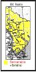
Austria-Hungary
Empire [Rumania]
-
Banat
German - mid 1700s to 1867
-
Map shows Hungary with some areas found around such as Volhnia, Ottoman Empire
and others
-
Found in the article on Important Dates about half way down the page
-
Batschka - See Torza
-
Perjamosch / Banat
-
Map
#1: shows enlarged section of a map which shows Perjamosch and
Sackelhausen from an old map; Hubert Families.
-
Map
#3 - shows on modern map Perjamosch known, now, as Perim and Arad;
Hubert Families
-
Map
-shows Perjamosch [Perim], Sackelhausen [Sacalaz] and Ulmbach [Peciu
nou] on a 1999 map; Hubert Families
-
Sackelhausen / Banat
-
Map
#1 -shows enlarged section of old map with Sackelhuasen [Sockelhausen]
and Perjamosch; Hubert Families
-
Map
#2 -Map of Rumania shows Temsvar and by this large city are the
towns/villages of Sackelhausen and Perjamosch; Hubert Families
-
Map
#3 -shows Perjaomosch [Perim], Sackelhausen [Sacalaz] and Ulmbach
]Peciu nou]; Hubert Families
-
Map
-shows Perjamosch, Sackelhausen and Ulmbach; Hubert Families
-
Torza
(Savino Selo) / Batschka, Ungarn, Austria-Hungary - Pfaff
Families (Remmick)
-
Ulmbach / Banat
-
Map
#1 -shows enlarged section of old map with Sackelhuasen [Sockelhausen]
and Perjamosch; Hubert Families
-
Map
#4-shows Perjaomosch [Perim], Sackelhausen [Sacalaz] and Ulmbach
]Peciu nou]; Hubert Families
-
Map-shows
Perjamosch, Sackelhausen and Ulmbach; Hubert Families
-
Utvin Banat
-
Map
#1-shows enlarged section of old map with Sackelhuasen [Sockelhausen]
and Perjamosch; Hubert Families
|
|
Banat, Ungarn - See Austsria-Hungary [Rumania]
|
|
Beresan Area, S. Russia: See Russia
|
|
Berglicht / n.
Merscheid
, Rhineland-Pfalz, Germany
|
|
Bessarabian Area, S. Russia - See Russia
|
|
Black Sea Area - See Russia
|
|
Borodino / Bessarabia / S. Russia [Ukaine] and
Others German-Russian Colonies in Bessarabia, S.
Russia [Rumania/Ukraine] - See Russia
|
Danube
River from Ulm, Wu. Germany to Black Sea - 2
maps
-
Map 1 shows Ulm, Wu. where a great many German immigrants began their long
journy on wooden boats that would take them to the mouth of the Danube River
which flows into the Black Sea on their trek to Russia
-
Map 2 shows the flow of the Danaube River through Europe and all the way
to the Black Sea
|
|
Edenkoben / Landau, Palatinate, Germany on the Rhineland-Pfalz
(Palatinate) Old Wine Road (Weinstrasse) from Kirchheim-Bolanden to Kandel
- See Germany
|
France NOTE: Some parts of Alsace have belonged
to France and Germany. See the history of Alsace.
-
Alsace
-
Map showing Rhin-Bas, Alsace, France - 2004
-
Remmick's
Maps showing Alsace on a historic German map and on a historic map
of France
-
Map
#3 of Alsace - Remmick Families
-
Hunspach
-
Ingolsheim
-
Klimbach
-
Lembach
-
Map
#4 of Alsace Area - Hubert Families
-
Hagenau
-
Hoffen
-
Lembach
-
Kutzenhausen
-
Schwabwiler
-
Surburg
-
Weissenburg
-
Wingen
-
Map
showing Alsace as part of Germany [German State before 1800]
-
Alsace
and the other French Departments
-
"Where Did They Come From".
German-Russians
migrated from Alsace to Russia in the early 1800s to Borodino / Bessarabia,
S. Russia Project.
-
"A" to "Zz"
-
Historic France
-
Alsace-Lorraine
-
List of Districts plus map
-
Bas-Rhin Dept., France
-
Dachenbronn / Weissemburg, Alsace
[=Drachenbrennen/ [Drachenbrennen/ Dept of Base-Rhin, Alsace, France]
-
Eschburg, Alsace [Eschbourg, Township of La
Petite-Pierre, Saverne Dist., Bas-Rhin Dept., Alsace, France]
-
Schlettstadt / Alsace [Schlettstat / Bas-Rhin
Dept., Alsace, France]
-
Sessenheim / Hagenau, Alsace [Sessenheim / Haguenau,
Bas-Rhin Dept, Alsace, France]
-
Strasburg, Alsace.
|
Germany -
-
"A"
to "ZZ" - Individual German Villages Connected to Borodino / Bessarabia,
S. Russia Project
-
Migration Routes 1700s to 1800s
-
"A"
to "L"
-
A Map of German States 0 Year 2000
-
Baden 1801 - 1819 Map
-
Bavaria - 71 district map and free cities
-
Bradenberg District -2010
-
Calw - Wu Invavsion 1622 o 1648
-
Freudental District - Baden, Wuerttemberg
-
Fuerberg
-
Heilbronn / Heilbronn Urban area = county,
Baden-Wuerttemberg- Neckar River Map
-
Horb - Neckar River Map
-
Ludwigsburg Dist. Map
-
"M"
to "Z"
-
Merzig Area / Saarland
-
Hubert Family Villages and Cities
-
-
Moersfeld / Rhineland-Palaltinate
-
Neckar River Towns and Cities
-
Heilbronn / Heilbronn Urban area = county,
Baden-Wuerttemberg
-
Horb
-
Palatinate Areas - Old and New Maps
-
Rhineland-Palatinate (Pfalz)
-
Romans in German
territories - 150 A.D. - Map
-
Schwarzwaldkreis = Black Forest Dist. - 2012 "Black Forst Circle:
-
Balingen
-
Calw
-
Freudenstadt
-
Herrenberg
-
Horb
-
Nagold
-
Neuenbuerg
-
Nuertingen
-
Oberndorf
-
Reutlingen
-
Rottenburg
-
Rottweil
-
Spalchingen
-
Sulz
-
Tuebingen
-
Tuttlingen
-
Urach
-
Tiefenthal / Bad Kreuznach, Rhineland-Palatinate
-
Ulm
-
Alsace [presently a part of France]
-
Baden-Wuerttemberg maps
-
General
Map showing important cities
-
Baden-Baden
-
Freiburg
-
Heidelberg
-
Heilbronn
-
Mannheim
-
Schwabish Hall
-
Stuttgart
-
Tuebingen
-
Groetzingen
, Aich, Nuertingen, Neckartailfingen in Baden-Wuerttemberg,
Map
-
Luetzelsachsen
with Eppelhim, Landenburg , Mannheim, Schriesheim and
Weinheim
-
Luetzelsachsen
Map #2
-
Mannheim
with Ludwigshaven, Viernheim, Lampertheim, Heppenheim, Worms and Burstadt
areas
-
Necker
Valley showing Old Romantic Road - cities, towns, vilages and castles
:
-
Amorbach
-
Bad Friedrichshall
-
Bad Mergentheim
-
Bad Rappenau
-
Bad Wimpfen
-
Creglingen
-
Crailsheim
-
Dinkelsbuhl
-
Erbach
-
Feuchtwangen
-
Frankfurt
-
Friedrichsruhe
-
Gutenberg Castle
-
Heidelberg
-
Heilbronn
-
Hirschhorn
-
Hornberg Castle
-
Iphofen
-
Jagsthausen
-
Klingen
-
Kronberg
-
Miltenberg
-
Schaffersheim
-
Schwaebish [Schwabish] Hall
-
Tauberbischofsheim
-
Tauberscheckenbach
-
Tauberzell
-
Wurzburg
-
Schwaibish Hall, Schwabisch Hall, Ba-Wu, Germany:
-
Schwaigern / n. Heilbronn, Ba-Wu
-
Edenkoben
/ Lanau, Palatinate, Germany on the Rhineland-Pfalz (Palatinate) Old Wine
Road (Weinstrasse) from Kirchheim-Bolanden to Kandel
-
General
Map showing times of Romans in German Territory - 150
A.D.
-
General
Map showing early states of Germanic tribes [Frankish]-
400 AD
-
General
Map showing important cities - 1921
-
General
Map showing castles, palaces and stately residences #1
-
Stuttgart to Burg Hohenzollern
-
General
Map showing cities, towns and districts - 1923
-
General
Map show German Dist.- 2000
-
Heidelberg / Bavaria, Germany
-
Imsbach
/ n. Kaiserslauthern, Pfalz, Germany - Germans to
Austrai-Hunary
-
Mecklenburg
Maps
-
Mecklenburg-Schweirin
-
Meckenburg-Strelitz
-
Palatinate (Pfalz) see Rhineland-Pfalz [for a time was part of
Bavaria]
-
Prussian Maps - See Prussia
-
Rhineland-Pfalz
-
Bavaria
with Palatinate within Germany - 1923 map
-
Berglicht / n.
Merscheid
, Rhineland-Pfalz, Germany
-
Edenkoben
/ Lanau, Palatinate, Germany
-
1923
Map
-
General
Map show German Districts - 2000
-
Germany
- 1772
-
Heidelberg / Bavaria, Germany
-
Imsbach
/ n. Kaiserslauthern, Pfalz
-
Moersfeld
/ Kirschheimbolanden, Pfalz - Map
-
Palatinate-Bavaria
within Germany - 1923 map
-
Pasturelands
Map of Germany
-
Rapperath
/ n. Morbach, Rhineland-Pfalz, Germany
-
Rhineland
- Pfalz (Palatinate) on the Wine Road (an der
Weinstrasse) Map: from the village of
Kirchheim-Bolanden than south to Kandel
-
Merscheid
/ n. Morbach, Rhineland-Pfalz, Germany
-
Wine
Road (an der Weinstrasse) Map: from the village
of Kirchheim-Bolanden than south to Kandel
-
List:
-
Bad Duerkeim
-
Bellheim
-
Blumersheim
-
Bockenheim
-
Burrweiler
-
Deidesheim
-
Dirmstein
-
Dreisen
-
Edenkoben*
-
Edesheim
-
Eschbach
-
Frankweiler
-
Freinsheim
-
Forst
-
Geisweiker
-
Gleiszellen
-
Grosskarlbach
-
Gruenstadt
-
Haardt River
-
Hambach
-
Herxheim
-
Ingstein
-
Impflingen
-
Kallstadt
-
Kleinkarlbach
-
Landau
-
Leinstadt
-
Leinsweiler
-
Maikammer
-
Mussbach
-
Neuleiningen
-
Neustadt an der Haardt*
-
Niederkirchen
-
Ranschbach
-
Ruppertsberg
-
St. Martin
-
Siebeldingen
-
Rhodt*
-
Weisenheim am Berg
-
Saarland,
Germany
-
Bettingen
/ n. Lebach, Saarland, Germany
-
Borg
/ Merzig, Saarland, Germany
-
Schwarzenholz
/ Saarlouis, Saarland, Germany
-
Schwemlingen
n. Merzig, Saarland, Germany
-
Serrig
/ n. Saarburg, Saarland, Germany
-
Urexweiler
/ St. Wendel, Saarland, Germany
-
Wuerttemberg - See Baden-Wuerttemberg
-
See Prussia Section
|
|
Hohenzollern Castle [Zollern
Burg / Hohenzollern Burg] n. Tuebingen/ Ba-Wu,
Germany
|
|
Hungary - See Austria Hungary Empire
|
|
|
|
M
Migration
of Germans from Palatinate to the Banat area in Austria-Hungary to Russia
by the route of the Danube River from Ulm, Wu. to the Black
Sea
3 Maps:
Migration
By Land From German States and Estate to Russia 1763- 1824
|
|
Merscheid
/ n. Morbach, Rhineland-Pfalz, Germany
|
|
Moersfeld
/ Kirschheimbolanden, Pfalz , Germany
|
|
Montana, State of
|
|
N
Norway
|
|
Prussian
Map 1772
|
|
Palatinate (Pfalz) - See Germany
|
|
Perjamosch / Bant See Austria-Hungary Empire
|
Poland:
-
Gdansk,
port city on the Baltic Sea, south to Kulm [Chelmo]
-
Borodoino History: Where Did They Come From Project
-
Poland
& Prussia from "A" to "L"
-
Braunsberg / Pomerania (Poland)
-
Brosowo / Kulm, West Prussia [Brzozowo / n,
Chelmno, Poland]
-
Canstadt (Kanstatt or Canstadt) / Po. [Kanstadt
= Katy / n. Warsaw, Poland]
-
Dolkin-Prussia n. Chelmno (Kulm) Poland
-
Duchy of Warsaw 1807-1815
-
East Prussia (Ostreussen)
-
Grabow, Prussia (Poland)
-
Gross and Kleim Koenigshuld (See Klein and Gross Koenigshuld)
-
Gruenbach, Prussia (Poland)
-
Kannstatt (Canstadt/ n. Warsaw (Poland)
-
Krammer / Kulm, Prussia (Chelmno, Poland)
-
Klein and Gross Koenigshuld
-
Koenigsburg
-
Kutno / __, Poland [Kutno / Lodz Dist.,
Poland
-
Kulm, Prussia (Chelmno, Poland), Old and New
maps
-
Lodz (Locsch) / Lodz (Lodsch) Voivodeship (Dist.),
Poland
-
Louisenau / Posen, Po. [Louisenau (maerged with
Hohensalza) / Kuyavian-Pomeranian Voivodeship, Poland]
-
Poland
& Prussia from "M" to "Zz"
-
1772, - 1793 and 1795-Poland Map showing First, Second and Third
Partions
-
Magrowolle (Wola Magierska) by Warshau IWarsaw) , Poland
-
New Sulzfeld (Neusulzfeld)/ Lodz, Duchy of Warsaw (Poland)
-
New Wuerttemberg (Neu-Wuerttemberg) / Lodz, Poland
-
Map showing partions of Poland in 1772, 1793 and 1795
-
Posen / Posen Province, Poland
-
Prussia
-
Map showing the history of Brandenburg & Pussia
-
HISTORY OF BRANDNENBURG & PRUSSIA
-
Pre-12 th century - Northern March
-
Pre-13th cetnruy - Old Prussians
-
1157-1618 Margraviate of Brandenburg
-
1466-1772 Royal (Polish) Prussia
-
1525-1618 Duchy of Prussia -
-
1701-1772 Brandenburg-Prussia
-
1701-1772 Kingdom "in" Prussia
-
1772-1918 Kingdon of Prussia
-
1918-1947 Free State of Prussia
-
Prussia's Partion of Poland, 1772, 1793 and 1795
-
Expanion of Prussia from 1807 to 1871
-
Rehden, Prussia (Radzyn Chelminski / Grudziadz, Poland)
-
Rudetz / Graudenz n. Kulm (Chelmno) Prussia (Poland)
-
Segartowitz / Kulm, Prussia (Poland)
-
Stadt Schloppe, Prussia [Schloppe = Czlopa
/ Walcz County, West Pomeanian Voivodeship, Poland.]
-
Thorn, Prussia [Thorn = Torun/ Torun County,
Kuyavian-Pomeranian Voivodeship, Poland.]
-
Trebis, Prussia. [Trebis / n. Kulm , West Prussia
]
|
|
Rapperath
/ n. Morbach, Rhineland-Pfalz, Germany
|
Rhineland
- Pfalz (Palatinate) on the Wine Road (an der
Weinstrasse) Map
-
Edenkoben
-
Kirchheim-Bolanden
-
Neustadt an der Weinstrasse
-
Rhodt
|
|
Romania - See Rumania
|
Rumania 1999
-
see Austria-Hungary
Empire [before WWI data]
-
Borodino
and Others German-Russian Colonies in Bessarabia,
S. Russia [Rumania/Ukraine] - See Bessarabia, S. Russia
|
Russia:
-
-
Black Sea Area
-
Map
#1-Shows area around the Black Sea from the mouth of the Danuble River
north into Moldavia [Bessarabia is the eastern section], than eastwardly
pass Odessa, Kherson, Crimea, Rostov to bend southward and edging past the
Casptian Sea on the far east edge, into the N. Caucasus to the S. Caucasus,
through Georgia, Armenian, Iran, where the Caspian Sea Southern shore lies,
than westward through the upper northern part of Turkey to Istanbul,
where the Mediterrean and the Black Sea almost touch, than north through
Bulgaria, Dobrudscha back to the mouth of the Danube River.
-
Map
#2 - Same as Map #1 but in black and showing points of interest for the
family history
-
Beresan
Area, S. Russia includes the following
German-Russian Colonies and Chuters [Estates], [religion= (1) ev -Lutheran
and (2) k=Catholic]
-
Black Sea
-
Bug River
-
Johannestal , 1820 [year founded], ev
-
Karlsruhe, 1817, k
-
Katharinetal, 1817, k
-
Landau, 1809/1810, k
-
Muenchen, 1809, k
-
N. Rohrbach
-
Odessa, Black Sea Port City of
-
Pfaff Chuter
-
Rastatt, 1809/1810, k
-
Roemmich Chuters
-
Roemmich Chutor = Kalagiea
-
Roemmich Chutor
-
Roemmich Chutor = Johannesfeld
-
Roemmich Chutor
-
Roemmich Chutor
-
Roemmich Chutor
-
Roemmich Chutor = Sarawnoje
-
Roemmich Chutor / Bess.
-
Rohrbach, 1809, ev
-
Speyer, 1809, k
-
Sulz k
-
Tiligut River
-
Waterloo [Beresan]1, 1819
-
Waterloo 2 , 1833
-
Worms, 1809, ev
-
Bessarabian
Area, S. Russia Bessarabian Area, S. Russia
[*German-Russian Colonies]
-
Map
#1: Geneal
-
Map
#2:
-
Bendery
-
*Beresina
-
*Borodino:
-
Showing Borodino, Leipzig and Taurtino in an enlarged map
-
*Freudenstal
-
*Hoffnungstal
-
Kischnev
-
*Kloetitz
-
Kogaenik River
-
Konrat
-
Kotovskoe
-
*Kulm
-
*Leipzig
-
*New Borodino
-
*Paris
-
Phillipowka
-
*Tarutino
-
Borodino / Bessarabia, S. Russia
-
Map
2005 showing Borodino in the Ukraine near the border of Moldavia
-
Map
of 1814 showing Borodino in Bessarabia/ Russia in times of the
Tsar's
-
Map
of German-Russian Villages in the southern part of Bessarabia
-
1927
Map of Bessarabia #1
-
Bess
Map #2
-
Bess
Map - Colonies, A List
-
Map
#1-Shows area around the Black Sea from the mouth of
the Danuble River north into Moldavia [Bessarabia is the eastern section],
than eastwardly pass Odessa, Kherson, Crimea, Rostov to bend southward
and edging past the Casptian Sea on the far east edge, into the N. Caucasus
to the S. Caucasus, through Georgia, Armenian, Iran, where the Caspian Sea
Southern shore lies, than westward through the upper northern part of
Turkey to Istanbul, where the Mediterrean and the Black Sea almost touch,
than north through Bulgaria, Dobrudscha back to the mouth of the Danube River.
-
Map List
of Russia, Rumania, Germany and others
-
Other maps involving the German-Russians
-
Duchy
of Warsaw
-
Area near
Graudenz,
Duchy of Warsaw
-
Rudetz = May poss be Graudenz because the village of Rudetz has not
been
-
found by researchers to this date
-
Area near
Kulm,
Duchy of Warsaw = Chelmo, Poland
-
Dolken / n. Kulm
-
Klammer / n. Kulm
-
Freudental
/ Odessa, A Black Sea Colony, S. Russia
-
Pfaff
Chutor [Estate] near Freudental / Odessa, A
Black Sea Colony, S. Russia
-
Roemmich
Chutors (Estates) in Russia
-
Roemmich Chutor = Kalagiea
-
Roemmich Chutor
-
Roemmich Chutor = Johannesfeld
-
Roemmich Chutor
-
Roemmich Chutor
-
Roemmich Chutor
-
Roemmich Chutor = Sarawnoje
-
Roemmich Chutor / Bess.
-
Caucasus Area
-
Chutors
-
Chutor: What is a Chutor / Khutor?
|
|
Saarland - See Germany
|
|
Sackelhausen / Banat - See Austria-Hungary Empire
|
|
Torza
(Savino Selo) / Batschka, Ungarn, Austria-Hungary - Pfaff
Families (Remmick)
|
|
Ulmbach / Banat - See Austria-Hungary
Empire
|
U.S.A. [United States of America]
-
Minnesota, State of
-
Montana
|
|
Utvin Banat - See Austria-Hungary Empire
|
|

|
|
List of web sites where maps are found elsewhere which were recomended
by others:
|
GR=German-Russians
-
Excellent Website which has many maps is Roll Family:
|
|
|